
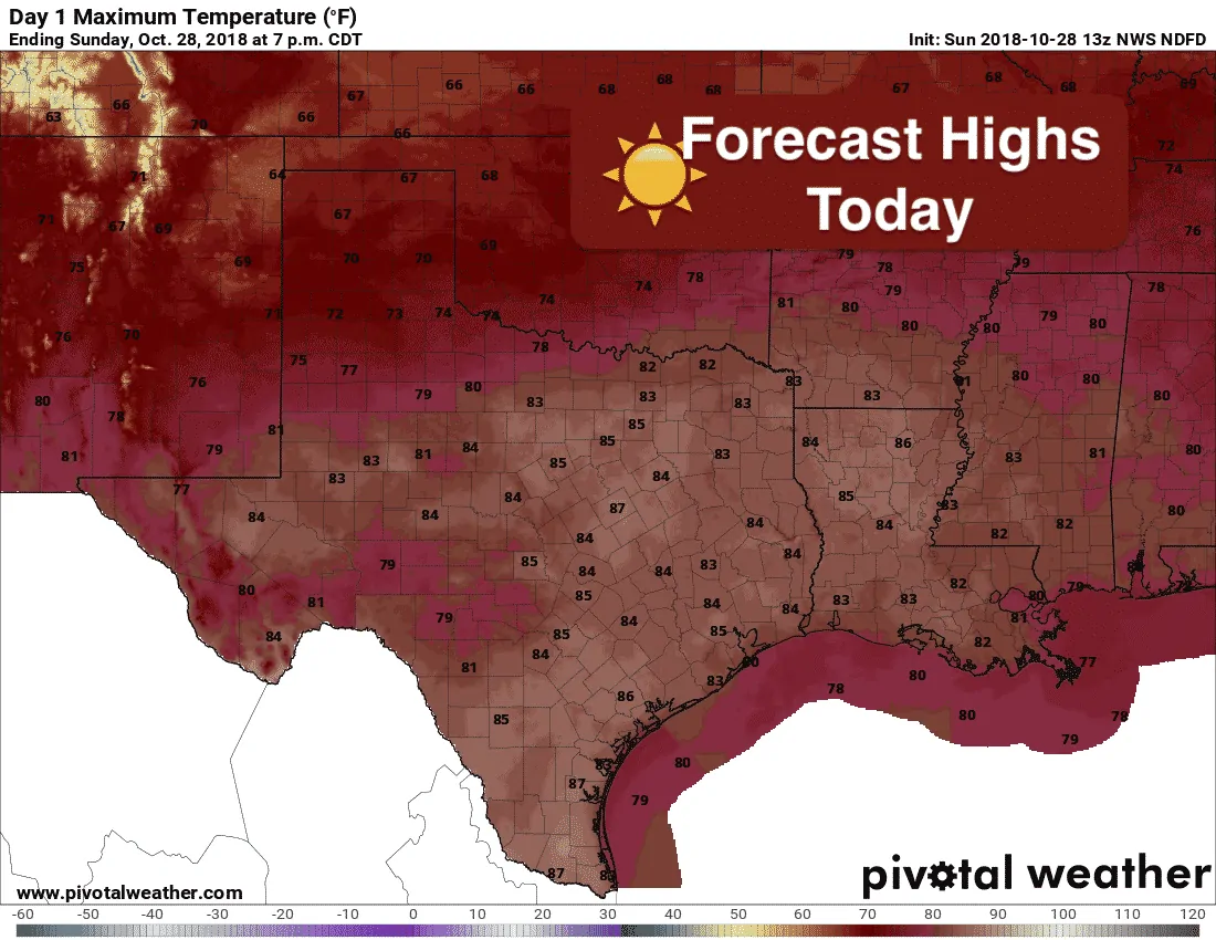
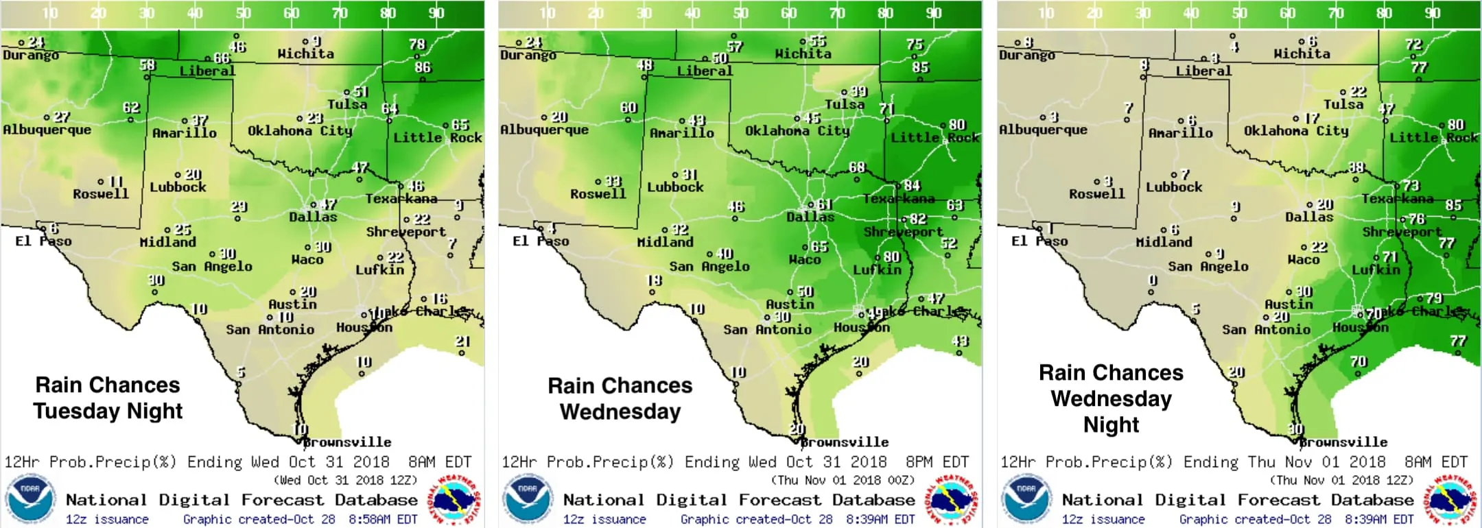
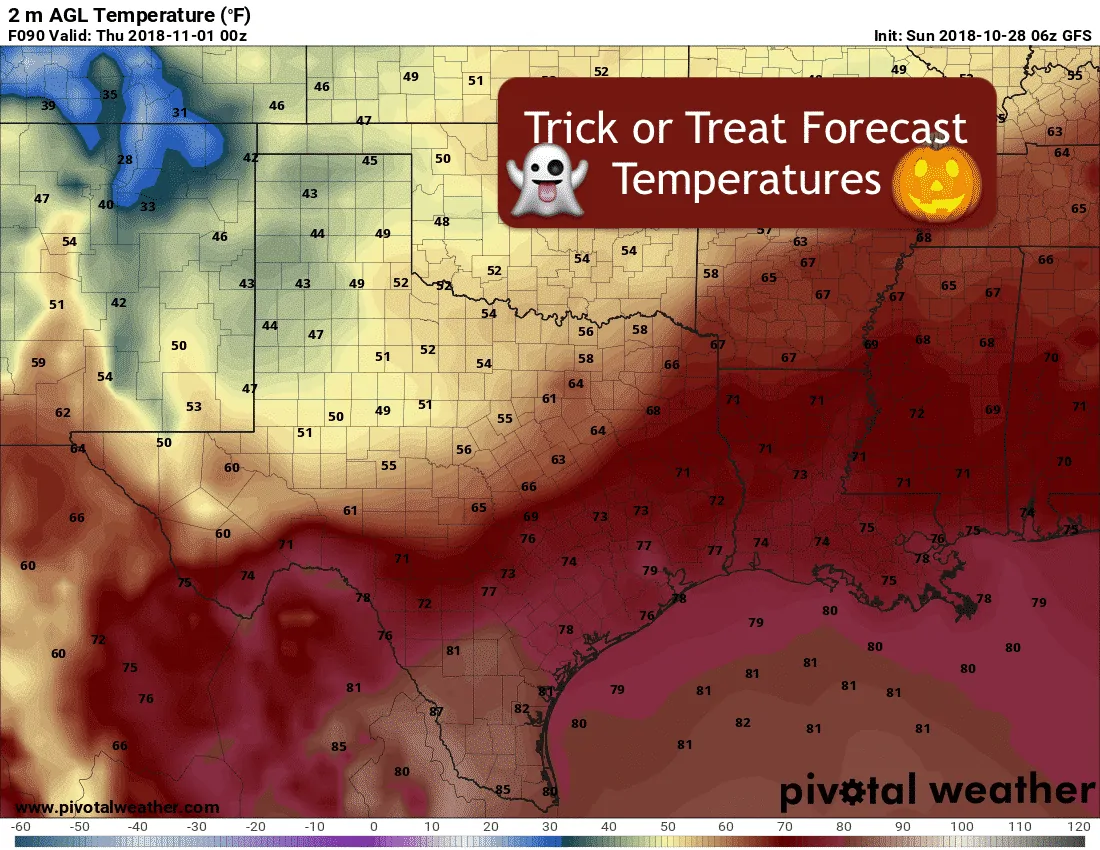
Today, and the first two days of the work week ahead, will feel more like late summer than mid-fall with temps soaring into the 80s. Moisture will be on the return once again, so we’ll see an increase in cloud cover tomorrow, and especially on Tuesday. So while we’ll see much warmer temps, it will be a bit gloomy. Rain chances are nil for today through Tuesday, but by Tuesday evening, we’ll see increasing chances of rain ahead of and behind our next cold front. Thankfully, our mid-week rain event will be short-lived, and there’s no tropical influences this time around, so impacts are expected to be minimal. Keeping in mind that we’re still several days out and timing could change by several hours…the cold front itself looks to arrive in the panhandle region by early Tuesday morning. It will continue to drop south/southeast throughout the day and arrive in north central Texas by Tuesday afternoon or evening. The front will continue its southward push overnight and into Wednesday but will not reach the coastal regions until late Wednesday night into early Thursday. At this point, it looks like the chances for seeing severe weather ahead of the front will be quite low. The atmosphere will be capped and storms will struggle to build. However, we will keep an eye on that as conditions could change between now and then, especially across the southern half of the state closer to the I-10 corridor where better conditions for thunderstorm development will lie by Wednesday afternoon and evening. Behind the front, we’ll be back to below normal temperatures ranging from the 50s to 60s with plenty of sunshine for a very nice end to the work week!


0 Comments