
The Weather Prediction Center has upgraded a good portion of Texoma and North Texas to a HIGH RISK of Flash Flooding tonight. Just like the severe weather outlooks, a high risk if rare and only used when confidence is high that a significant to a life-threatening event will occur. This is a dangerous and evolving situation with the potential for major flooding impacts tonight. In addition to flash flooding (roads closed, low-water areas flooded), we’ll likely see rivers rise into flood stage over the weekend. Those rises/peaks will likely continue to bring impacts into the upcoming week.
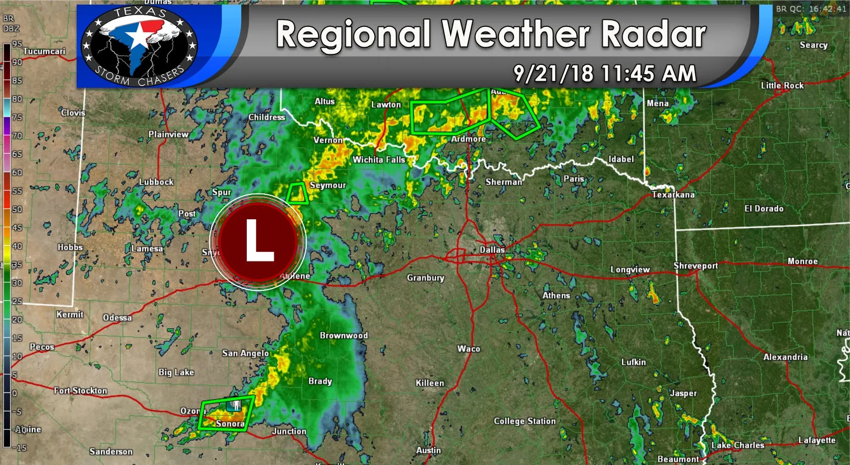
The primary culprit for our heavy rain event is an area of low pressure located northwest of Abilene. This low will slowly progress east over the next 12 to 18 hours. By around 4 AM Saturday the low may be located just west of Fort Worth. Lift associated with the low, combined with an approaching cool front, along with near record high moisture values for September -all lead to increasing confidence that a major flood event will unfold into tonight across Texoma and North Texas.
Localized rainfall amounts over 10 inches are certainly possible in Texoma and North Texas by sunrise Saturday. In fact, some models are indicating rainfall amounts in excess of a foot in some areas. Let me be clear in saying that not everyone will see prolific rains and flooding. However: we are very concerned about some folks seeing major to life-threatening flooding tonight. This may evolve into a particularly dangerous situation.
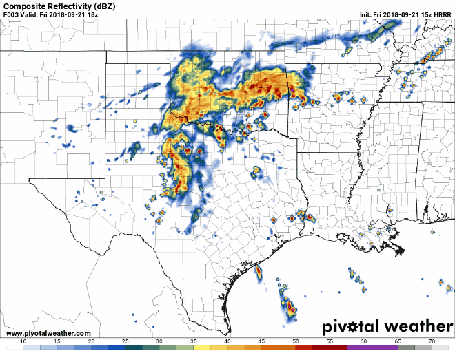
The last several HRRR runs have been uncertain in the exact location of the heaviest rains tonight, but all are in agreement that someone will have serious rains. This radar animation begins at 1 PM CT and runs hourly through 9 AM on Saturday. Understand that this model probably doesn’t have the exact location of the heaviest rains right, but there is going to be training heavy rains moving over the same areas for several hours.


0 Comments