
A line of showers and thunderstorms is moving east across the Texas Panhandle, South Plains, and Permian Basin this evening. This activity is associated with a surface cold front that extends from the Texas Panhandle back southwest into southeastern New Mexico. Showers farther east across Central Texas, East Texas, and North Texas are mostly diurnally driven and will generally become more isolated by late evening.
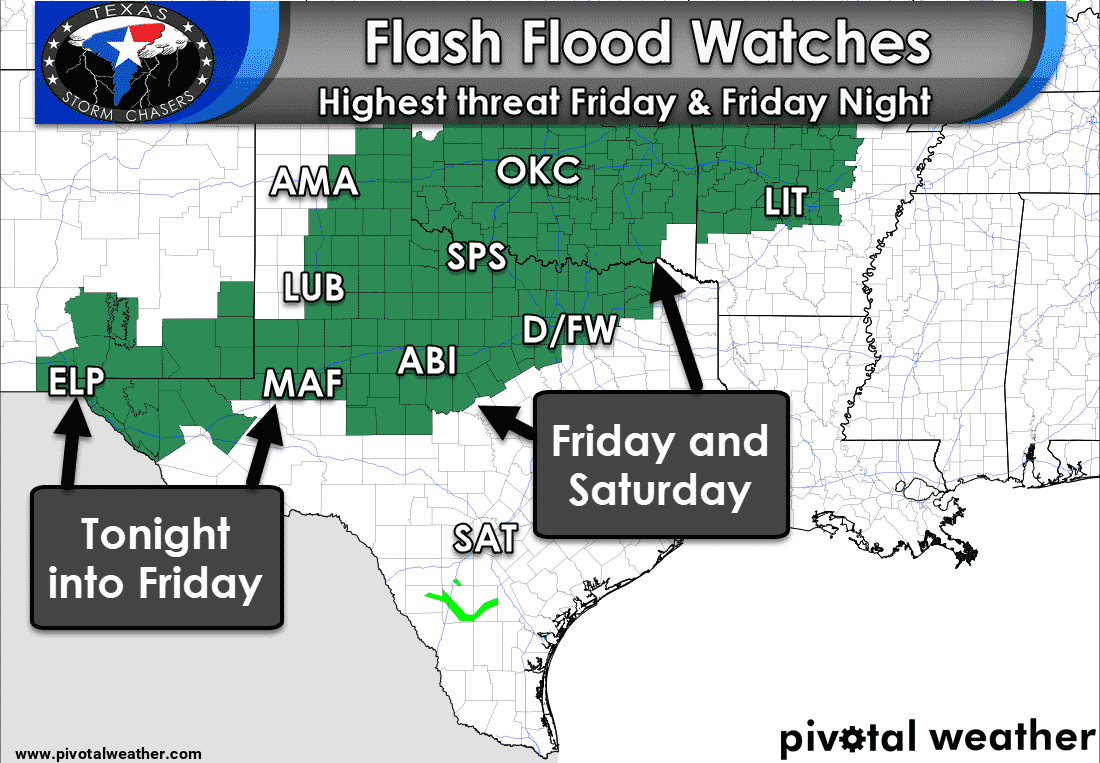
Localized flooding may become a threat tonight across the eastern Texas Panhandle, south into the Permian Basin, and into the Big Country and Hill Country. Widespread heavy rain is not anticipated – or at least we’re not expecting much of that heavy rain to ‘train’ (or move) over the same areas. Should training occur there will be the threat for localized flooding due to enhanced rainfall totals. New thunderstorms may fire up as early as 5 AM across parts of North and Central Texas.
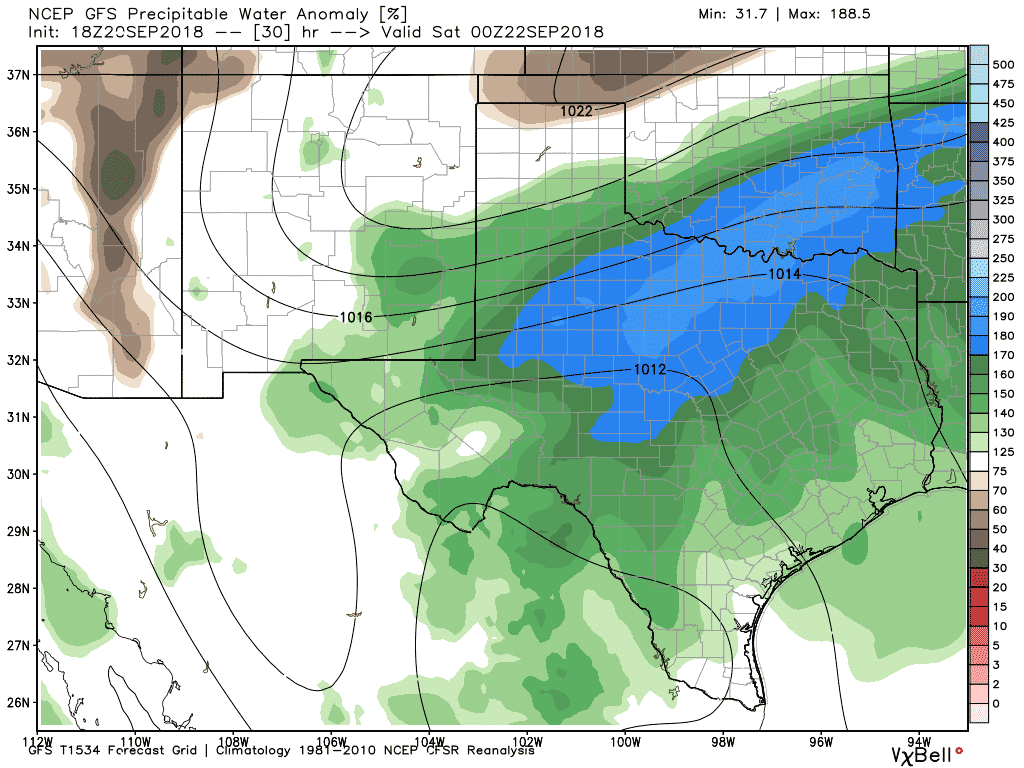
Tropical moisture advecting in from the remnants of a tropical disturbance near Baja California along with moisture from the Gulf of Mexico will make for a very conducive heavy rain set up by tomorrow afternoon. Some models are estimating that atmospheric moisture values (precipitable water, or PWAT) will be above 175% of normal across the Big Country, Texoma into North Texas by lunch-time Friday. That means rain rates with any activity will be heavier and easily allow for 1-3 inches of rain in one hour under tropical downpours.
I’m not going to get too in-depth in the setup for Friday and Saturday. However, an area of low pressure looks like it’ll set up shop and spin somewhere in West Texas. That’ll allow for southerly winds to draw in a moisture-rich airmass across the eastern half of Texas. As that moisture interacts with the still slow-moving cold front we expect widespread thunderstorms with heavy rain to break out. This setup is one that favors ‘training’ thunderstorms. Combined with abnormally high precipitable water values (the amount of water in the atmosphere) the stage looks to be set for a heavy rain and flood event.
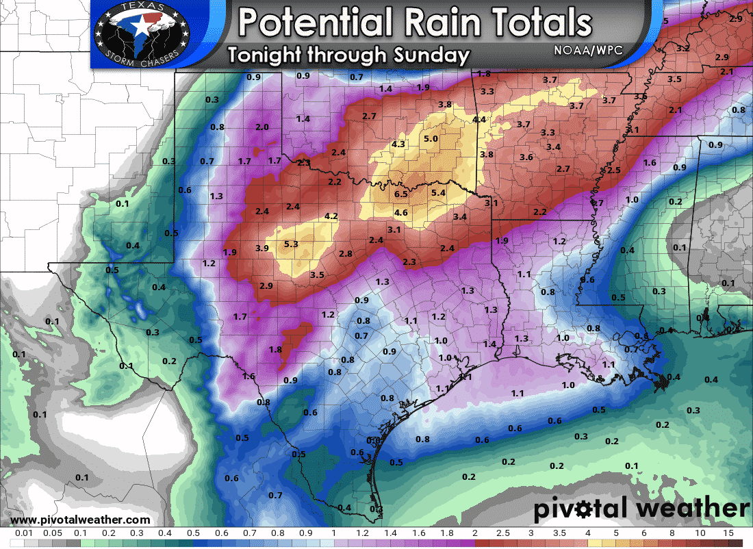
Where the axis of heaviest rains set up tomorrow is still a bit uncertain, but it has certainly shifted south over the last twenty-four hours. Yesterday it looked like the heaviest rain totals would be across Oklahoma. However, model guidance today has shifted that axis farther south into Texoma and North Texas. This kind of setup can produce rain totals of 4 to 7 inches within six hours – and that would cause flash flooding. Add that over an urbanized area and you’re talking about the potential for a more significant flood event.
[click_to_tweet tweet=”Parts of the Big Country, Texoma, North Texas, and Northeast Texas Texas could have flooding underway by the early-afternoon Friday and for the evening commute home.” quote=”I am concerned that parts of the Big Country, Texoma, North, and Northeast Texas Texas could have flooding underway by the early-afternoon Friday and for the evening commute home.”]
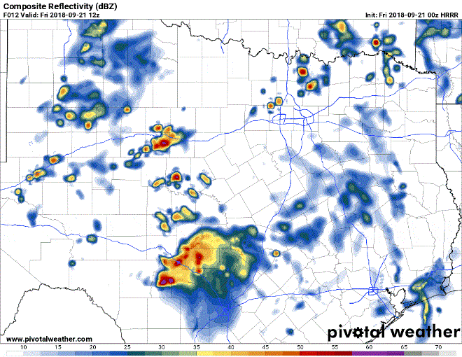
Simulated weather model radar beginning hourly at 7 AM Friday through 1 AM Saturday. Radar will probably not materialize as depicted above.
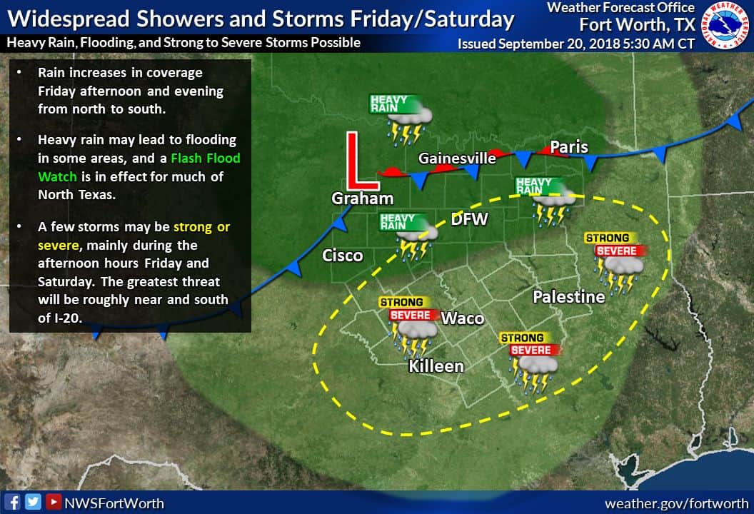
Heavy rains will continue into Friday Night across portions of the Concho Valley, Central Texas, North Texas, and Northeast Texas. I anticipate we will have flooding issues well underway and those issues would continue into the night. Additional flooding will likely materialize tomorrow night. The Weather Prediction Center has placed a moderate risk of flash flooding across Texoma, the northwestern half of North Texas, southwest into the Big Country. A slight and marginal risk surrounds it. Like severe weather outlooks, a moderate risk is a significant risk – and one to be taken seriously. We’ll keep an eye on data to see if the threat for heavy rains expands south by Saturday.
Severe Weather Potential on Friday and Saturday
Secondary to the heavy rain/flooding risk is the marginal possibility of a couple of brief tornadoes. The low pressure out in West Texas will place portions of North and Central Texfavorablevoriable quadrant for storm rotation. With tropical moisture in place, it certainly isn’t out of the realm of possibility that we see a low-end/localized tornado threat on Friday and again Saturday. This threat would increase if we had breaks in the clouds to help destabilize the atmosphere; or if low-level wind shear ended up being stronger than expected.
Stay tuned to your preferred source of weather information for updates. The National Weather Service and local verified meterologists are great resources to add to your news feed.


0 Comments