
While many eyes are on Florence in the Atlantic, we’ve got a little backyard tropical mischief to discuss. I say mischief only in the sense that it sort of just ‘popped up’ yesterday in the midst of a crazy busy Atlantic. A few disclaimers to get out of the way first. Florence is likely to bring catastrophic impacts to portions of the eastern United States later this week. Very severe winds, a destructive storm surge, and the potential for a historic rainfall event are all on the table. None of those threats will impact our weather in Texas.
Hurricane Isaac is expected to encounter strong wind shear in the eastern Carribean toward the end of the work week. That should effectively shred it to bits – and we’re not worried about that system making it into the Gulf of Mexico (for now, we’ll keep an eye on whatever is left of it just in case). Isaac is not the system we’re referring to in this discussion.
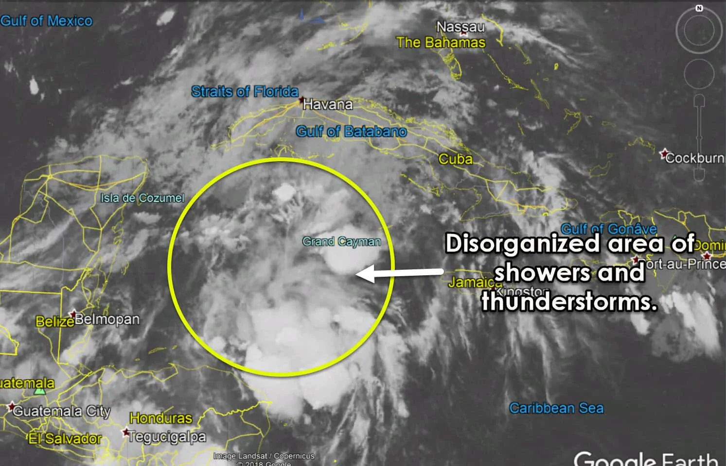
Our little mischief is actually not very mischievous at all this morning. It consists of a large area of disorganized showers and thunderstorms in the northwestern Carribean. There is no surface low pressure. Convection is associated with a tropical wave and an upper-level disturbance. This wave will continue moving slowly to the northwest over the next few days. By Thursday or Friday, it should be in the western Gulf of Mexico.
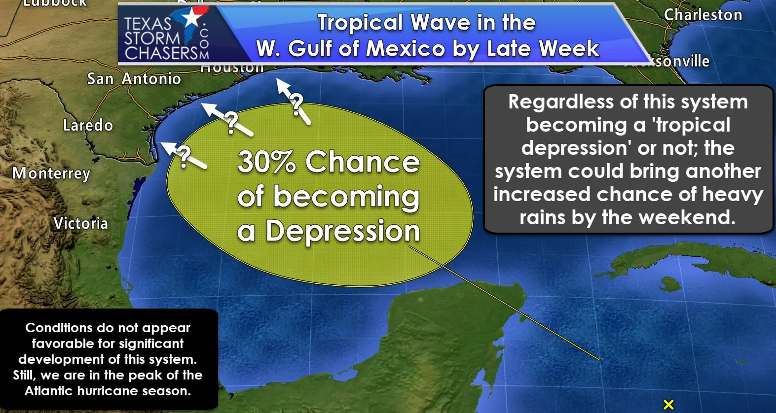
When it arrives in the western Gulf of Mexico we may see upper-level winds become marginally conducive for slow development of the wave. The overnight weather model suite was not aggressive of developing a tropical cyclone. The European weather model (one of the more reliable ones) did develop a very weak tropical depression before moving the system into Texas next weekend. Is that going to happen? It could, but being over five days out means we’re taking it as a grain of salt. We’re in the peak of the Atlantic hurricane season. Be vigilant, but don’t get over-hyped on the potential of a weak tropical system that could very well not even happen.
Regardless of this system becoming a tropical depression or remaining a ‘wave’ the chance of rain looks like it’ll increase this weekend into early next week. Abundant tropical moisture would accompany this system if it moved into Texas, so the threat of heavy rain and potential flooding would have to be monitored.


0 Comments