
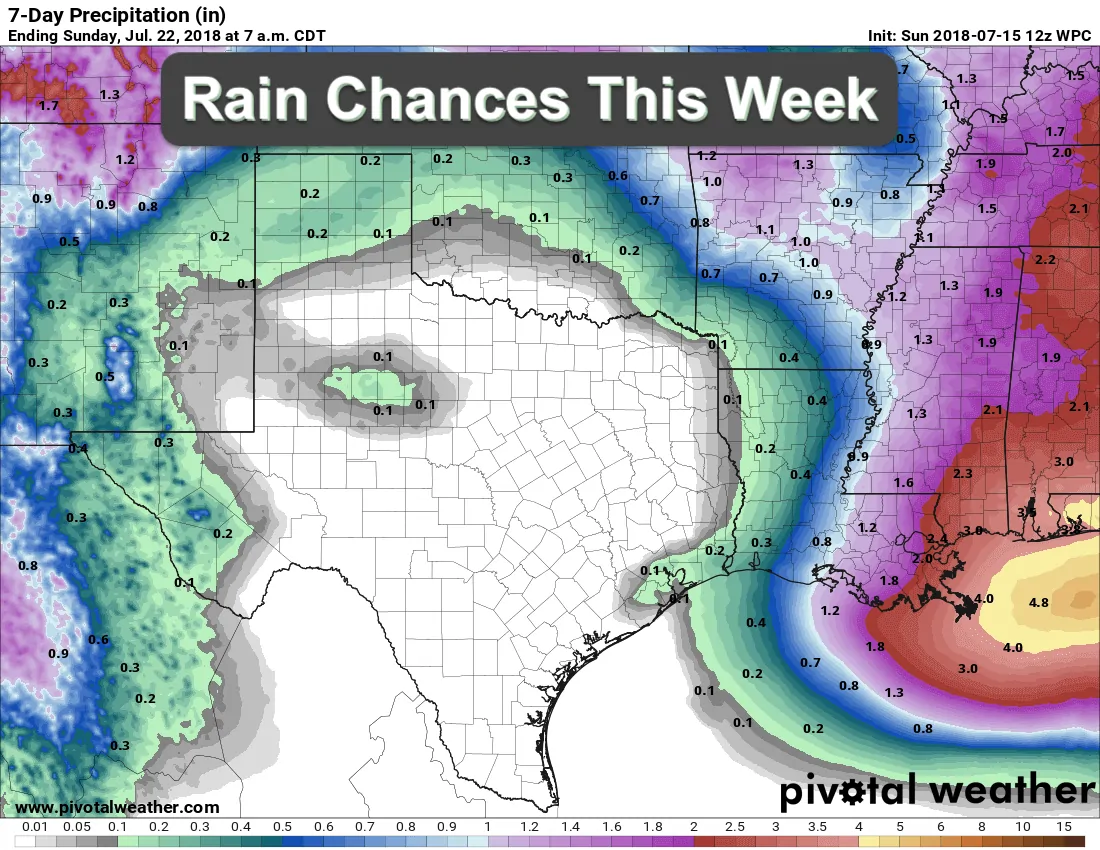
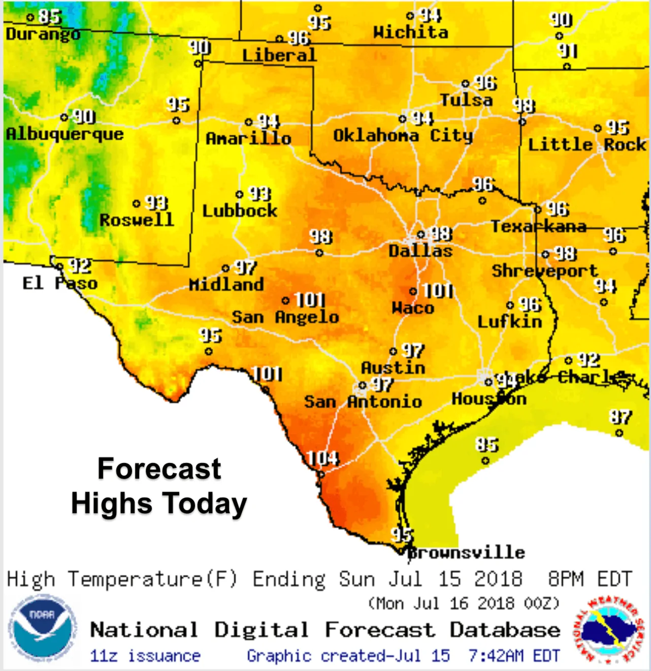
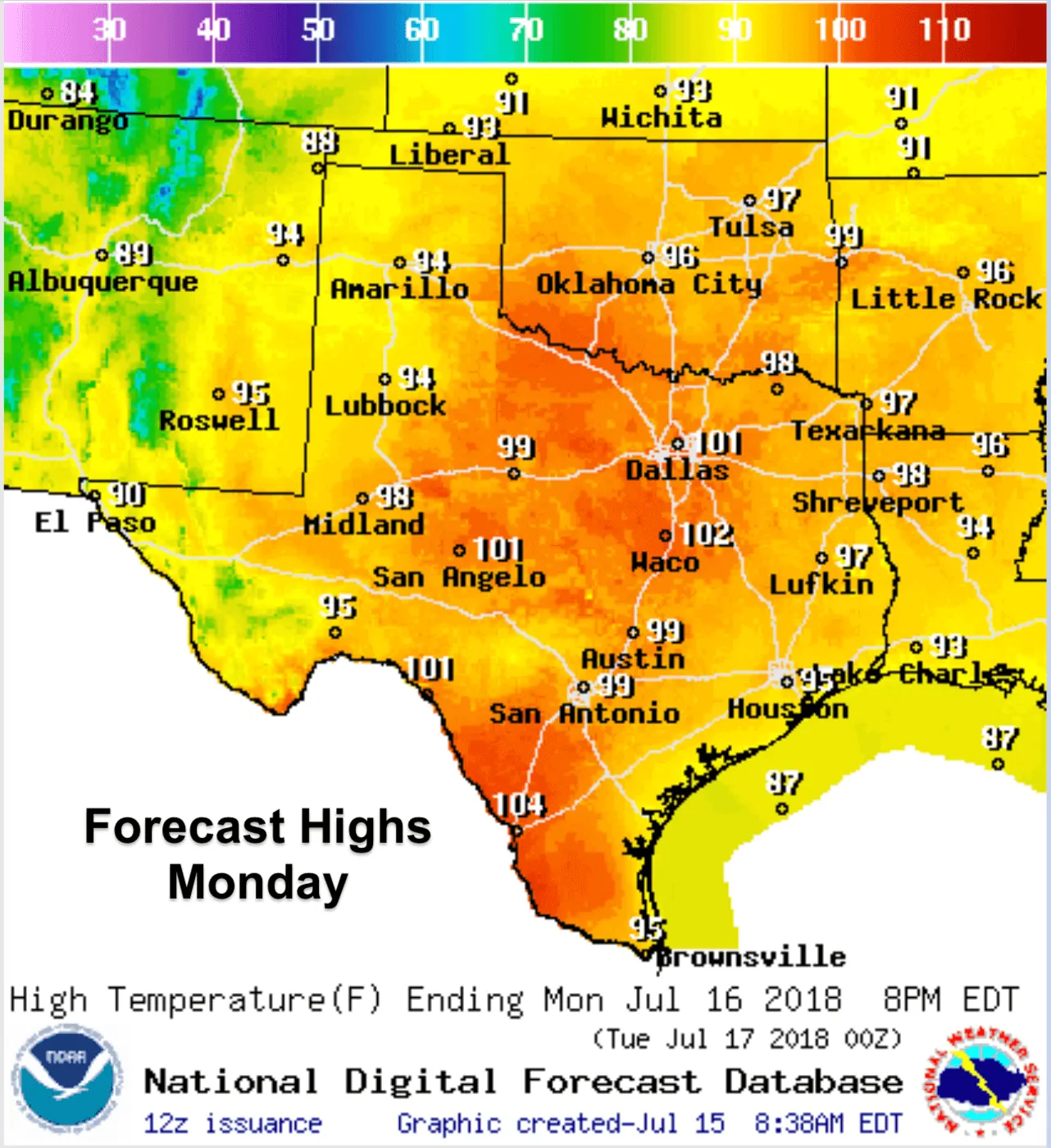
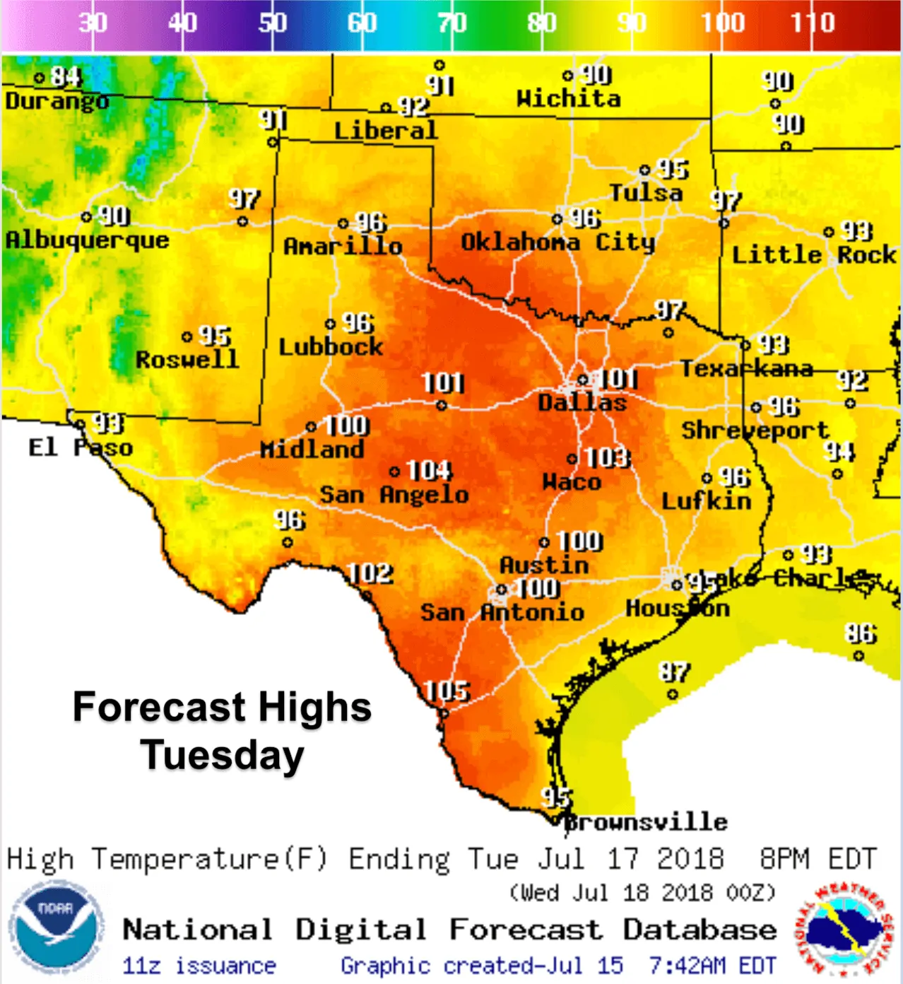
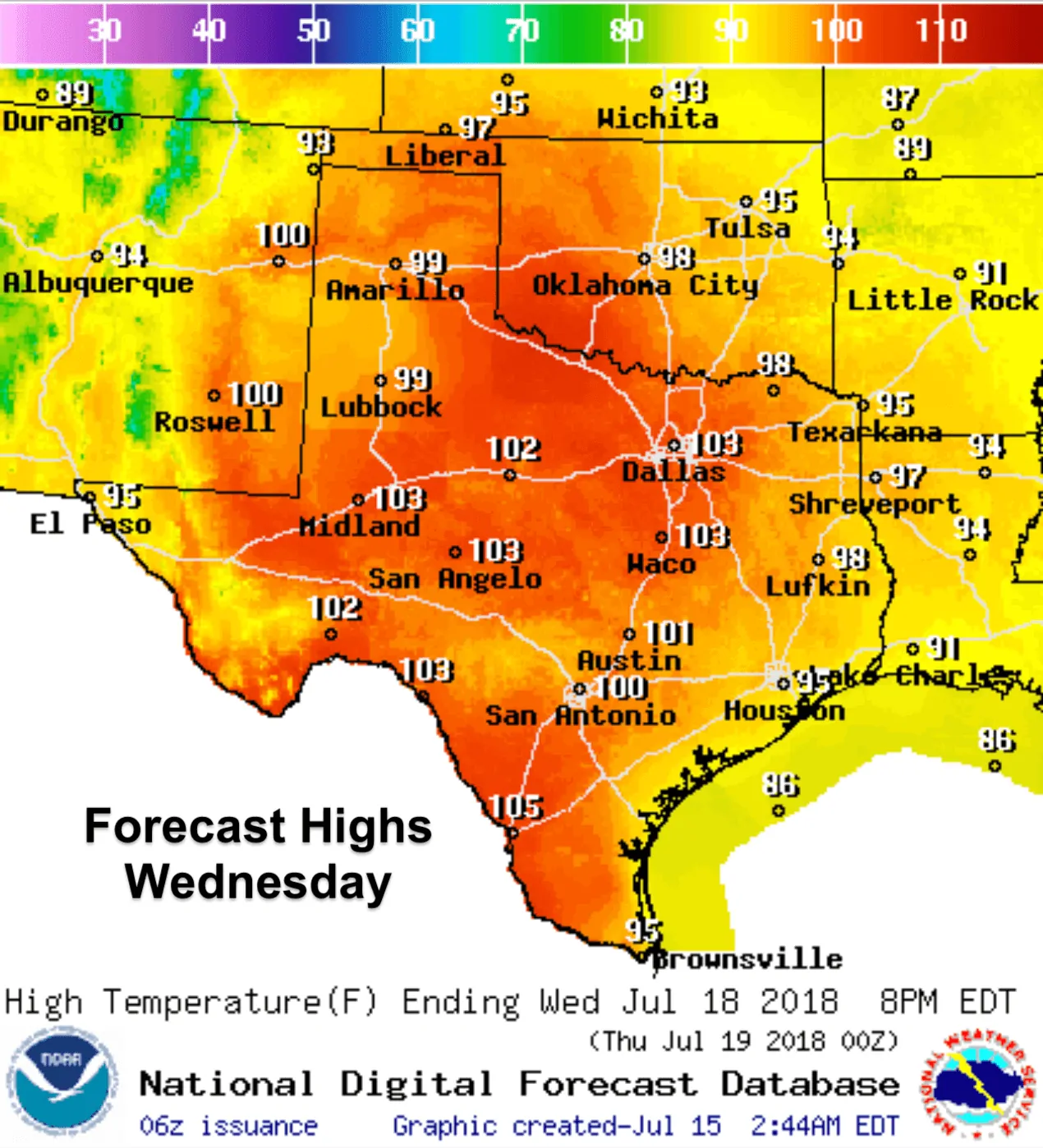
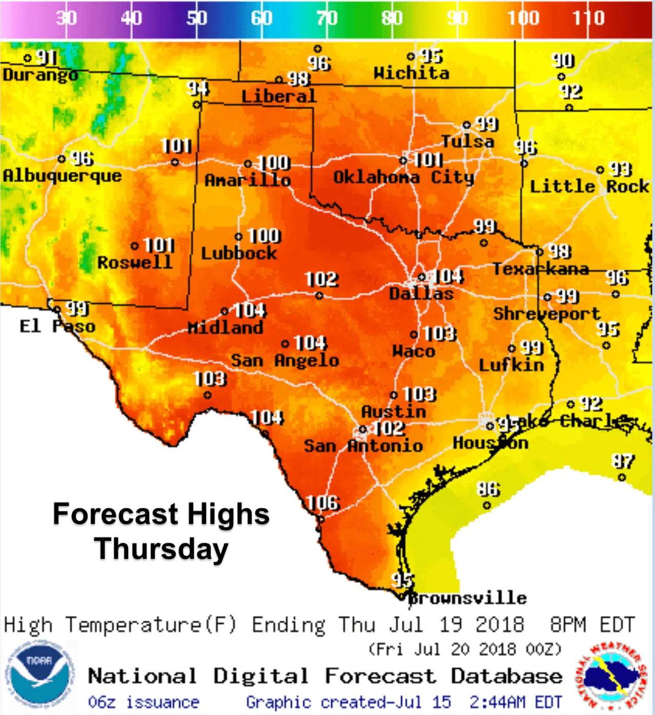
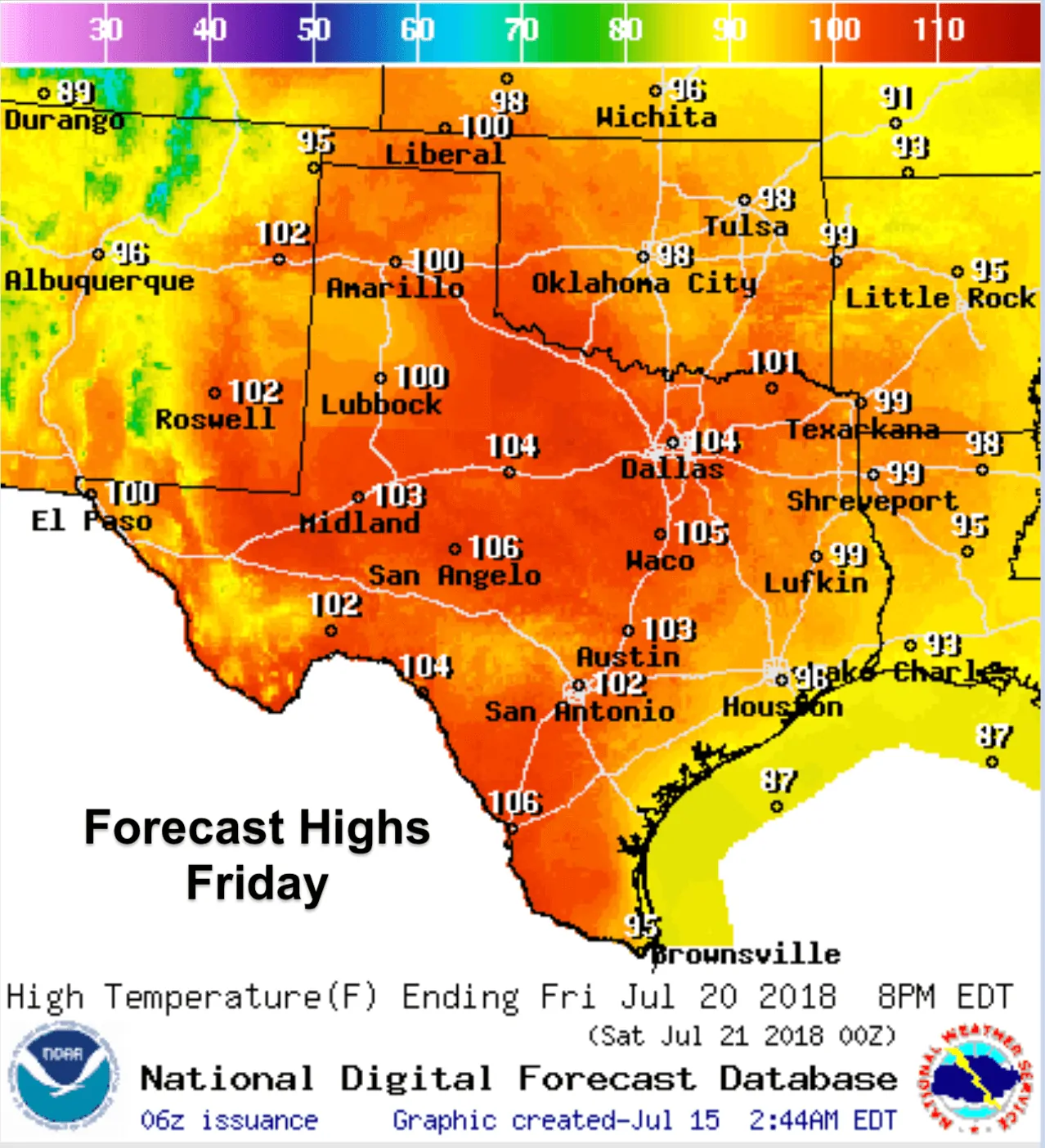
We hope everyone enjoyed the “cooler” temps and rain chances last week because all that comes to a screeching halt for the week ahead. High pressure will dominate the desert southwest this week with its reach expanding into Texas as well. Temperatures will gradually increase each day with record to near-record highs expected by the middle to latter part of the work week. Heat Index values will likely be at or slightly above the actual temps each day and we’ll soon begin to see Heat Advisories issued for a broad swath of the state later this week. At this point, it looks like the most extreme high temperatures during the week ahead will be found across parts of north central Texas, western north Texas and down into the Permian Basin region of west Texas. Thankfully, humidity values will be decreasing across these areas, so the heat index values will only vary a few degrees from the actual temperature. For eastern Texas and for areas along the coast, we’ll be less likely to see temps in the 100s this week, but with forecast highs in the upper 90s and higher humidity values, we will see heat index values easily reaching into the 105-110 degree range. Rain chances look bleak with exception to far eastern Texas which will be on the periphery of the ridge of high pressure…and for far western Texas which is in the midst of monsoon season.


0 Comments