
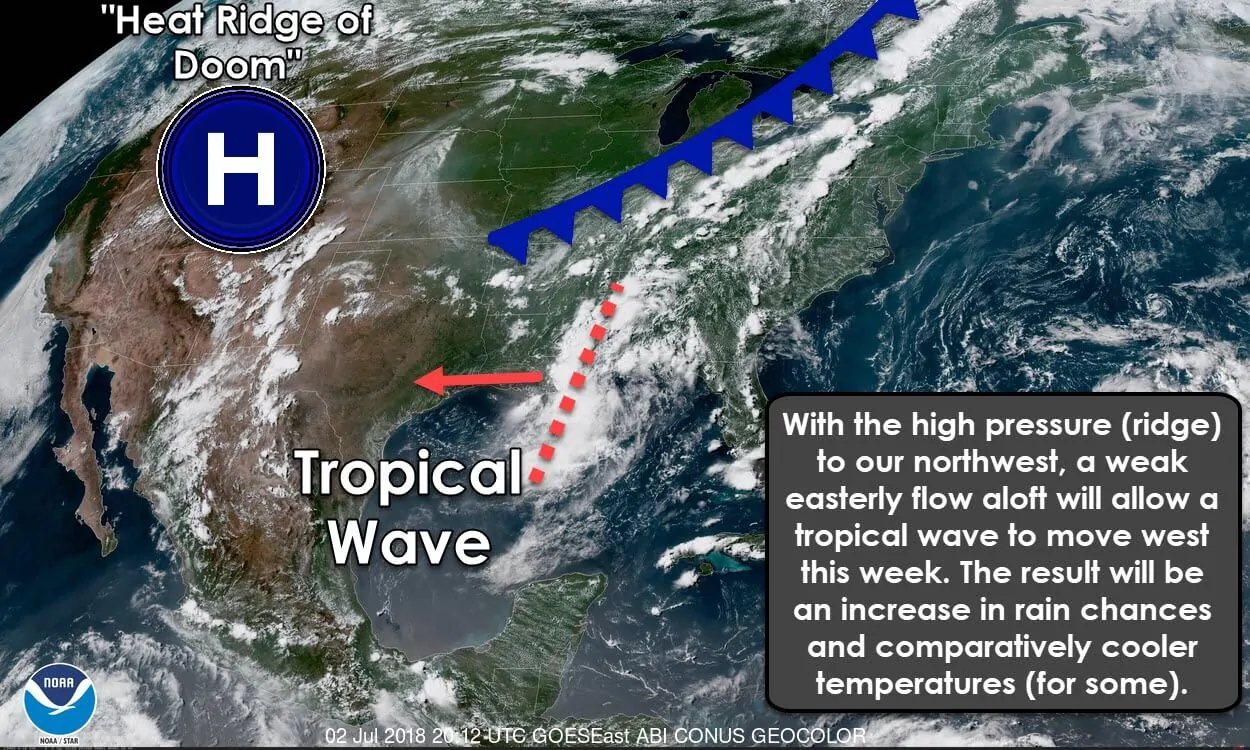
Summer is the time of year where the only appreciable precipitation chances in Texas come from tropical mischief, a weakening of the high-pressure ridge over the state, and the monsoon in the Borderland and western Texas. The core of the high-pressure responsible for our summer heat has shifted to our northwest this week. A weak easterly flow has developed on the southeastern periphery of the ridge. A tropical wave located near Mobile, Alabama today will slowly move west this week. While rain is appreciated given the ongoing drought and wildfire threat, I’m afraid it’ll impact some of your Independence Day plans.
Scattered showers and thunderstorms will begin on Tuesday across far East Texas and Southeast Texas. It’ll be quite rainy in Lousiana with more widespread rain. Those higher rain chances will move west into Southeast Texas during the night on Tuesday and into Wednesday morning.
Independence Day Forecast
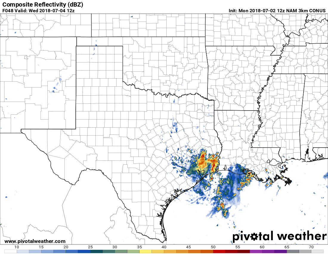
Simulated model radar from 7 AM Wednesday to 7 PM Wednesday (each frame progresses 3 hours forward). This is only a model-depiction and will not completely verify. Check back for updates and more accurate/specific Independence Day rain forecasts.
Scattered to numerous showers and thunderstorms are expected on Independence Day (Wednesday) across East Texas, Southeast Texas, the Brazos Valley, west into Central Texas. Isolated to scattered showers and thunderstorms will likely continue into Wednesday night across the Concho Valley, Southwest Texas, Central Texas, South-Central Texas, South Texas, the Brazos Valley, the Coastal Plains, into the Middle Coast, and the Rio Grande Valley. Unfourtinietly this will likely impact some outdoor plans. Remember, lightning is the primary hazard with summer storms with unexpected wind gusts a concern for those on the water.
Widespread flash flooding is not expected this week. However, localized flooding may occur where heavier rains fall. Summer storms can produce one to three inches of rain in a short period of time. Street flooding is a good bet during heavier rains with minor flooding possible. Unlike two weeks ago this system is not expected to produce higher-end or widespread flooding.


0 Comments