
Our hottest stretch of summer heat since 2011 is upon us. High temperatures peaked in the upper 90s to 110-degree range across Texas today. Temperatures could end up being even warmer tomorrow and on Friday. Radiant heat will become more of an issue at night as well. Every day we make it up into the triple digits is another night where temperatures will struggle to dip below 80 degrees. With lows in the 80s and increased humidity at night, our bodies are going to have issues keeping cool – especially those who are more susceptible to heat illness.
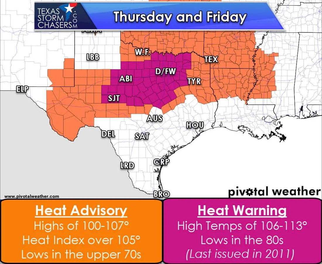
An excessive heat warning has been issued for the Concho Valley, Big Country, North Texas, and portions of Central Texas. These locations all easily made it into the 100s today and could be warmer the next two days. Peak afternoon temperatures of 106-113 degrees are expected. Temperatures will be slow to cool after sunset with the 90s continuing into the pre-dawn hours. Lows will probably not make it below 80 degrees until this weekend. A heat advisory is in place across the Permian Basin, West Texas, Northeast Texas, and East Texas where high temperatures and/or heat index values over 105 degrees are expected. I anticipate additional advisories being issued for the weekend – and probably farther south too.
I won’t blast you with heat safety tips. Still though, with the hottest weather since 2011 upon us, let’s review a few notes. Understand the differences between being out in the heat too long and actually having a life-threatening heat emergency. Just because you’re used to being outdoors when it’s in the 90s doesn’t mean the same can be said when its 110 degrees with no overnight relief. Check up on your elderly neighbors and make sure they’re staying cool and hydrated.
There are indications in long-range model data that we may have some relief arrive late next week. Until then we’re going to be under the influence of the “heat dome of doom”. Temperatures will approach or exceed records across parts of the state into early next week. While this heatwave will not compare to the stretch we had in 2011, the temperatures themselves are comparable to the peaks from 2011. Below you’ll find the daily high-temperature forecast through next Tuesday from the National Weather Service. While not shown, low temperatures in the upper 70s to middle 80s will only make this heatwave more dangerous and unpleasant.


0 Comments