
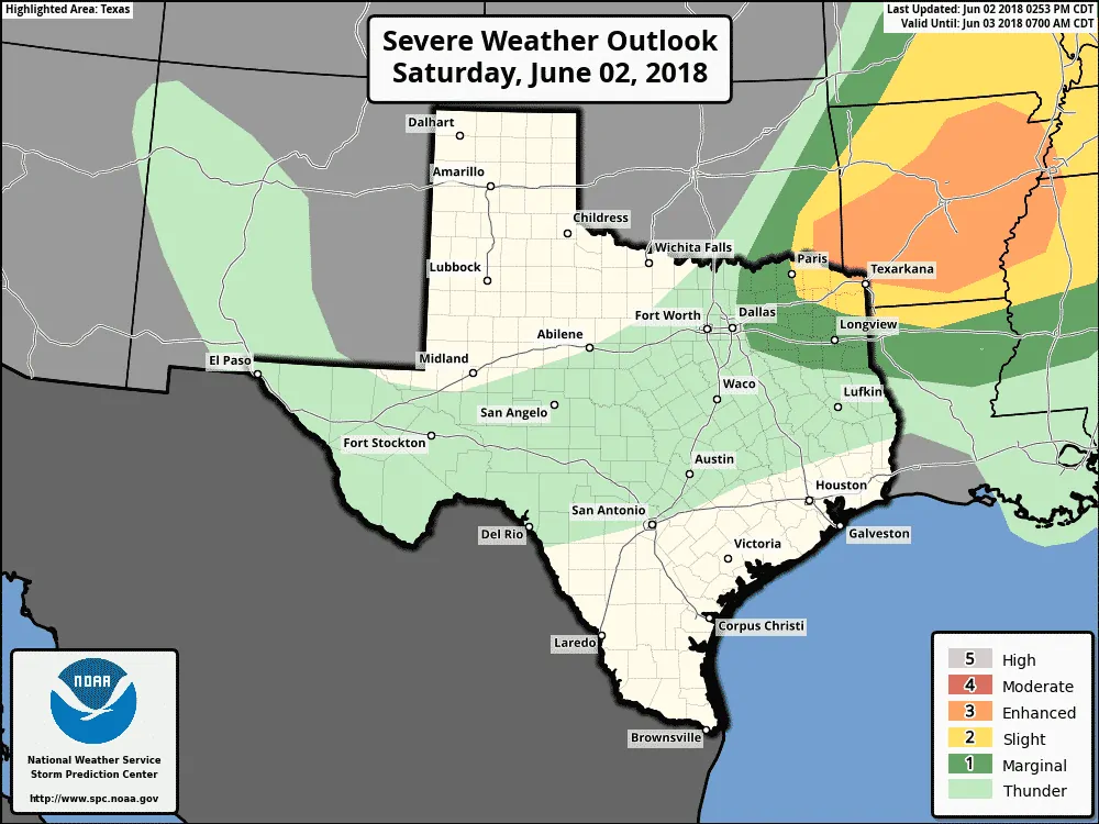
Isolated to scattered strong thunderstorms may impact Northeast Texas and North Texas tonight. A weak frontal boundary is progressing this afternoon across southern Oklahoma eastward into central Arkansas. Severe thunderstorms have developed on this boundary northwest of Little Rock. Additional thunderstorm development may occur farther west into southeastern Oklahoma by 8 PM.
Thunderstorm activity may increase across Northeast Texas after 8 PM as isolated to widely scattered storms fire up in Southeast Oklahoma. These storms would have a tendency to move south. In addition, any outflow boundaries that are produced may also move into North and Northeast Texas tonight. Those outflow boundaries could provide the lift needed to fire off additional thunderstorms.
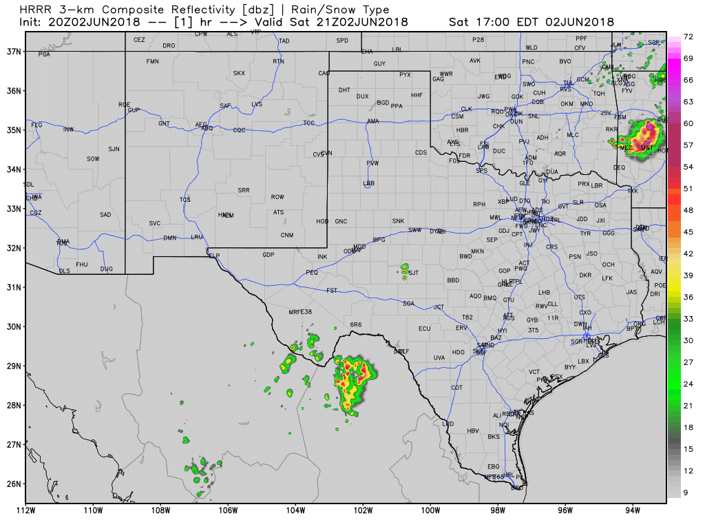
One high-resolution model’s simulated radar through Sunday morning. Times are in eastern on the top-right portion of the graphic. This is only a model simulation.
Most folks should stay dry tonight, but those that are impacted by thunderstorms may receive strong outflow winds, dangerous cloud to ground lightning, and even small hail. Gusty outflow winds will be a significant hazard to those on lakes and rivers. One or two storms may become intense enough to produce hail larger than the size of quarters and wind gusts up to 70 MPH.
Thunderstorms may continue developing into the late evening hours across North Texas and Northeast Texas as the weak front progresses south toward Interstate 20. A majority of folks will remain dry but remain mindful of outflow winds well away from any storm. If you can hear thunder you’re at risk of being struck by lightning. If thunder roars move indoors!
Most thunderstorm activity should be concluded by 2 AM Sunday, but isolated activity could continue well into the night. A positive note from any nearby storm is that outflow winds (while dangerous for those on water) will provide relief from the heat.


0 Comments