
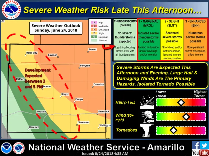
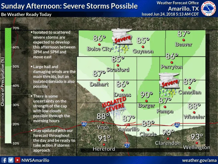
The Texas Panhandle region will be under the gun later today for strong to severe storms. Ongoing storms across southern Kansas into Oklahoma are expected to push an outflow boundary into the northern and eastern panhandle region which will enhance the focus for strong to severe storm development later this afternoon and through the evening hours. The focus for initiation is a bit uncertain and will depend on the eventual location of the various outflow boundaries by this afternoon and how far east the dryline pushes by mid-afternoon. Current thinking is that the dryline will push to near or just east of the I-27 corridor which means storm initiation will occur east/northeast of Amarillo. Strong instability upwards of 3,000+ joules of CAPE (Convective Available Potential Energy) will be in place along with abundant moisture with dewpoints ranging from the mid 60s to low 70s. In other words, there will be plenty of storm fuel in place later this afternoon. The main threats will be large hail, damaging winds and possibly a few tornadoes with any storms that manage to stay more isolated. As the evening progresses, the storms will begin to cluster into a squall line and we’ll see the tornado threat decrease and the damaging wind threat increase. Folks in and near both the Enhanced and Slight Risk areas will need to keep an eye on the weather conditions later this afternoon and have a way to receive weather warnings should any be issued for your particular location. We expect most of the team to be out chasing today, so be sure to track the storms via our live interactive radar at texasstormchasers.com/radar and check back for live updates once the storms get going!


0 Comments