
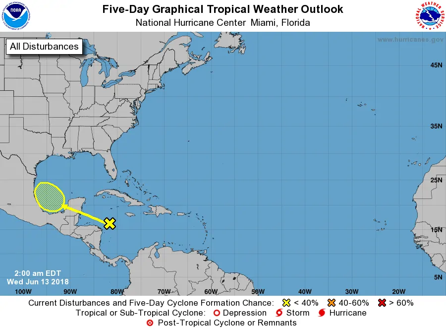
A disorganized area of low pressure is located near the Yucatan Peninsula this morning. This low will move into the Southwest Gulf of Mexico this weekend. Observations and model data continue to indicate this system only has a low probability of becoming a tropical cyclone. However, it is still loaded down with copious amounts of atmospheric moisture. All that moisture will advect inland into Texas this weekend. Additional moisture from Hurricane Bud out in the Pacific will also contribute to a very moisture-rich atmosphere this weekend and next week. A multi-day rain episode will probably occur in parts of the state this weekend and early next week.
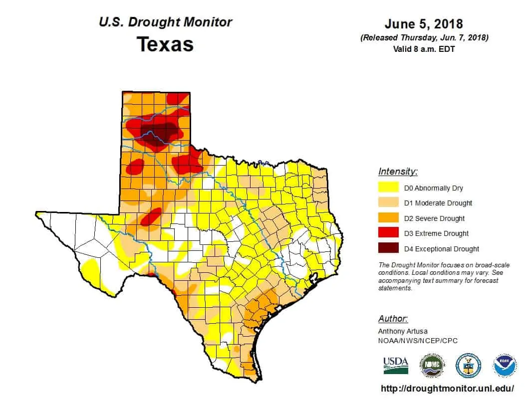
While an updated drought monitor will be posted later today, the one from last week shows we really need the rain. Drought conditions are expanding across Texas thanks to a very warm and relatively dry May. We need the rain and it looks like some folks are going to get it. One benefit of drier conditions is that it’ll take higher rainfall rates to cause flooding.
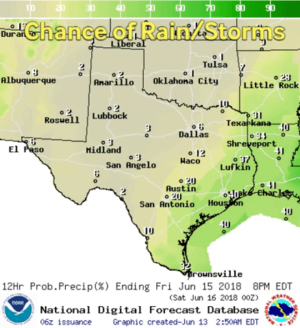
Chance for rain Friday through Tuesday from your local National Weather Service office(s)
Rain chances will begin increasing on Friday along the coast from the Rio Grande Valley northeast to far Southeast Texas. The highest coverage of rain should generally be during the peak heating hours. That may change on Saturday into Sunday as higher rain chances expand inland toward South-Central Texas and the Brazos Valley. From there rain chances will expand to encompass a majority of the state by Monday. Those rain chances will continue into Tuesday. Some of the increased rain chances will be from the ‘Gulf’ upper-level low while farther west may be due to monsoonal influences and Bud’s moisture influx.
Specific information on rain chances will be adjusted as we get closer to the Sunday-Tuesday timeframe, but overall this is looking like the best chance for rain most of the state has seen in several weeks. Some regions could see several inches of rain over a multi-day span. At this time the highest probability of rain totals exceeding 3 inches seems to be across the Coastal Plains and Southeast Texas. Once we get a probable forecast solution we’ll be able to start generating more detailed rain total estimates for the state.
There could be some flooding potential, especially by early next week after some locations have had several rounds of rain. Ongoing drought conditions will mitigate the flooding risk initially. An exception will be if one location receives several inches of rain in a one to three-hour span. Even with dry soils, that amount of runoff will overwhelm drainage systems and produce flash flooding. We’ll refine the flood outlook as future forecasts begin to depict a more precise forecast evolution. Luckily, many locations need the rain.
These scenarios typically do not result in more than a marginal severe weather risk. Stronger thunderstorms may produce localized damaging wind gusts known as microbursts. These summer-time microbursts can cause localized wind gusts of 35 to 55 MPH and are primarily a threat to aviation and recreational boating interests.


0 Comments