
A strong capping inversion and upper-level lift remaining to our north should result in a quiet dryline day in Texas. That will not be true for Kansas where a regional severe weather event is expected. Most of the TSC team will be in Kansas chasing today. Be sure to check out our new live stream page as it should be rocking this afternoon.
Wednesday, May 2nd
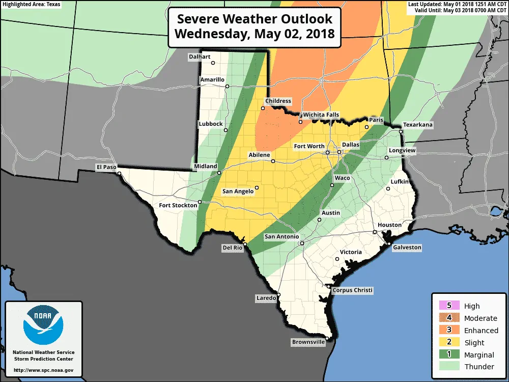
A level three risk of severe weather remains in place across most of Northwest Texas. Generally speaking, the risk runs from Childress to Roby to Henrietta. This zone has a 30% chance of seeing severe weather occur within 25 miles of a given point. Convective mode remains uncertain, but all modes of severe weather will be possible. Very large hail larger than the size of baseballs will be possible. We’ll refine the specific hazards in later outlooks.
A level two risk of severe weather includes the Big Country, Concho Valley, Edwards Plateau and the northwestern half of North Texas. This zone has a 15% chance of experiencing severe weather within 25 miles of a given point. Large hail and damaging wind gusts are the primary threats. An isolated tornado may occur. We may see the threat actually increase after dark and into the pre-dawn hours Thursday as a line of storms moves from west to east.
A level one risk of severe weather does surround the level two risk zone and those within it have a 5% chance of experiencing severe weather within 25 miles of a given point.
If you’re IN or NEAR any of the risks please pay attention. Storms don’t know how to read maps and don’t care where risk lines are drawn. Check back for forecast updates tonight and on Wednesday. You can always see the latest severe weather outlooks here.
The best chance for severe storms in the western half of the risk zones will be from about 3 PM to 11 PM Wednesday. However – a possible second round of storms may try and develop Wednesday night as upper-level forcing increases. This aspect of the forecast remains low confidence. Expect changes.
Thursday, May 3
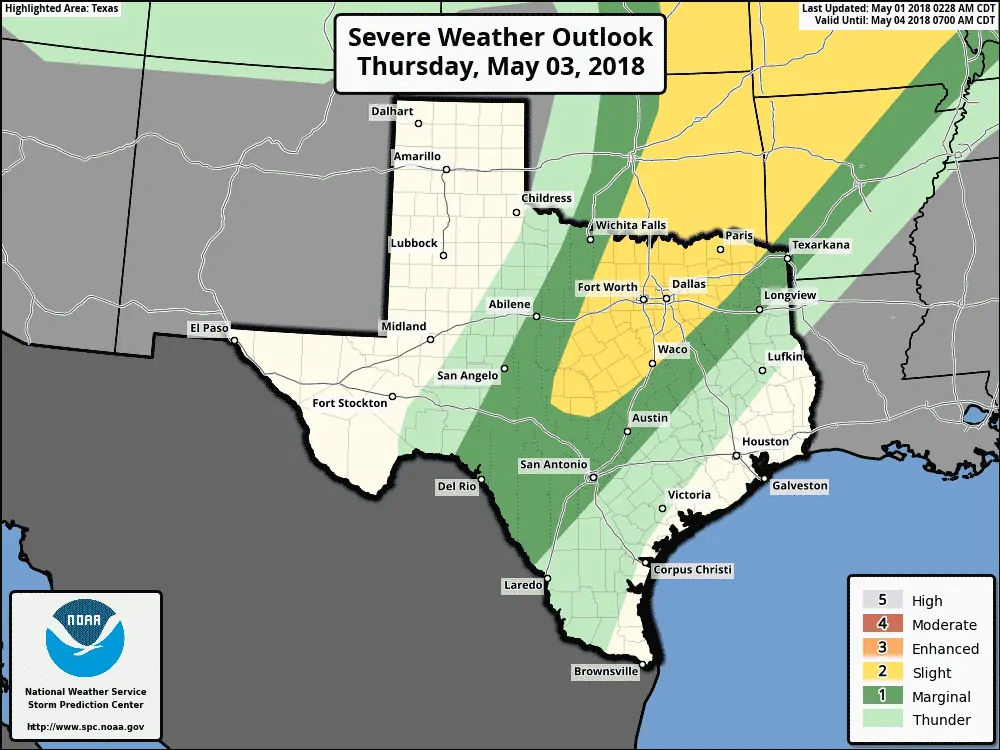
A level two risk of severe weather is in place across much of North Texas extending south into portions of Central Texas. A level one risk includes the Hil Country, eastern portions of the Big Country and Concho Valley, the Edwards Plateau, and portions of Northeast Texas and East Texas.
Wednesday’s eventual evolution will play a large role in how Thursday comes together. The dryline will be farther east compared to the day before. Depending on residual cloud cover we may see a strongly unstable airmass develop. Wind shear should be weaker, but the high amount of instability could off-set that to a certain extent.
Storms capable of producing large hail and damaging wind gusts could occur. The tornado threat will be determined as we get closer, but it doesn’t look to be zero.


0 Comments