
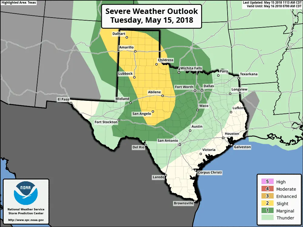
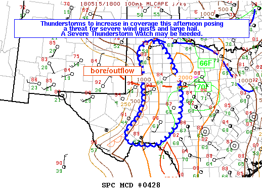
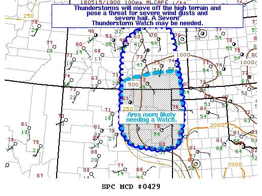
 The Storm Prediction Center has indicated a severe weather watch may be needed this afternoon. This discussion area includes a good chunk of West Texas. Temperatures have warmed into the upper 80s to lower 90s. A remnant outflow boundary from thunderstorms yesterday is located roughly from near Andrews to Abilene. The capping inversion is weakest along that boundary. Other small-scale boundaries are located across the region. Any of these boundaries could help spark off a thunderstorm as hot temperatures weaken the cap.
Compared to Monday we still have plenty of instability and enough wind shear to support organized thunderstorms. As is typical for our late spring setups we’ll likely see a mix of convective modes today. The strongest storms this afternoon through early evening will probably be supercelluar. The strongest of those supercells may produce very large hail and localized damaging wind gusts. Splitting supercells are a good bet as well… meaning one storm ‘splits’. The left-mover would move more north/northeast with a hail threat. The right-mover would tend to move more slowly to the south/southeast with a threat of hail, localized damaging winds, and perhaps a brief tornado.
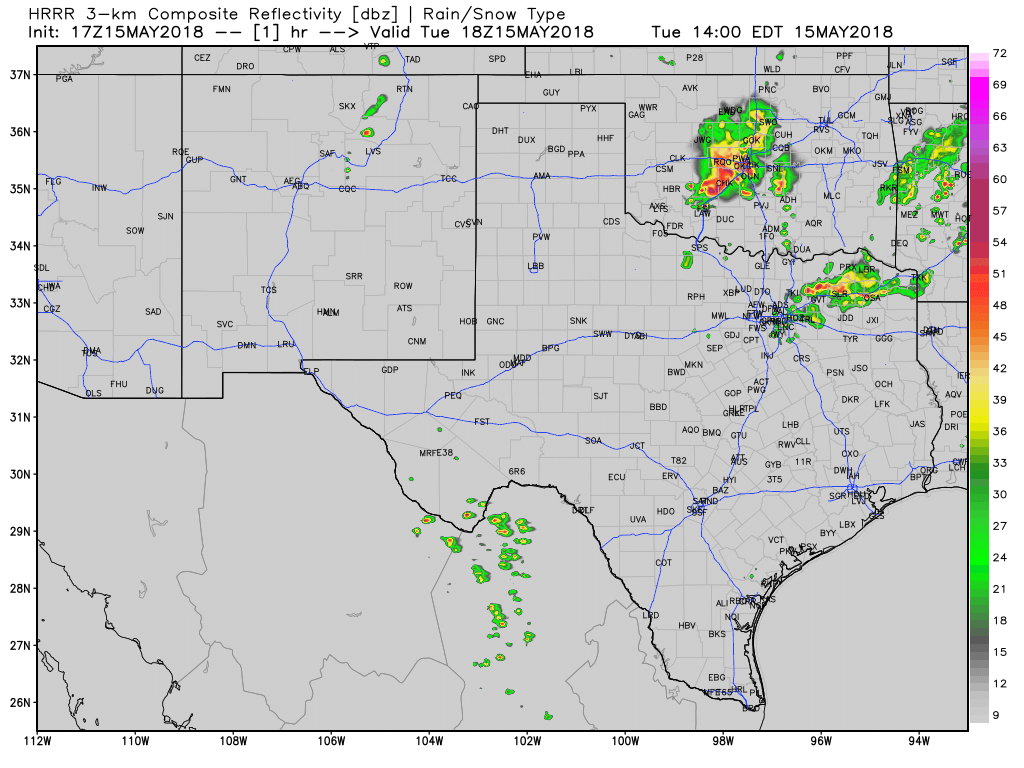
Simulated model radar depiction through 6 AM Wednesday. This model probably won’t verify completely, so use with that in mind.
Another area we’re watching is an ongoing cluster of severe storms in south-central Oklahoma. They’ve turned more southerly over the hour with a history of damaging wind gusts. We’ll have to keep an eye on this storm cluster in case it moves toward the Red River. Outflow generated by these storms may also spark off new storms in Texoma. This scenario is not guaranteed, but if it unfolds the chance for a few stronger storms would increase later this afternoon and evening in Texoma and North Texas. Hail and damaging wind gusts would be possible with the strongest storms as they move south/southeast.
We may see one or more clusters of thunderstorms organize by the early evening hours from northeastern New Mexico, the Texas Panhandle, and south through West Texas. Where exactly we see one or two clusters eventually organize is still TBD. Should these clusters organize they’d likely move east/southeast with a threat of damaging straight-line winds over 70 MPH and heavy rainfall. Storms should gradually weaken as they move east tonight, but they may make it into western North Texas early Wednesday morning. Gusty winds will be the main concern with those storms tonight.


0 Comments