
Good morning and welcome to May 24th. This day has produced many of my personal best tornado chases in the past decade. Today will not be one of those days as an extremely quiet tornado season continues. What we will be talking about is the likelihood of an early season tropical threat in the Gulf of Mexico by the weekend. Before we start up the post-2017 hurricane anxiety let’s dive into the details.
Data from WDT WeatherOps
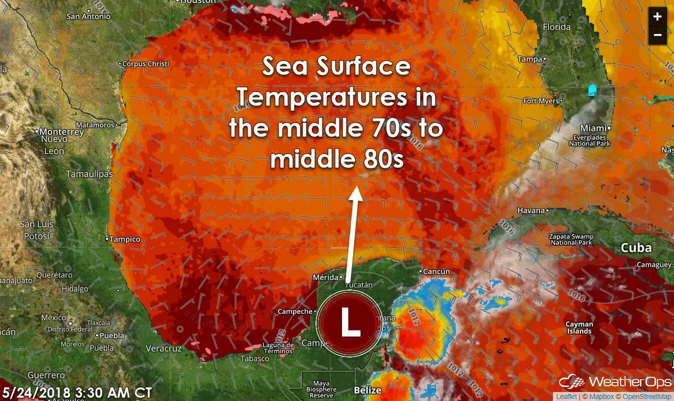
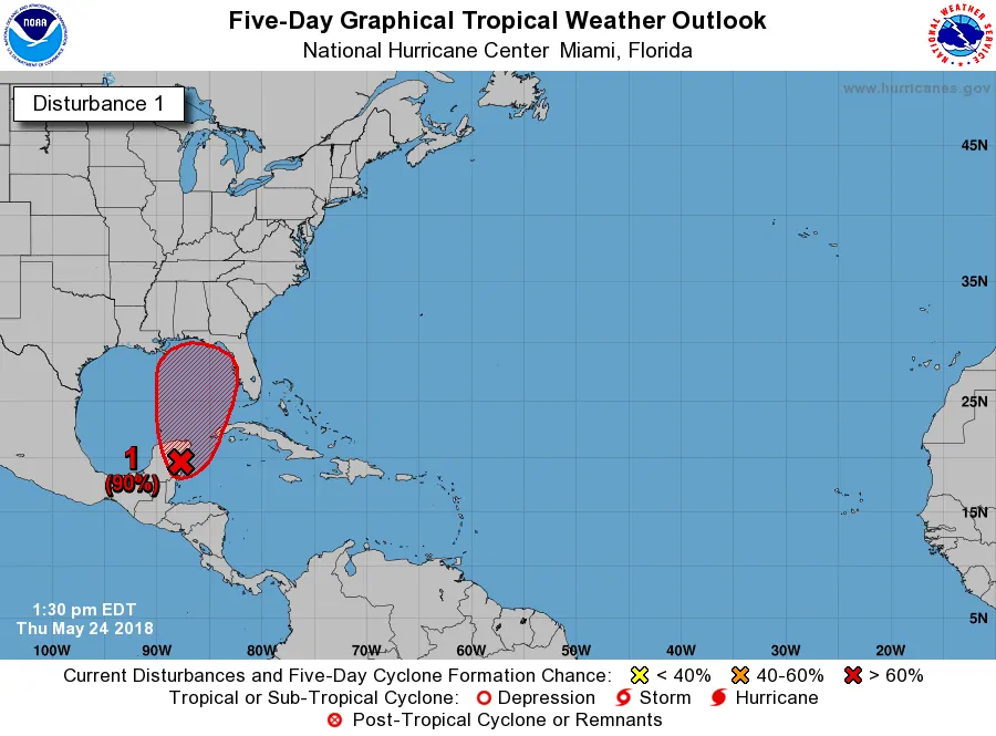
A broad surface low, known as Invest 90L, is located over the southeastern Yucatan Pensenlya. This system is producing pockets of showers and thunderstorms. It has become better defined over the last day, but development into a tropical cyclone (anything from a depression to hurricane) is unlikely in the next 48 hours.
NOTE: This 12:30 PM CT updated graphic was inserted into the post several hours after it was written. The post itself remains unchanged.
Invest 90L will slowly drift around the northern Yucatan Peninsula for the next couple of days. Thereafter it will begin moving toward the Central or Eastern Gulf of Mexico this weekend. Development into a tropical depression is a high probability according to the National Hurricane Center.
Where’s it going and is it going to impact us in Texas?
Nearly all weather model guidance takes Invest 90L east of Texas early next week. Should that occur we’d probably see little impacts. If anything, we might actually see subsidence occur with a better shot at higher temperatures. However – we’ll need to wait until the system actually develops until we can start pinpointing more exact landfall locations.
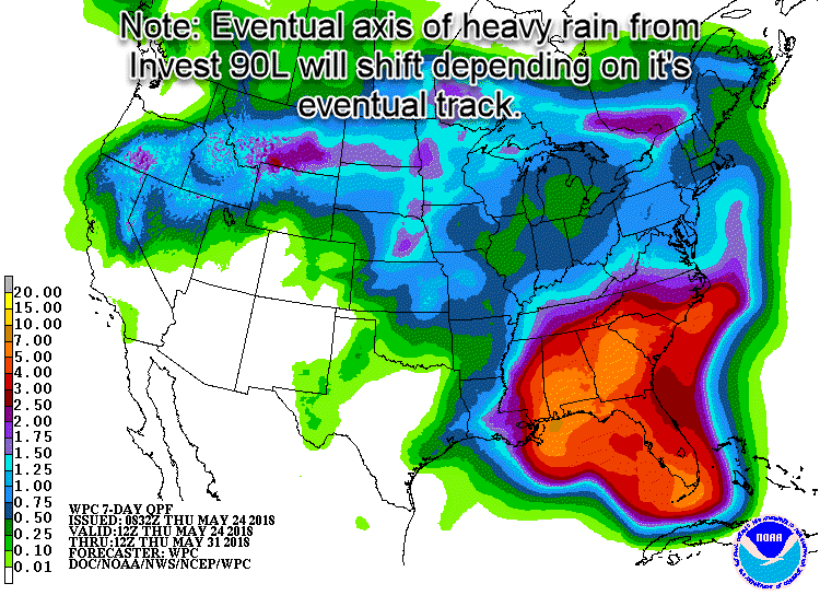
Potential rain totals over the next seven days.
Points near and east of the storm’s track are in for a wet period with four to seven inches of rainfall possible. That’s certainly enough to ruin a beach day. Conditions shouldn’t favor rapid intensification, but it may become organized enough to be classified as a weak tropical storm before landfall. Should that tropical storm classification occur the system would be named ‘Alberto’.
Does an early start mean it’ll be a bad hurricane season?
We’re off to an early start for the 2018 Atlantic Hurricane Season – which technically doesn’t begin until June 1st or a week from tomorrow. Is this a sign of a more active hurricane season? It’s not my place to say. However, it only takes one storm to make a season memorable. Take this early start as a reminder to check up on our hurricane preparedness kit and know what you’d do/where you’d go if you live in an evacuation zone.


0 Comments