
I hope you haven’t missed us too badly! The relatively quiet weather has allowed each of us to take a breather from the weather. Widespread severe storms are not anticipated in the next couple of days. However, localized severe storms will be daily threats east of the dryline in the Texas Panhandle. Modest upper-level winds and high temperature-dewpoint spreads will result in a microburst threat.
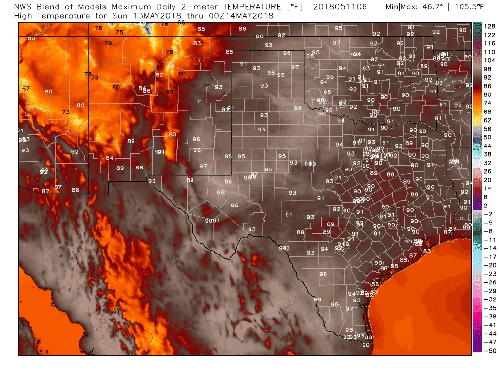
Surface temperatures climbing into the middle to the upper 90s each afternoon should allow the cap to weaken each of the next three afternoons. Widespread severe storms are not expected and thunderstorm coverage should remain isolated to widely scattered. An exception may be on Sunday when we may see higher coverage of storms. Cloud bases will be quite high which will result in a good chance of microbursts. The strongest microbursts may produce localized wind gusts over 75 MPH. Hail up to the size of ping-pong balls may also occur.
A third more uncommon threat is the risk of dry thunderstorms. Cloud bases may be high enough that most precipitation falling may evaporate before reaching the ground. That means storms producing lightning with little rain actually making it to the surface. Strong winds would occur with any dry storms as well. Lighting + strong winds + exceptional drought – rain = new wildfire ignitions. This dry thunderstorm threat will exist today and on Saturday.
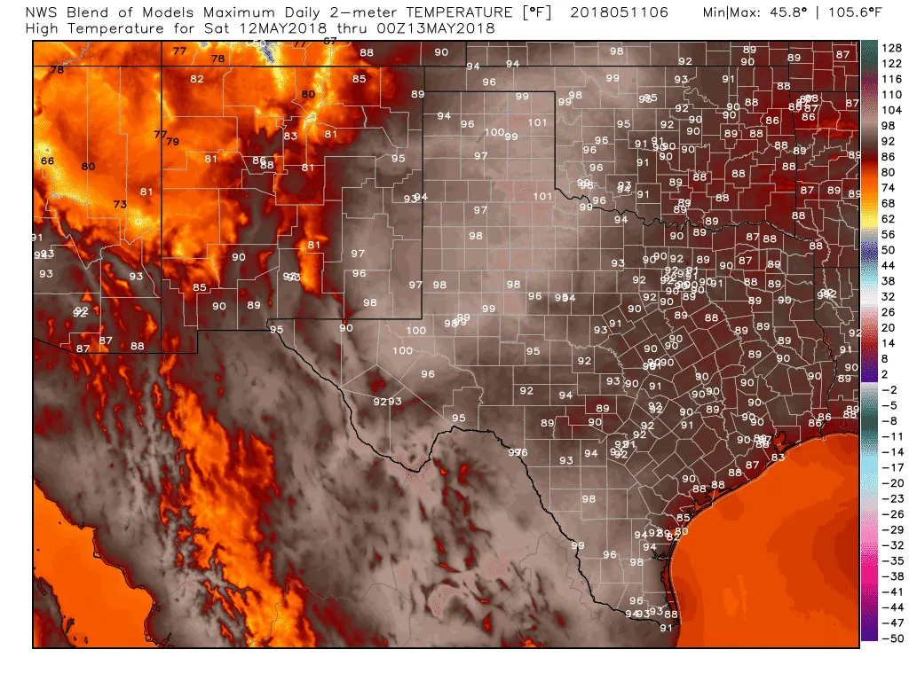
Saturday’s High Temperature Forecast
Sunday’s High Temperature Forecast
Outside of the dryline storm chances in the Texas Panhandle, a fairly summer-like pattern is expected across the rest of Texas. High temperatures today and on Saturday will generally be comparable to what you’d expect in July. Where temperatures are comparatively lower the humidity will be higher, thus making it feel just as warm. Some locations across Northwest Texas into the southeastern Caprock will probably make it into the triple digits this afternoon.
These hot temperatures, gusty south winds (east of the dryline, southwest/west to the west of the dryline), and exceptional drought conditions will result in near-critical fire weather danger today across the Texas Panhandle, West Texas, the Permian Basin, the Trans-Pecos, and west into the Borderland. Any fires that develop will probably spread at a fast rate and require substantial initial attack resources to contain.
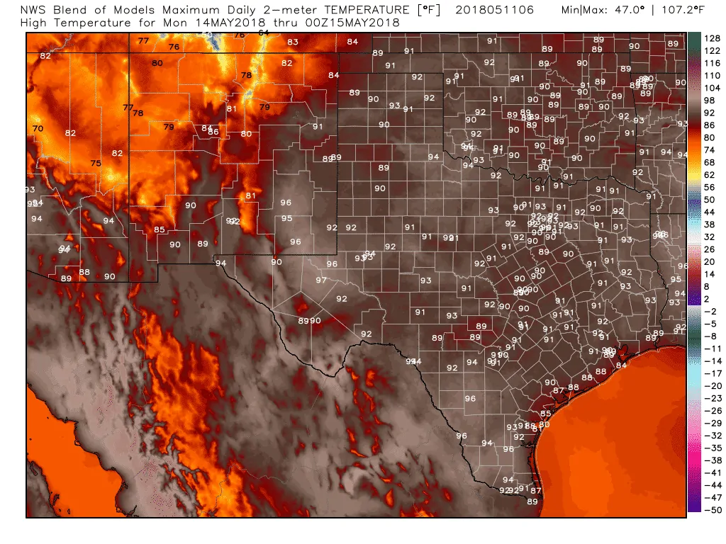
This warm and relatively dry pattern looks to continue into early next week. There are some indications (depending on which weather model suite one uses) that we may see some increase in precipitation chances farther east in Texas around Wednesday. We’ll just have to wait and see, but I’m hopeful we can get back into a more active weather pattern for the second half of May. While that would result in some severe weather chances, it would also bring much-needed rain before we get into the doldrums of summer.


0 Comments