
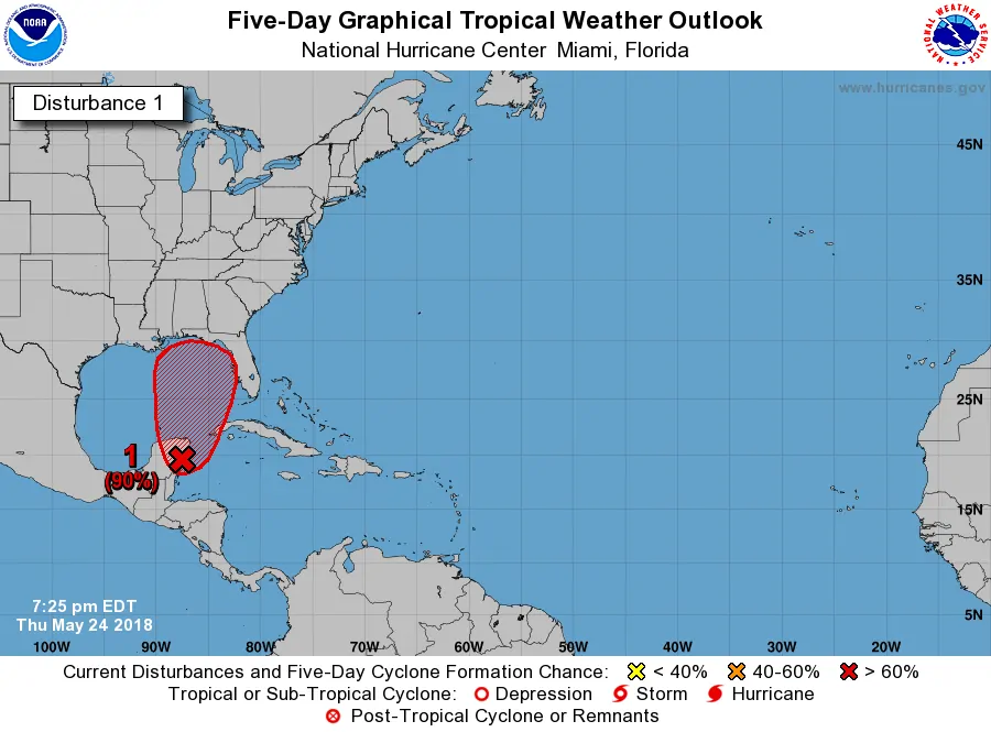
A broad area of low pressure continues to slowly drift over the eastern Yucatan Peninsula. It has become more defined since yesterday, but strong upper-level wind shear is hindering further organization. As wind shear decreases and the area of low pressure moves north into the Gulf of Mexico this weekend additional development is probable.
The National Hurricane Center has given Invest 90L a 90% probability of becoming a tropical depression/storm before impacting the United States Gulf Coast next week. June 1st is the official start of the 2018 Atlantic Hurricane Season, but we’re starting early this year. Yet another reminder that Mother Nature follows no calendar.
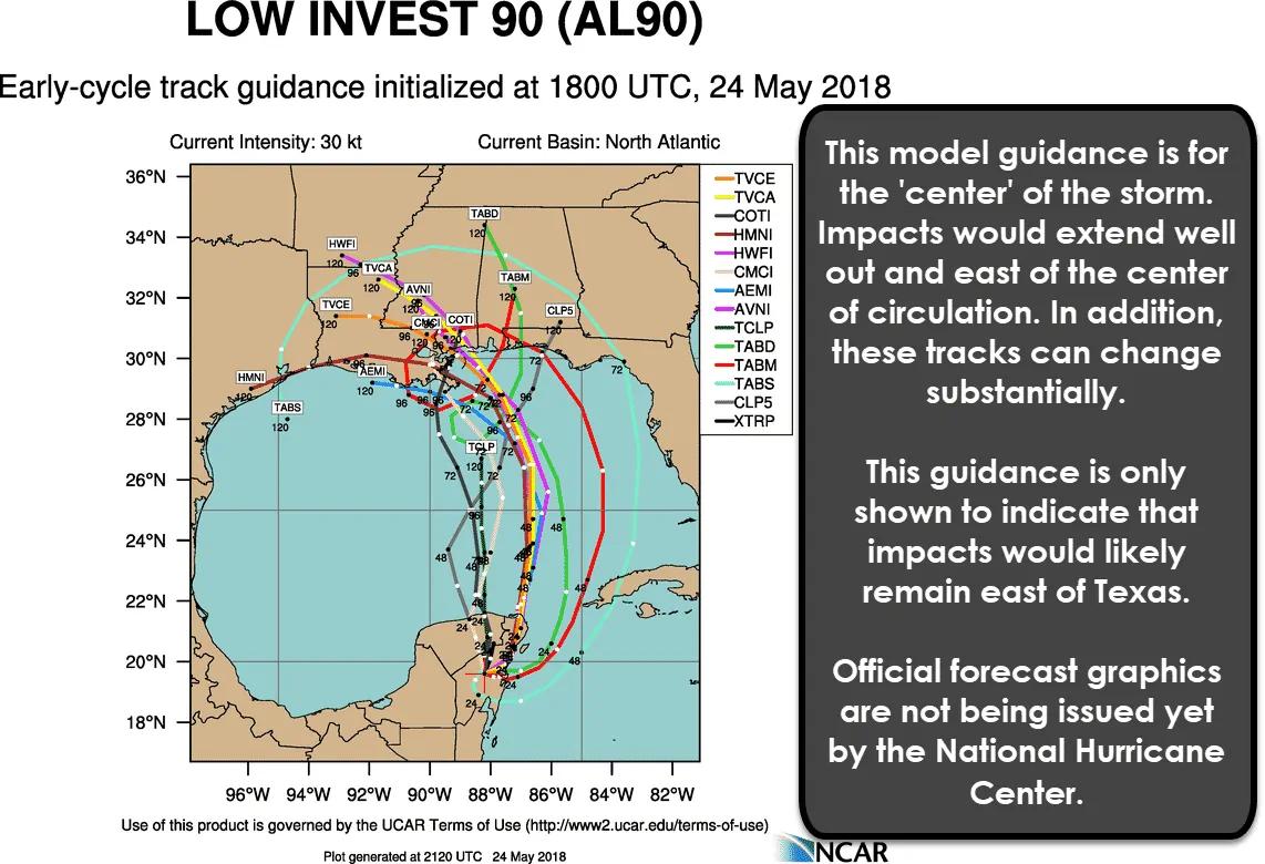
Tropical weather model guidance continues to indicate that Invest 90L/future ‘Alberto’ should remain well east of Texas. However, this guidance isn’t overly reliable until we have a defined/developed system. Still, most global weather model guidance is in general agreement.
Projected conditions should allow Invest 90L to become a weak tropical storm early next week before it makes landfall on the northern Gulf Coast. This system would be called ‘Alberto’. Landfall could be anywhere from eastern Louisiana to the Florida Panhandle.
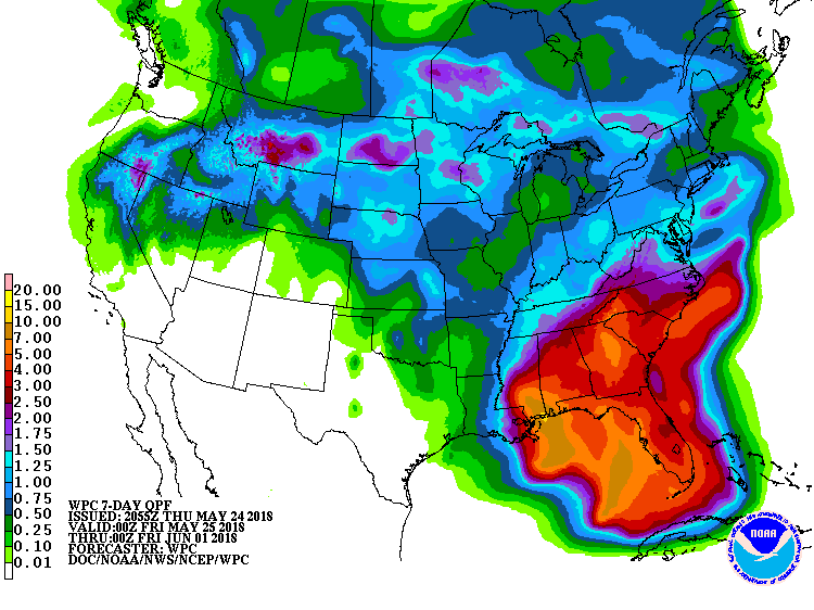
Potential rain totals over the next seven days. The axis of heaviest rains will depend on the eventual track of the tropical system.
Weak tropical systems don’t usually have a ‘defined’ core of higher impacts, so the biggest threat would be along and well east of the centerline. Very heavy rainfall looks to be the highest threat with some locations receiving 12 to 15 inches of rain east of the system’s track. Most data places the highest threat for flooding along the Mississippi, Alabama, and western Florida Panhandle coastline. That could shift some as the eventual track of future ‘Alberto’ becomes more clear.
Unless we see a drastic shift to the west in the model guidance we’d unlikely see impacts in Texas. Perhaps increased surf on the beaches, but that’s about it. If anything, the subsidence (sinking air) west of Alberto might cause temperatures to be even warmer. Before you ask, yes a drastic shift west is always possible – but quite unlikely at this time. We’ll keep tabs on it.


0 Comments