
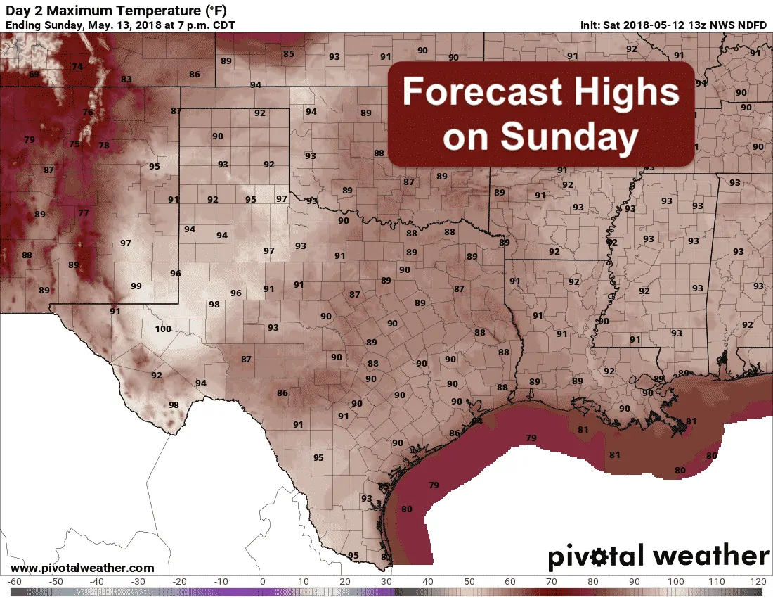
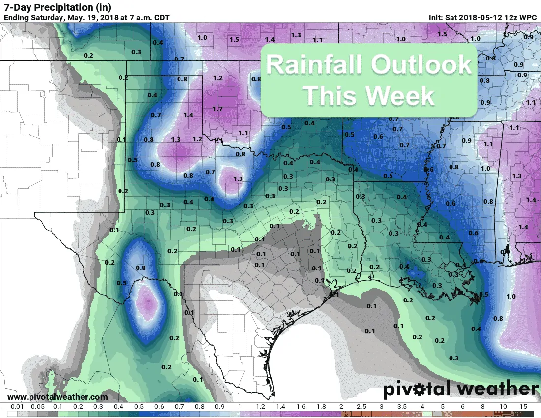
Chances for rain and storms across the western half of the state increases over the next several days. While widespread rainfall isn’t expected, we will have several days…mainly Sunday through Wednesday…where we see daily chances for afternoon storm development along the dryline which will bring at least some beneficial rainfall to folks in a very parched region of our state. At this time, Sunday and Monday will feature the best chances, then storm chances will begin to wind down by Wednesday and Thursday. Daily highs this weekend and into the first few days of next week will remain well above average for mid-May with record to near-record breaking heat expected across the western half of the state. If you’re working or playing outdoors for the next several afternoons, be sure to drink plenty of water and take frequent breaks. This sudden transition from a rather cool early Spring pattern to a rather hot late Spring pattern hasn’t given our bodies much time to adjust, so take extra precautions to avoid heat related illness.
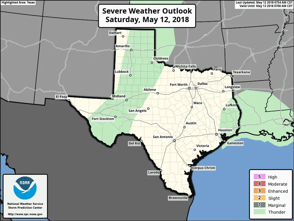
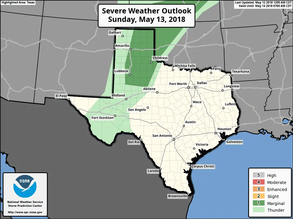
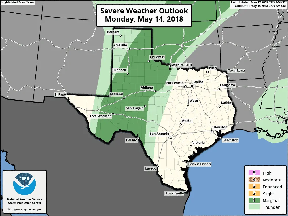
For today, isolated dry thunderstorms may develop later this afternoon on the dryline across the Texas panhandle down into the Permian Basin region. Lightning strikes and downburst winds with periods of blowing dust will be the main hazards with any of the storms that develop today. For Sunday, better moisture arrives ahead of the dryline which is expected to set up across the panhandle east of the I-27 corridor and down towards Midland/Odessa and into the Big Bend region. Due to the increase in available moisture on Sunday, more widespread severe storm development is expected with the threat of large hail, downburst winds and periods of heavy rainfall. This pattern will repeat itself again on Monday with even better chances for strong to severe storms extending further south into the Permian Basin/Big Bend regions of the state. Overall, we’re not expected any sort of widespread severe weather evening, nor a widespread rainfall event, but residents across western Texas from the panhandle down into Big Bend will need to be on the lookout each day for severe storm chances as we reach peak heating each afternoon.


0 Comments