
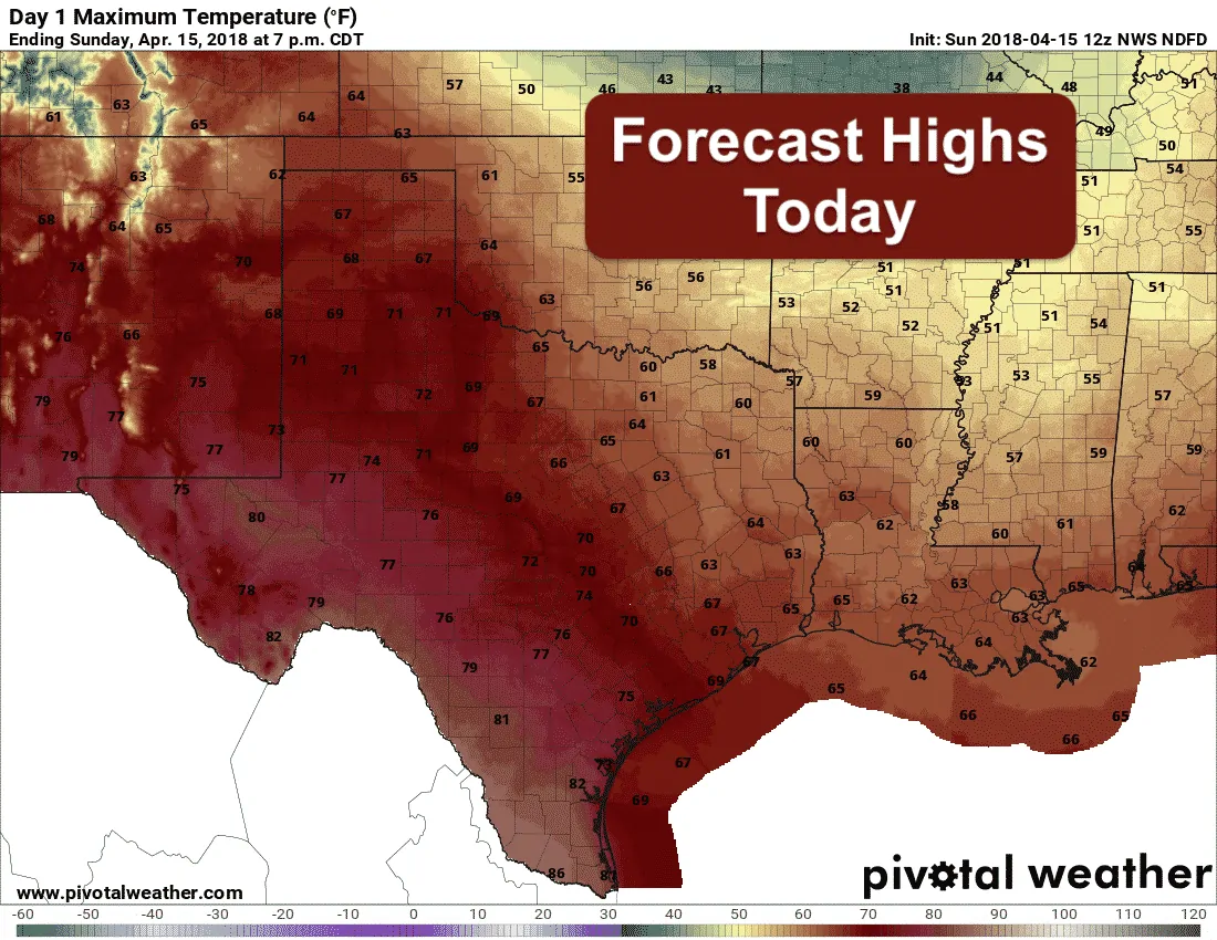
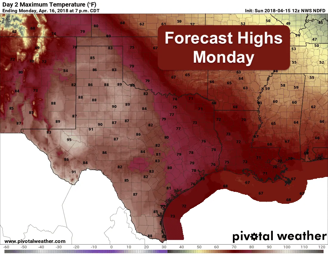
Good morning and happy Sunday everyone! I don’t know about y’all, but we’re getting tired of the constant wind and cold air intrusions. At least for the work week ahead, we’ll be talking about a warming trend which will have temps back above seasonal averages across most of the state tomorrow and Tuesday. As always, conditions will be a bit cooler where more humid air is present, so the eastern half of the state will warm, but remain cooler on average that locations out west where humidity levels in the afternoon will remain low. Forecast highs today for all of the state will be on the cool side for this time of the year, but for Monday and Tuesday, temps will soar into the 80s and 90s. Windy conditions will remain present across the panhandle and western Texas which means the ongoing threat for wildfires will continue. For the eastern half of the state early this week, highs will remain relatively pleasant with 70s expected. A weak high pressure ridge will cross overhead during the early part of the week which will keep us rain-free and with no threat of severe weather until the arrival of our next upper level system late in the week. More on that below. A weak cool front will slide in on Wednesday, but is expected to have minimal impacts on temperatures overall. We may see a dip of 5-10 degrees, but that’s about it.
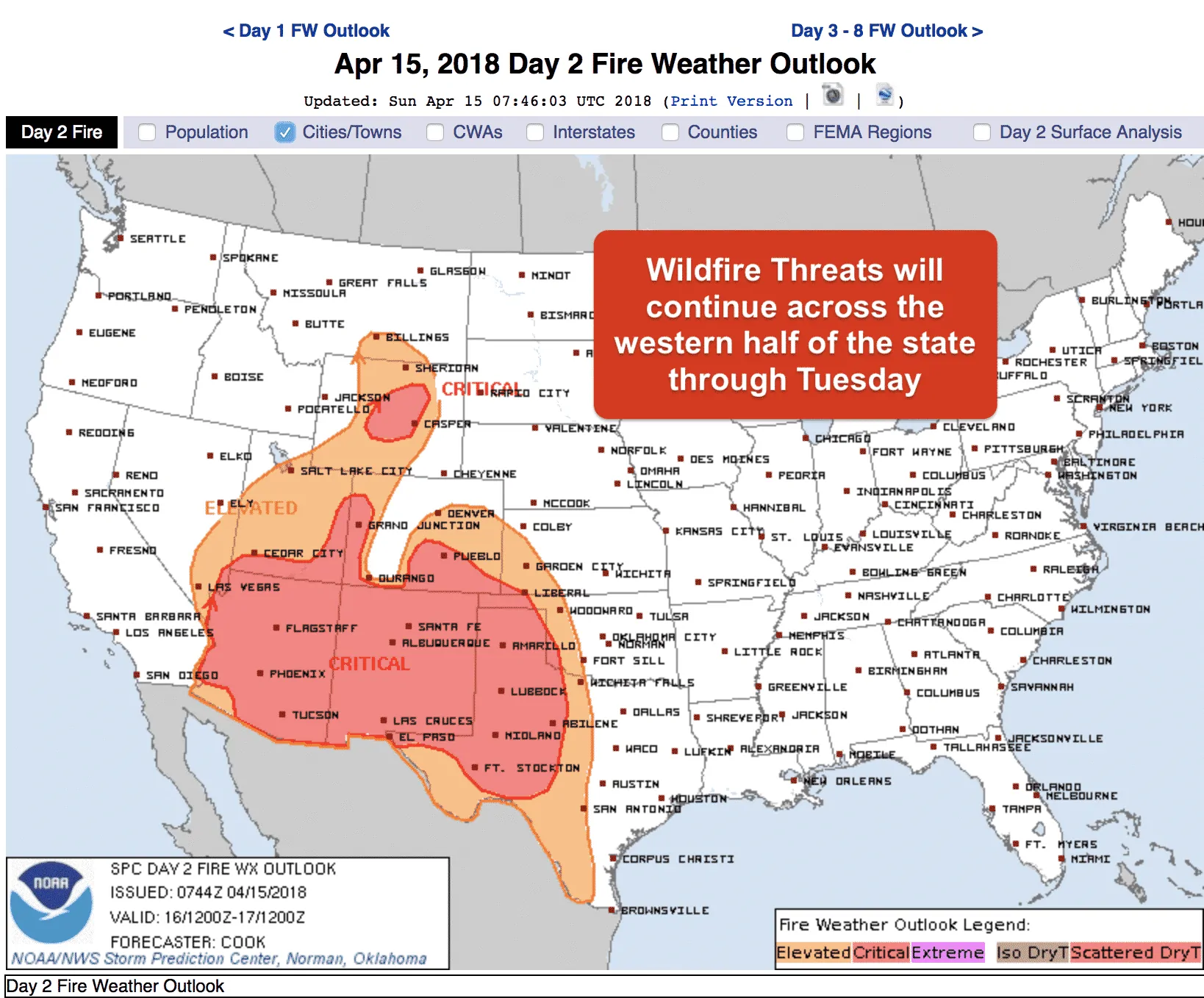
As mentioned above, fire weather threats will continue for the first part of the week with Critical to Extreme levels expected Monday and into Tuesday as well across much of the panhandle and western Texas. Gusty winds and periods of blowing dust will unfortunately remain the norm for these regions until we can get some decent rainfall. The climate outlook for the next 10-14 days is hinting at better chances for rainfall across parts of the panhandle, Oklahoma and northern Texas, but it’s too soon to get hopes up. We will continue to monitor this trend and keep praying for some meaningful rainfall for our parched regions.
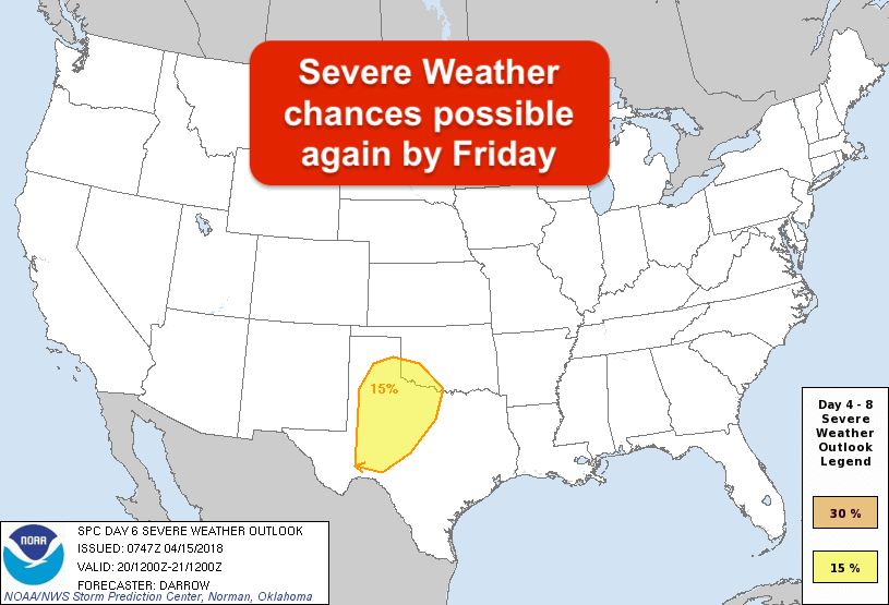
For late in the week, the long-range forecast models are hinting at the return of severe weather chances by Friday as a strong upper level low approaches from the west. Moisture return after Wednesday’s weak front is a concern as well as timing of the system’s arrival since our two main long-range forecast models are about 12-18 hours different at the moment. What is consistent is the upper level system itself which would bring at least some threat for severe storms along the dryline possibly as early as Thursday evening up in the panhandle, then again Friday afternoon and evening further east across western north Texas and down into southwest Texas. We’ll keep an eye on this and bring you the latest as the forecast continues to develop this week.


0 Comments