
The latest Storm Prediction Center Outlook as increased the probabilities of a few strong to severe storms across north central Texas this evening. Large hail and damaging wind gusts remain the primary threat, with the threat for tornadoes low. Isolated supercell thunderstorm development a few counties west of DFW this afternoon is likely within a narrow zone of destabilization and surface heating during the mid-afternoon hours. As these storms move east during the late afternoon/early evening hours, we’ll likely see them congeal into a squall line as they approach the DFW metroplex. At that point, hail and damaging winds will be the main threats, so if you’re attending outdoor events later this evening you’ll want to keep tabs on the weather and have a way to receive warnings should any be issued for your location.
Simulated Radar Through 3am
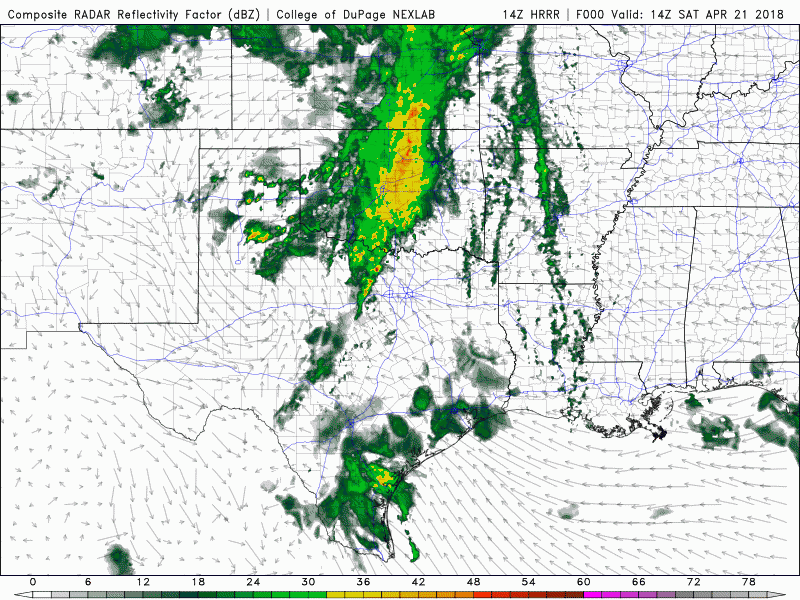
SPC Forecast Discussion (with annotations):
Day 1 Convective Outlook NWS Storm Prediction Center Norman OK 1049 AM CDT Sat Apr 21 2018 Valid 211630Z – 221200Z …THERE IS A SLIGHT RISK OF SEVERE THUNDERSTORMS OVER A SMALL PART OF NORTH TX… …THERE IS A MARGINAL RISK OF SEVERE THUNDERSTORMS ACROSS PORTIONS OF TX AND NORTHERN LA… …SUMMARY… Isolated severe thunderstorms are possible from northwest/north-central Texas this afternoon to east Texas and northern Louisiana tonight. …TX/LA… An upper low is centered today over eastern CO/western KS, with band of strong westerly flow around the south side of the low across TX. A large area of showers and thunderstorms is affecting much of OK and north-central TX within the strong low-level advection regime. This activity should spread northeastward and away from north TX by mid afternoon. In the wake of the morning activity, some heating/destabilization is expected west of FTW (Fort Worth), leading to an area of sufficient CAPE (Convective Available Potential Energy) and low-level convergence for isolated thunderstorm development. Low-level shear will decrease through the day as winds veer/weaken, but the consensus of 12z CAM solutions suggests 1 or 2 strong/severe storms will develop in this small area, capable of large hail. The threat should focus in the 22-02z period (5pm to 9pm). After that, storm intensities are expected to diminish but overall mesoscale organization may increase as storms become oriented into a line. A marginal risk of gusty winds or hail will persist through much of the night as storms spread into east TX and northern LA.


0 Comments