
The severe weather outlook we shared this morning wasn’t changed too much when updated this afternoon. There has been a minor expansion westward with both the level one and level two risks. Don’t pay too much attention to exactly where the lines are drawn. The point of these outlooks is to advise folks that there is a risk of stronger storms near and within the risks. Emphasis on the near. Thunderstorms don’t care where lines are drawn, so don’t get nitpicky if the level two line is ten miles to your east. Be sure you bookmark our free interactive HD weather radar for use tomorrow: It’s at texasstormchasers.com/radar.
Severe Weather Outlook
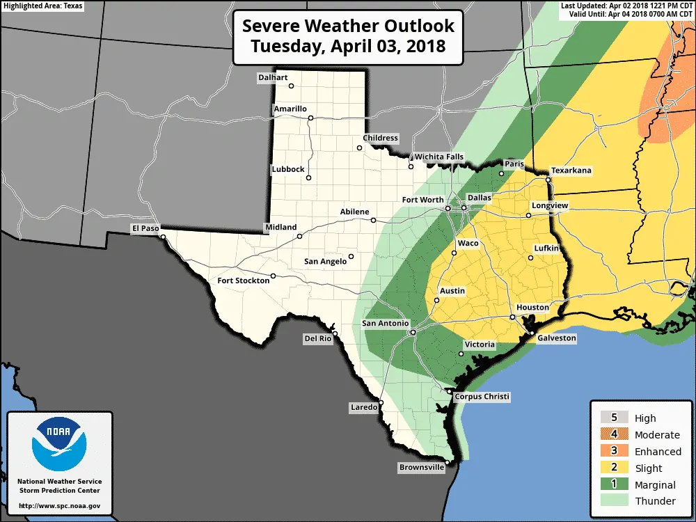
The level two risk means a fifteen percent (15%) chance of severe weather within 25 miles of a given point – such as your house. The level one risk means a five percent (5%) risk of severe weather within 25 miles of a given point. A level two risk is the ‘standard’ risk level with the level one being marginal and more isolated. Northeast Texas, East Texas, Southeast Texas, the Brazos Valley, and portions of Central Texas near and east of Interstate 35 are included in the level two risk zone.
The level one risk zone includes the eastern half of North Texas, portions of the Hill Country, South-Central Texas, and the Coastal Plains.
Threats
Localized damaging straight-line wind gusts over 60 MPH is expected to be the primary hazard with the stronger storms. Secondary hazards include the threat of hail up to the size of ping-pong balls and an isolated tornado.
Unidirectional low-level winds (meaning coming out of one direction versus veering/changing with height) should keep the tornado threat low. An isolated tornado cannot be ruled out.
Timing
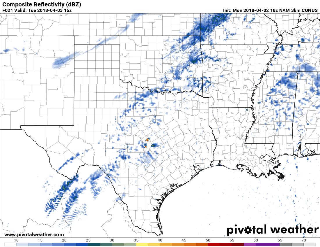
Simulated model radar from 10 AM Tuesday (15Z) progressing forward every three hours through 1 AM on Wednesday (06Z). This is only a projection of one model’s output. Don’t expect tomorrow to unfold exactly as depicted by this model.
The timing aspect will depend on the speed of the cold front. North of the front gusty north winds will occur. The highest chance for stronger thunderstorms will be along and south of the front. Thunderstorms that form along the front will tend to grow into line segments fairly quickly.
There is the potential we may see thunderstorm develop by early afternoon in Central Texas. These storms would still be south of the cold front. The strongest may have a risk of producing localized damaging winds and hail. They would generally move east and continue into portions of the Brazos Valley and East Texas. An isolated tornado cannot be ruled out.
Showers and thunderstorms are also expected to form on the leading edge of the cold front. Some of this activity may also be severe with a risk of localized damaging wind gusts. We’ll have to see how many storms fire ahead of the front tomorrow. That may end up becoming the main show versus a line of storms along the cold front.
Either way, the cold front will be moving off the Southeast Texas coast around midnight Wednesday along with thunderstorm chances. While the front will also be moving into South Texas, the atmosphere looks to remain ‘capped’. If that changes we may see a few storms fire up farther west tomorrow evening as the front pushes south.


0 Comments