
April showers bring May flowers? That certainly seems to be the case this year. The first half of April certainly started off dry enough. A pattern shift last week is now allowing us to receive two storm systems a week, or one every three to four days. Our next system will bring another round of beneficial rain to the drought-stricken regions out west Tuesday night. On Wednesday we’ll see rain chances spread farther east.
Severe Weather Outlook for Tomorrow
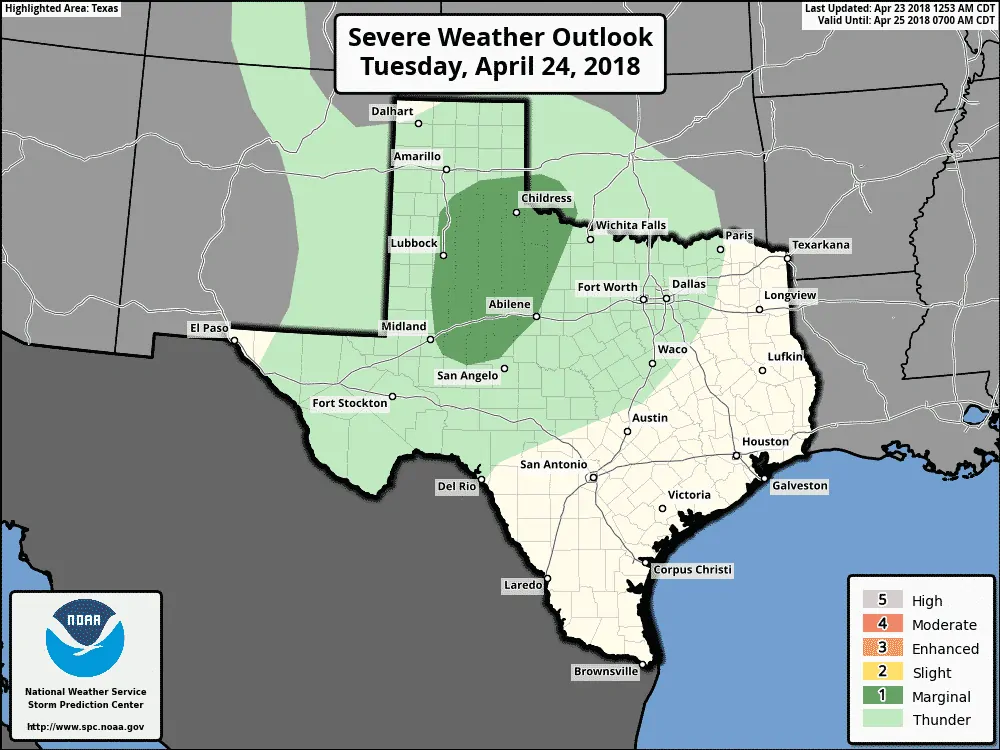
Severe weather outlook for Tuesday
It wouldn’t be April if we didn’t have some severe weather threat with the upcoming system. However, this threat will be relatively tame. Modest low-level moisture and weak low-level wind shear looks to keep Tuesday’s severe weather threat on the localized/marginal side. The Storm Prediction Center has placed a level one risk of severe weather across West-Central Texas. This ‘bubble’ of risk runs from Plainview to Lubbock to Lamesa to Midland on the west and San Angelo to Abilene to Electra on the east.
The best chance for a few strong storms with hail and localized damaging winds will be from 3 PM to 9 PM CT. A landspout tornado (usually weak and short-lived) may occur. Storms should gradually weaken not long after sunset with the loss of daytime heating and as they move east into a capped environment.
Detailed Rain Chances
Rain chances will increase Tuesday Night across the Texas Panhandle south/southeast into the Big Country, Northwest Texas, and western North Texas. A few storms may produce small hail, but severe storms aren’t expected. Scattered showers and storms will spread southeast on Wednesday with rain chances in the Permian Basin, Concho Valley, North Texas, into Northeast Texas.
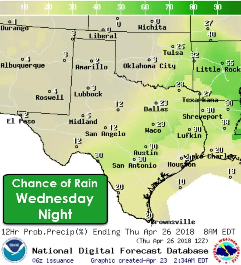
Not everyone will get wet, but hopefully, we can pull out another widespread rain event. Isolated to scattered convection will spread even farther south and east Wednesday night. We’ll shut off the tap by Thursday as the upper-level storm system moves away.
Forecast Rain Totals
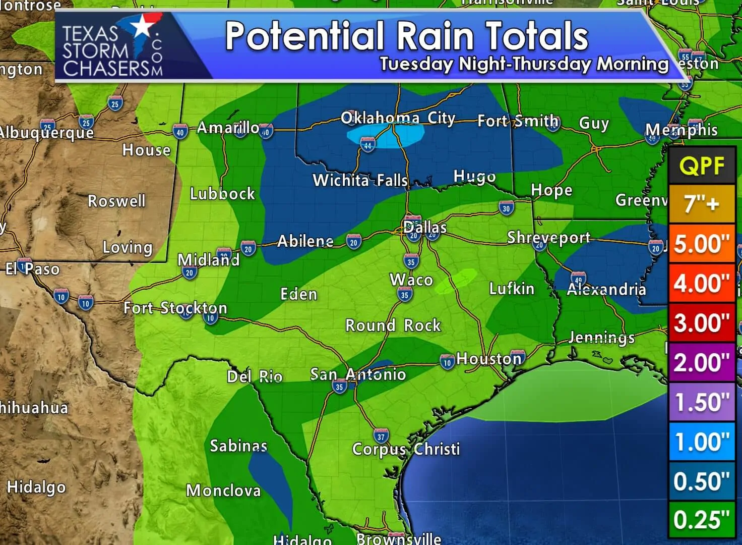
Rain totals may exceed one-half inch across the southeastern Texas Panhandle, West-Central Texas, into Northeast Texas. Every drop would be welcome with the ongoing drought and would be wonderful news after the rains on Friday. Amounts will be lower farther south and east, but some locations may pick up one-quarter to one-half inch locally. Flooding isn’t a concern with this forecast.
Looking ahead…
The weather pattern for this upcoming weekend and beyond remains uncertain. The long-range weather models can’t agree. One ‘set’ would result in an active pattern with additional rain chances. Another would result in quiet weather. We’ll just have to wait and see!


0 Comments