
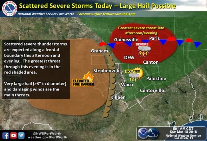
A complex forecast present today across north central, northeast and eastern Texas with a conditional risk of strong to severe storms later this afternoon and evening. While things are expected to remain relatively quiet for the next few hours, by mid to late afternoon, we’re expecting the atmosphere to become moderately unstable ahead of another disturbance approaching from the west…depending upon how much surface heating can be achieved over the next several hours. The dryline today will likely advance as far east as a Wichita Falls to Abilene to western Hill Country line. A frontal boundary is expected to be set up in an east/west fashion in the vicinity of, or just south of, the Red River. If we see a bit more clearing than what we have now and surface temps can rise into the mid to upper 70s, we may see Instability values this afternoon increase to moderate levels with ample moisture in place (mid 60’s dewpoints). Southeast surface winds are also expected to be in place which will provide a continuous feed of moisture into the region. If the atmosphere can generate enough instability this afternoon, we will likely see initial storm development by around 3pm west of the metroplex between Wichita Falls and Bowie near the intersection of the dryline and frontal boundary. Current short range models keep these storms rather isolated…as in two or maybe three potential supercells…with the main threats being large to very large hail and damaging winds. Storms that manage to develop this afternoon will track east across north central Texas during the late afternoon and early evening hours. Best timing for metroplex impacts will be between 4pm and 7pm before they move east and away from our major population center.
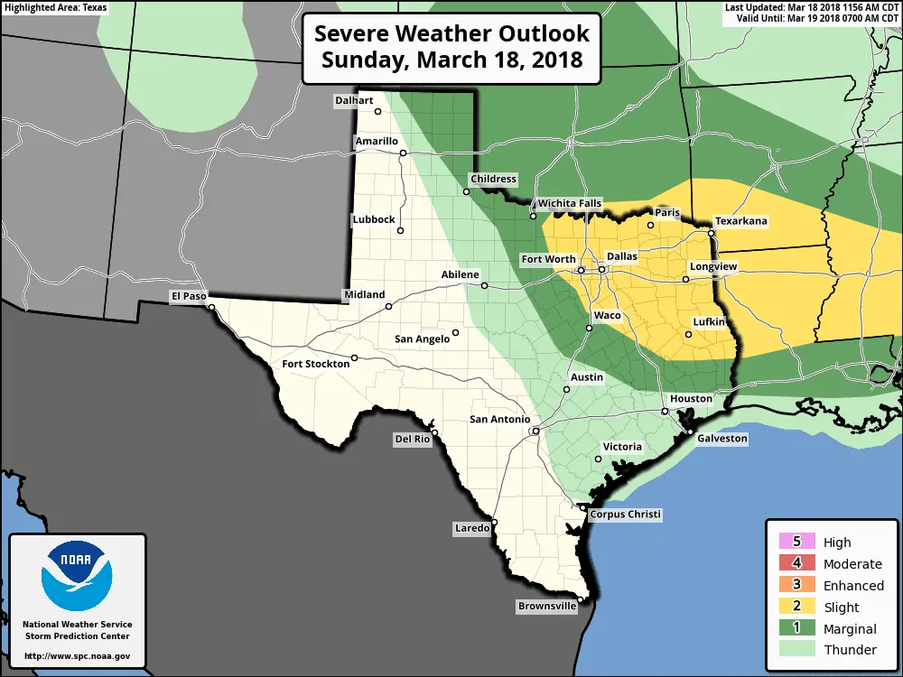
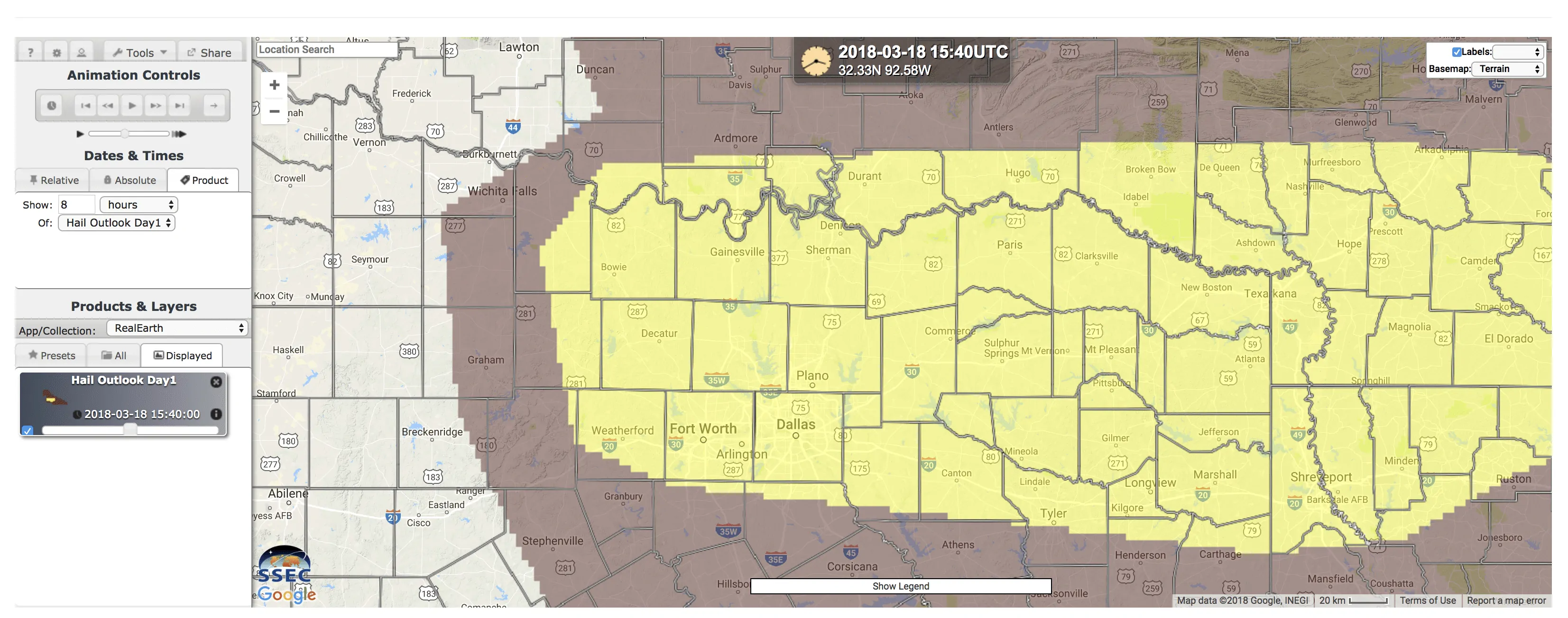
The Storm Prediction Center has placed a Slight Risk (Level 2) across much of the region…north central, northeast, and portions of eastern Texas for potential storm development later this afternoon and into the evening hours. This includes the yellow outlook area below for the threat of very large hail 2+ inches in diameter. As always, residents within or near the Slight Risk area need to keep an eye on the weather later today. Storm coverage is not expected to be widespread, and not everyone will be affected by storms this afternoon, but whatever does develop under these conditions will have the potential to pack a punch.


0 Comments