
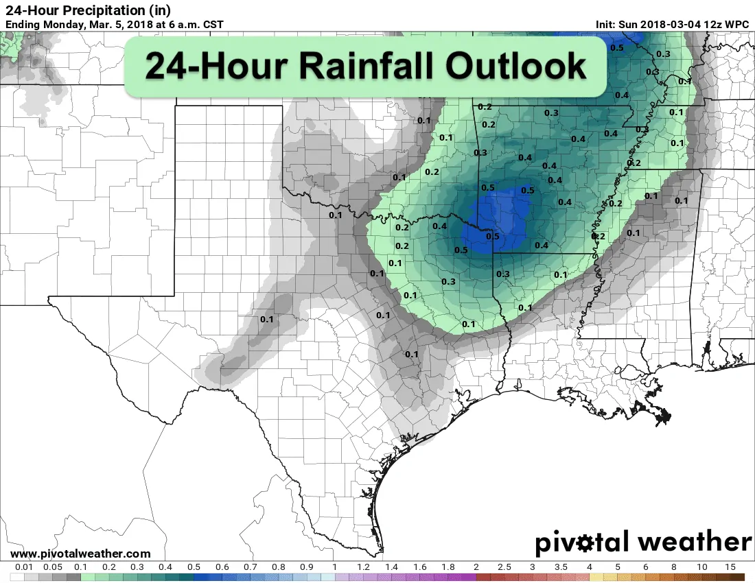
Good morning everyone and happy Sunday! The main weather topics today will be the chance for a few strong to severe storms across northeast Texas this afternoon, and the critical to extreme wildfire threat across the western half of the state. The overall weather pattern today will involve the approach of a weak cold front, an upper level disturbance to our northwest and a dryline which will bisect the state from north to south across western north Texas by this afternoon. As the upper level disturbance arrives this afternoon, we could see some scattered storm development mainly for areas along and east of the I-35 corridor across north central and northeast Texas. Conditions are not looking favorable for any sort of a widespread severe weather event, so we’ll be dealing with mainly small hail, some gust wind and thunder. A couple of stronger cells could become severe with quarter size hail, but with a fairly strong capping inversion in place, that threat will be low and very isolated. A Marginal Risk (Level 1) has been placed for northeast Texas to cover any issues we may see this afternoon and evening. Rainfall amounts today and overnight will be light and generally under 1/4 to 1/2 inches for most. The cold front will take its sweet time making it south but should be off the coast by early Tuesday morning. A skinny line of rain will likely develop out ahead of the front as it works its way south overnight and through tomorrow, but the likelihood of severe weather is very low. Behind the front, we’ll see drier and less humid conditions in place for much of the work week ahead.
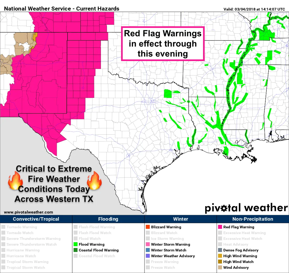
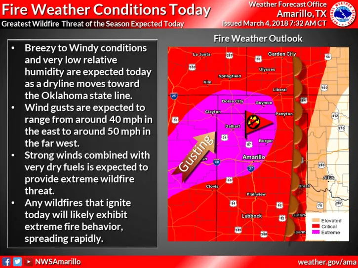
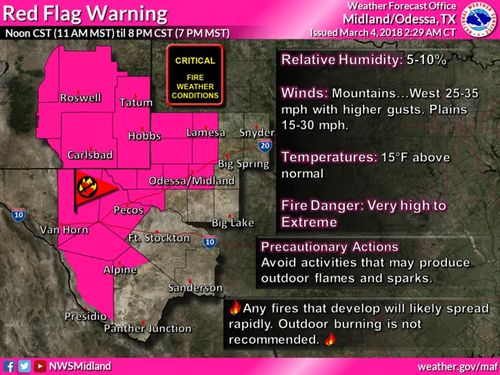
Across western Texas, behind the dryline, critical to extreme fire weather conditions will be in place throughout the day. Temps will soar up into the upper 70s to lower 80s across the region while relative humidity values plummet into the low teens to single digits. Gusty winds up to 50mph are possible for part of the central and northern panhandle regions. Gusty winds up to 35mph are likely further south across the southern rolling plains and trans Pecos regions. Any fire that ignites across the region today is expected to spread very quickly. Do not conduct any outdoor burning and use extreme caution with anything that could spark a fire. Critical fire weather conditions will be in place tomorrow as well with gusty north/northwest winds expected behind the cold front.


0 Comments