
While most of the state will remain quiet and rain-free today, we once again have the potential for a few storms to develop along the dryline this afternoon and into the evening hours. By 4pm this afternoon, the dryline is forecast to be oriented north to south as far east as the Hwy 183 corridor across western north Texas. An upper level disturbance will be overhead at the time, but looks to be weakening as we get into the late afternoon and evening hours. There’s not a lot of certainty that we will see storms develop along the dryline this afternoon, but IF we see any development, we will have ample instability, wind shear and moisture in place to see isolated supercell development with mainly a large hail and wind threat. As this will be a situation where the dryline is the major source of forcing for ascent and development of storms, once they travel east off the dryline this evening and we begin to lose daytime heating, we’ll see the threat of severe weather drop off rather quickly. It’s not expected that we’ll see anything move into the immediate DFW area. A Slight Risk (Level 1) has been outlined for the areas most likely to see any development this afternoon, so if you live in or near the Marginal Risk area, keep an eye on the sky this afternoon.
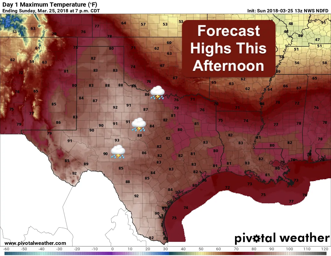
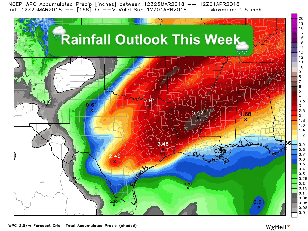
Temps this afternoon will once again soar into the 80s today for a great majority of the state. We’ll even see some 90s across the western half of the state behind the dryline, and a majority of south Texas. Thankfully, we’ll be seeing temps drop off this week as we see an uptick in cloud cover and rain chances, especially during the Tuesday – Thursday time period.


0 Comments