
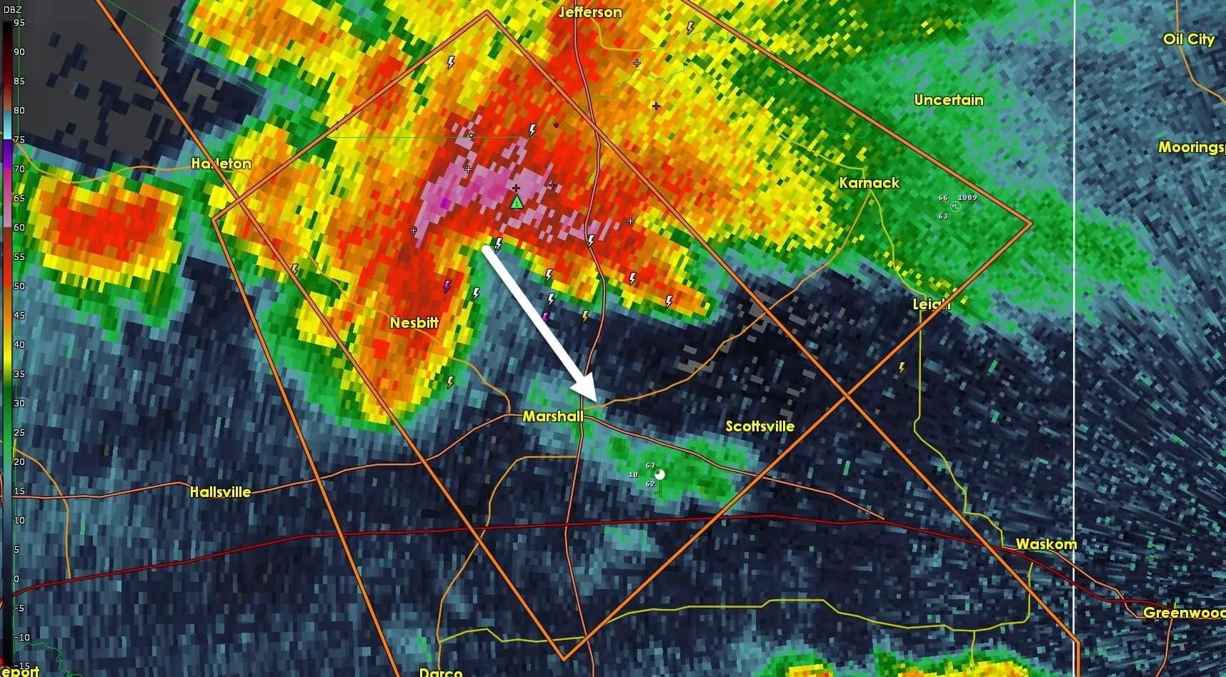
A dangerous thunderstorm with a history of producing damaging hail will arrive in Marshall shortly. This storm has a very formidable appearance on radar. Moving southeast at about 30 MPH wind-driven hail could arrive in Marshall by 12:35 AM. Mount Pleasant received golfball size hail that damaged vehicles from this thunderstorm. Those in Marshall should get away from windows and take shelter in a center room on the lowest floor of their structure. Hail sizes could approach the size of tennis-balls with winds gusting to near 60 MPH.
Severe Thunderstorm Warning
National Weather Service Shreveport LA
1221 AM CST SUN MAR 11 2018
The National Weather Service in Shreveport has issued a
* Severe Thunderstorm Warning for…
South central Marion County in northeastern Texas…
Central Harrison County in northeastern Texas…
Northeastern Panola County in northeastern Texas…
* Until 115 AM CST
* At 1220 AM CST, a severe thunderstorm was located near Woodlawn, or
8 miles northwest of Marshall, moving southeast at 35 mph.
HAZARD…Two inch hail and 60 mph wind gusts.
SOURCE…Radar indicated.
IMPACT…People and animals outdoors will be injured. Expect hail
damage to roofs, siding, windows, and vehicles. Expect
wind damage to roofs, siding, and trees.
* Locations impacted include…
Marshall, Deberry, Elysian Fields, Woodlawn, Scottsville, Nesbitt
and Darco.
PRECAUTIONARY/PREPAREDNESS ACTIONS…
For your protection move to an interior room on the lowest floor of a
building.
This storm is producing very large hail. SEEK SHELTER NOW inside a
sturdy structure and stay away from windows!


0 Comments