
Scattered severe storms have brought quarter to golfball size hail to portions of West-Central Texas this afternoon. Fourtinietly the threat of higher-end hail seems to be waning north of Interstate 20. Scattered severe storms with hail will certainly remain possible through the early evening hours. Cloud-cover has helped keep instability values a bit lower. As such I’m hoping we can keep hail sizes below two inches. That’ll certainly do a number on your car but is better than baseballs.
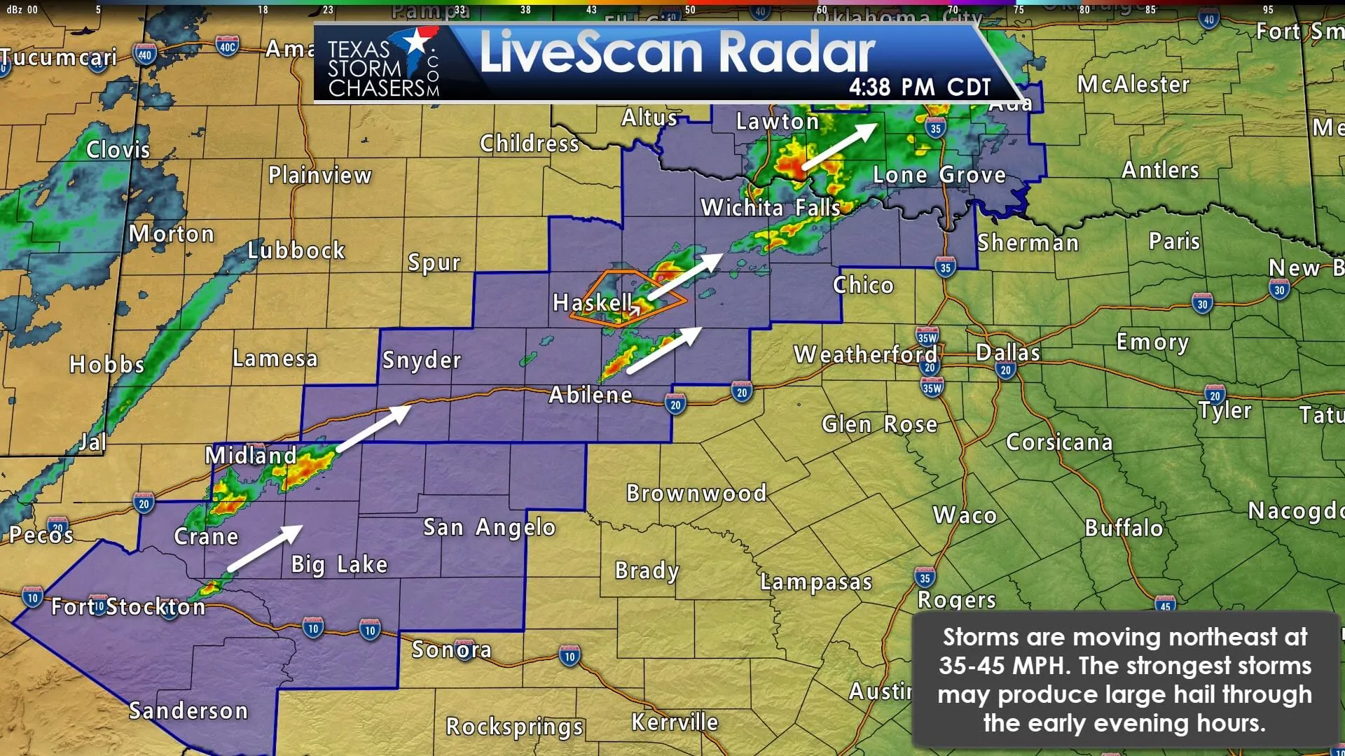
Thunderstorms are moving to the northeast around 40 MPH. The strongest storms will be capable of producing hail up to the size of golfballs. Heavy rain and frequent cloud to ground lightning are also occurring. Thunderstorm coverage south of Interstate 20, in the western Concho Valley, has remained isolated thus far. We anticipate an uptick in thunderstorm coverage and intensity by dinner-time.
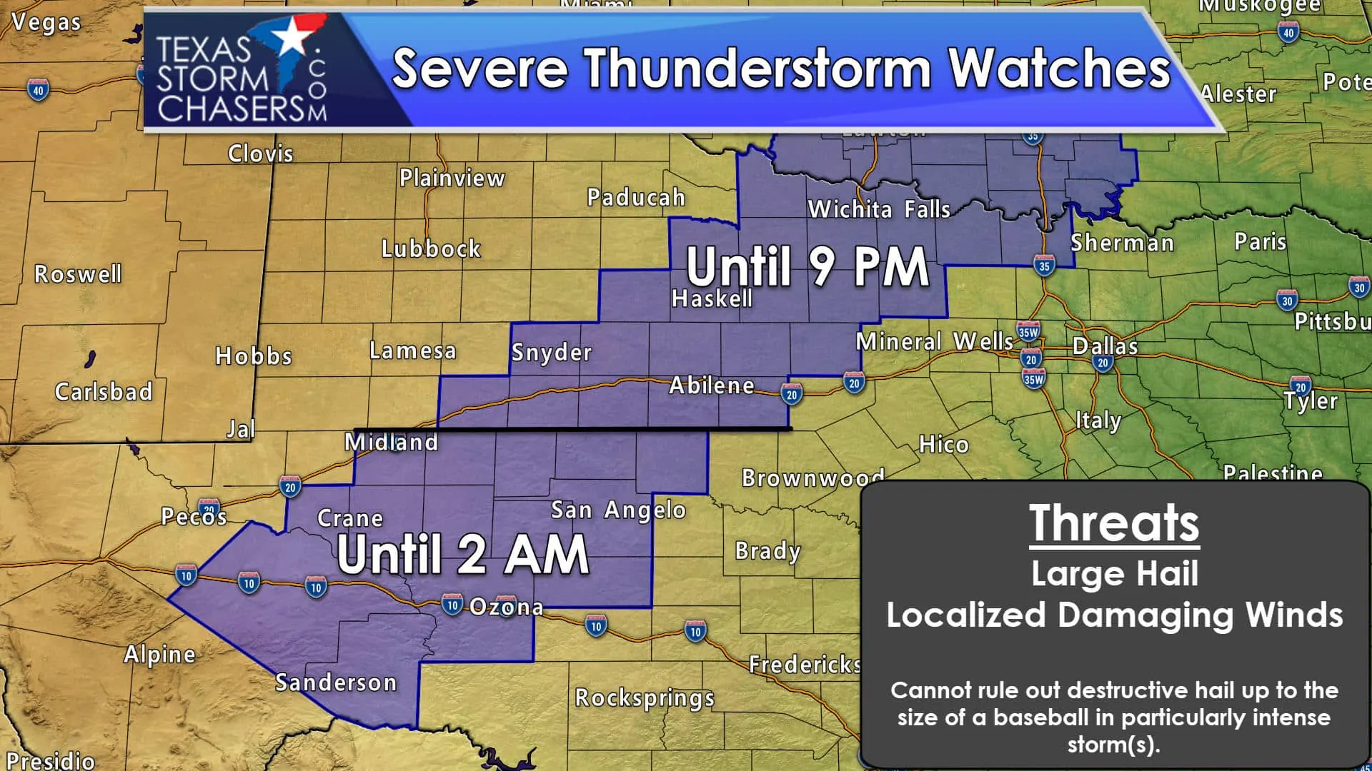
A Severe Thunderstorm Watch remains in effect until 9 PM for Texoma, West-Central Texas, and the Big Country north of Interstate 20. A second severe thunderstorm watch is in effect until 2 AM Tuesday for the western half of the Concho Valley. The strongest storms through this evening may produce damaging hail and strong wind gusts. Localized flooding may briefly occur where intense rainfall falls. Widespread flooding problems are not expected in these regions.
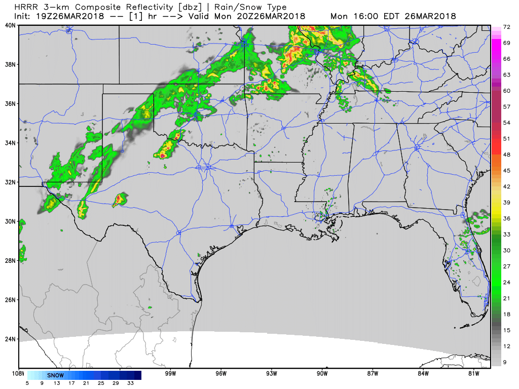
The High-Resolution Rapid Refresh (HRRR) model develops numerous thunderstorms tonight in the Concho Valley, Big Country, and in Northwest Texas. Some storms may be strong to severe with a threat of hail and strong wind gusts. Overall the threat of severe storms will be lower tonight than this afternoon. Heavy rainfall may result in brief episodes of flooding. Activity will shift east/northeast into North Texas tomorrow morning. This model is probably overdoing the rain coverage in the Texas Panhandle and West Texas.
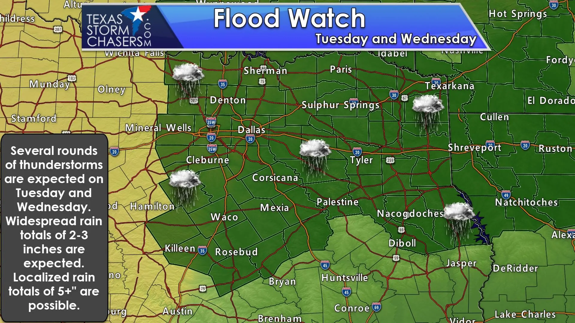
Numerous showers and thunderstorms will spread farther east into Texas on Tuesday and Wednesday. Some severe weather will be possible with large hail. However, heavy rainfall and an increasing risk for flooding may become the primary hazard. Jenny will chat more about that aspect of the forecast in a blog post this evening.


0 Comments