
Severe weather potential will creep back into the picture across portions of North Texas this weekend. An ‘outbreak’ isn’t anticipated at this point. Although if a hail storm ends up hitting your neighborhood it’ll be an ‘outbreak’ to you. Remember that mother nature doesn’t care about risk outlooks or where they’re drawn. Forecasts change and there is always a surprise or two. Those who have lived in Texas a while are well aware of that. Those new to the state will learn that secret soon enough. I’ll keep this article short and sweet since most are probably out enjoying this wonderful spring-like evening.
Isolated to widely scattered thunderstorms may develop by early afternoon near an area of low-pressure southwest of the D/FW Metroplex. This set-up is known as a triple point. A warm front extends north/east away from the low. A dryline extends southward from the low, and a cool front – or at least north winds – to the west. It is along and south of that warm front and east of the dryline where we’ll be watching for some severe weather potential tomorrow.
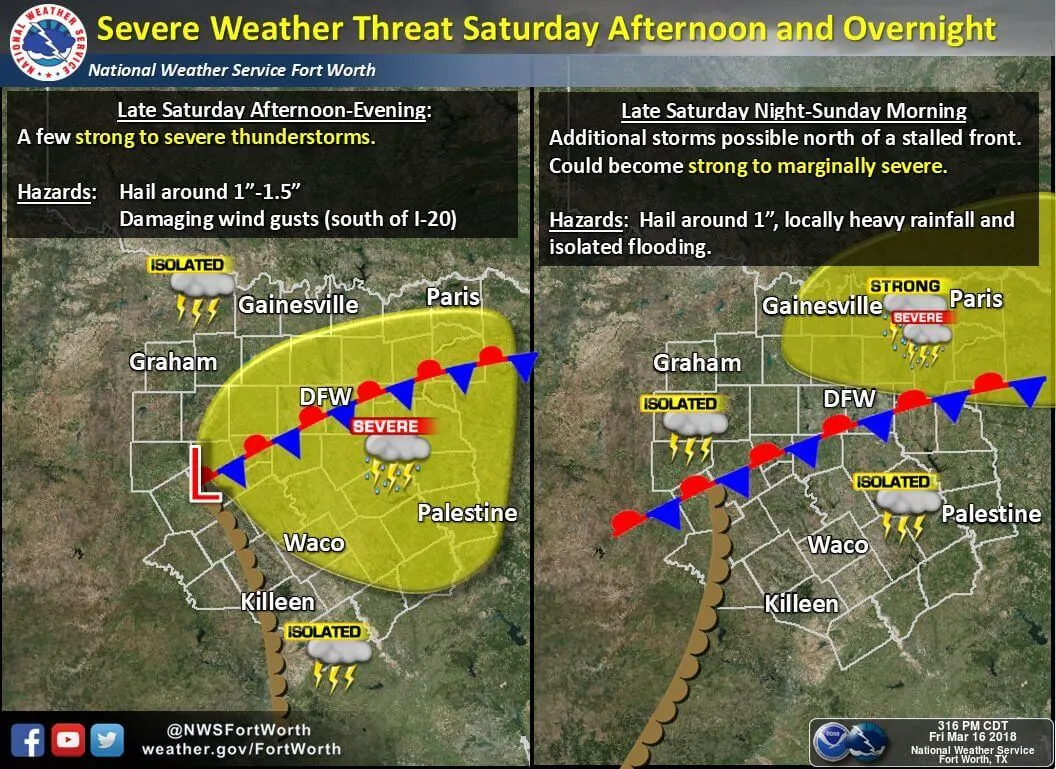
Current indications are that this ‘risk zone’ will set up from Fort Worth and Dallas south toward Waco. The first storms would probably fire up southwest of Fort Worth around 1-4 PM. Most storms would move east/northeast. Some of the stronger storms might deviate to the right of that mean flow with an east/southeast movement. By the late afternoon, storms could move east of Interstate 45 and toward East Texas.
Using data from one of the more aggressive weather models yields a favorable parameter space for organized thunderstorms. The strongest storms could attain a supercellular storm mode with an attendant threat of large hail. If we were able to get some clearing and destabilization we may even see a threat for damaging hail (larger than the size of golfballs). Localized damaging winds and an isolated tornado would be secondary threats.
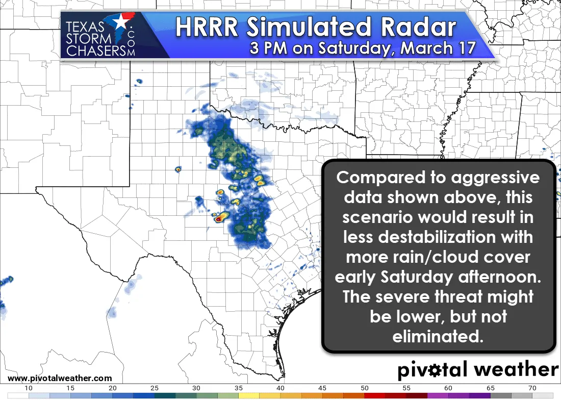
Other weather models are not so bullish with tomorrow’s storm threat. One relatively good short-range model, the High-Resolution Rapid Refresh (HRRR), for example. The HRRR has an area of light rainfall across the Big Country into western North Texas early tomorrow afternoon. Stronger than anticipated upper-level lift (a stronger upper-level storm system) could cause this solution. This scenario would result in lower instability values and more cloud cover. Consequently, the threat of severe weather would be comparatively lower. The severe weather threat wouldn’t be eliminated, but it might keep it more marginal.
While I’ll leave this for tomorrow’s blog, we may see the second round of thunderstorms late Saturday evening into the morning hours on Sunday in Texoma and Northeast Texas. Some of those storms could be strong with a threat of small hail. Let’s see how tomorrow afternoon’s storm setup evolves before we worry about any potential round two. A third round of severe storms may occur Sunday afternoon east of the dryline. Again, let’s worry about this first round and we’ll deal with any additional storms after that.


0 Comments