
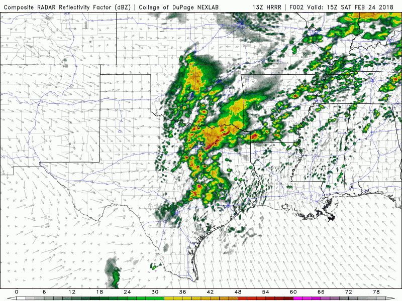
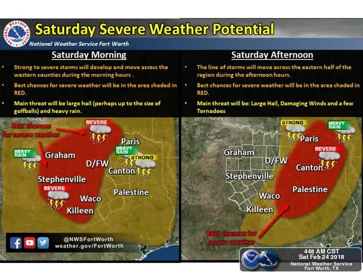
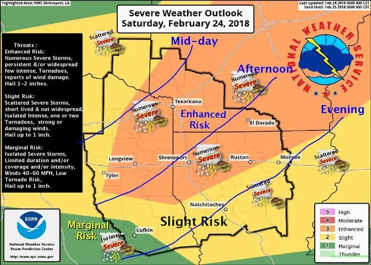
As of the latest update from the Storm Prediction Center, the main threats for severe weather today will exist from the eastern portions of north central Texas this morning and into northeast Texas by this afternoon. At present, a cold front is bisecting the DFW area which will slowly move east southeast during the day. Storms thus far this morning across north central Texas have remained below severe limits, but as we get into the late morning hours, we’ll see the storms currently off to our northwest, which are currently behind the cold front, begin to morph into a semi-squall line and move across the metroplex. The individual cells within the line will be racing off to the northeast as the line itself moves to the east. Within the line, damaging winds and quarter size hail will be the main threats along with periods of heavy rainfall. As the storms move east of the metroplex by early afternoon, we’ll see them cross the frontal boundary and enter into an environment more favorable for surface-based storms and a higher likelihood of seeing a few tornadoes this afternoon along with widespread strong to severe storms, damaging winds, large hail and heavy rainfall. Mitigating factors to how much the atmosphere can destabilize across eastern north Texas and northeast Texas this afternoon will depend on how much early and late morning rainfall across the area contaminates the atmosphere. If early day storms end up being more widespread than models currently show, we’ll see less instability across the region resulting in a lower threat for severe storms. This is something that will be closely monitored this morning. Flooding will continue to be a concern across the entire north central Texas and northeast Texas areas due to the soil being saturated from rainfall this week. Folks within the Slight and Enhanced Risk areas will need to pay close attention to the weather today. Monitor local media, have your weather radios on and be prepared to seek shelter if any weather warnings are issued for your location. The simulated radar graphic below will show how things are expected to shape up between now and about 9pm this evening. We’ll be keeping an eye on things and will post updates as necessary throughout the day. Stay safe everyone!!!


0 Comments