
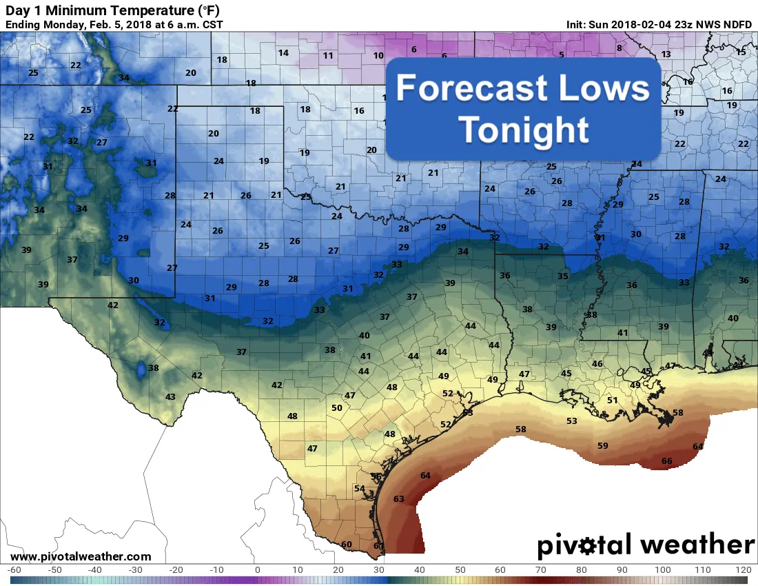
Roller coaster temps will be the theme this week. Today’s cold front will continue to drift south tonight making it down into south Texas by late tonight. It will begin to retreat back north as a warm front tomorrow, but it’s northward progression will likely be halted by our next front which is expected to begin moving through the northern half of the stat by mid-day Tuesday. The western half of the state will see the quickest recovery of temperature tomorrow, with the eastern half of the state staying on the cooler side mainly due to extensive cloud cover. Tuesday’s front looks to be slow to push through northern Texas, but should pick up some steam by Tuesday evening and arrive along the upper coast by early Wednesday. We’ll need to be on the lookout for the potential of strong to severe storms across southeast Texas on Tuesday ahead of the front. Still a bit early to say for sure with a few potential factors working against it, but we’ll be keeping an eye on it. Temps will begin to recover again by late in the week with both Friday and Saturday featuring temps back up above normal once again. Another strong cold front is forecast to barrel through the panhandle and north Texas by Saturday afternoon which will bring a quick end to our mid-winter heatwave and drive temps back down again by Sunday. That’s our week ahead in a nutshell!
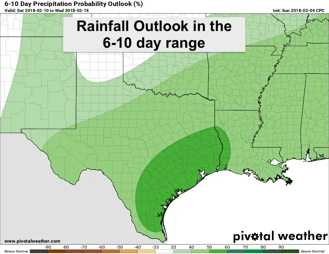
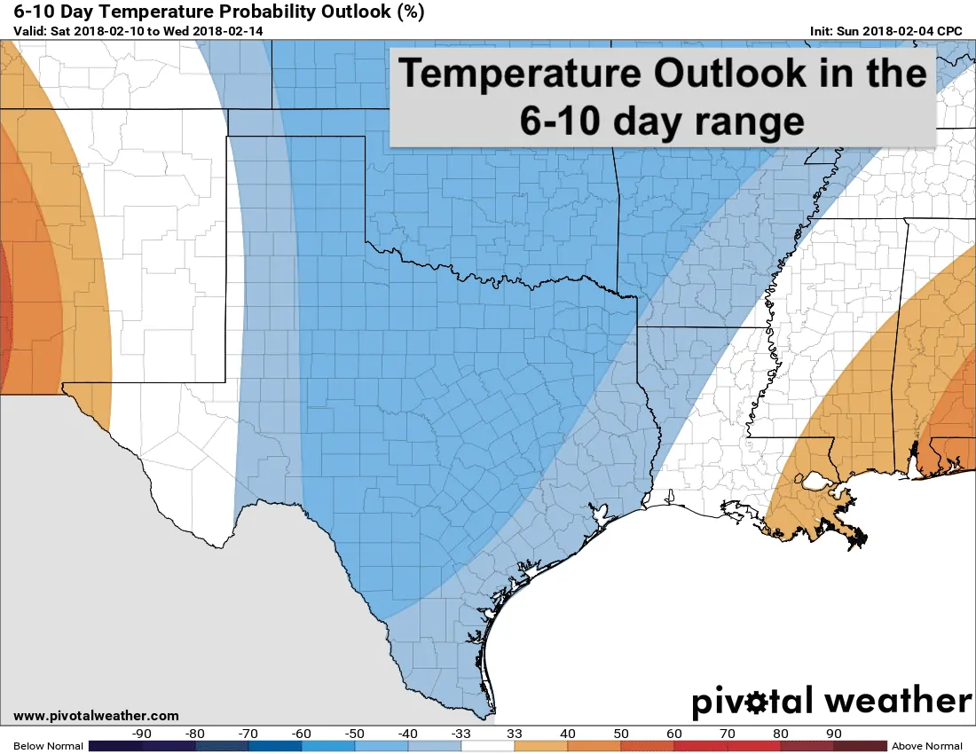
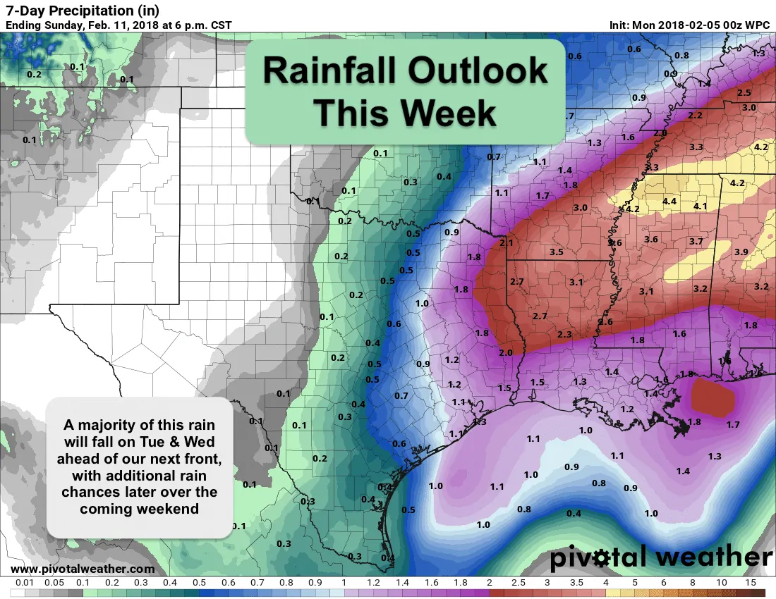 Rain chances this week will be best on Tuesday and Tuesday night ahead of our next cold front. As mentioned above, there may be a chance for seeing a few strong to severe storms across southeast Texas on Tuesday. Instability values look sufficient for generating at least a few strong storms, but there’s also the potential for the atmosphere to be a bit too capped for much in the way of deep convection. We’ll be providing updates tomorrow and again on Tuesday as new data continues to roll in. Rainfall amounts overall are expected to be lighter side for all but the eastern Texas where accumulations between 1 and 2 inches will be possible. Additional rainfall is likely over the weekend ahead of Saturday’s front, so that will be something to watch this week. As we look ahead to next weekend and beyond, the trends are looking to be wetter than average and cooler than average for the 6-10 day range. Of course none of that is set in stone, but it’s good to see something hopeful in the longer range forecast models for seeing some widespread meaningful rainfall. Fingers crossed!


0 Comments