
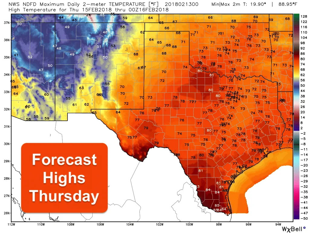
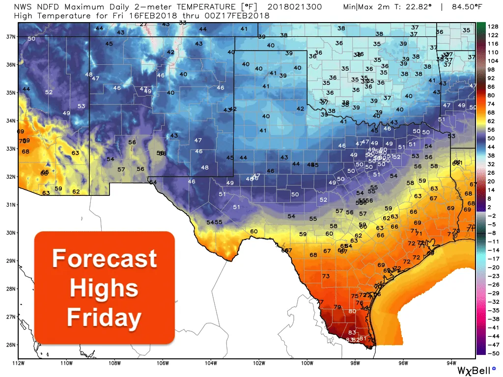
After a chilly start to the work week, it looks like we have one more day of chilly, but seasonal, temps before we see a rapid warm-up for Wednesday and Thursday. Rain chances will return to the forecast Tuesday into Wednesday, then reappear Friday and Saturday as another cold front arrives. The warmest days this week will be Wednesday and Thursday with highs averaging in the 70s across a large swath of the state both days. It will be a nice reminder that Spring is not far away! On Friday, we’ll see another cold front arrive just in time to knock us back down to chilly and seasonal temps for the start of the weekend.
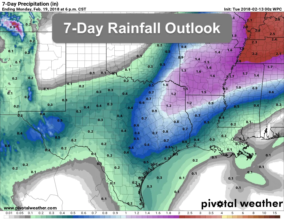
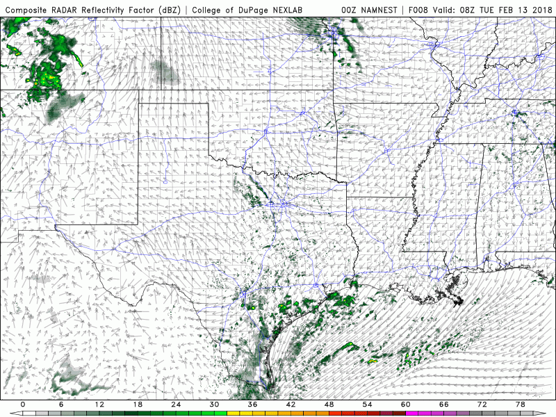
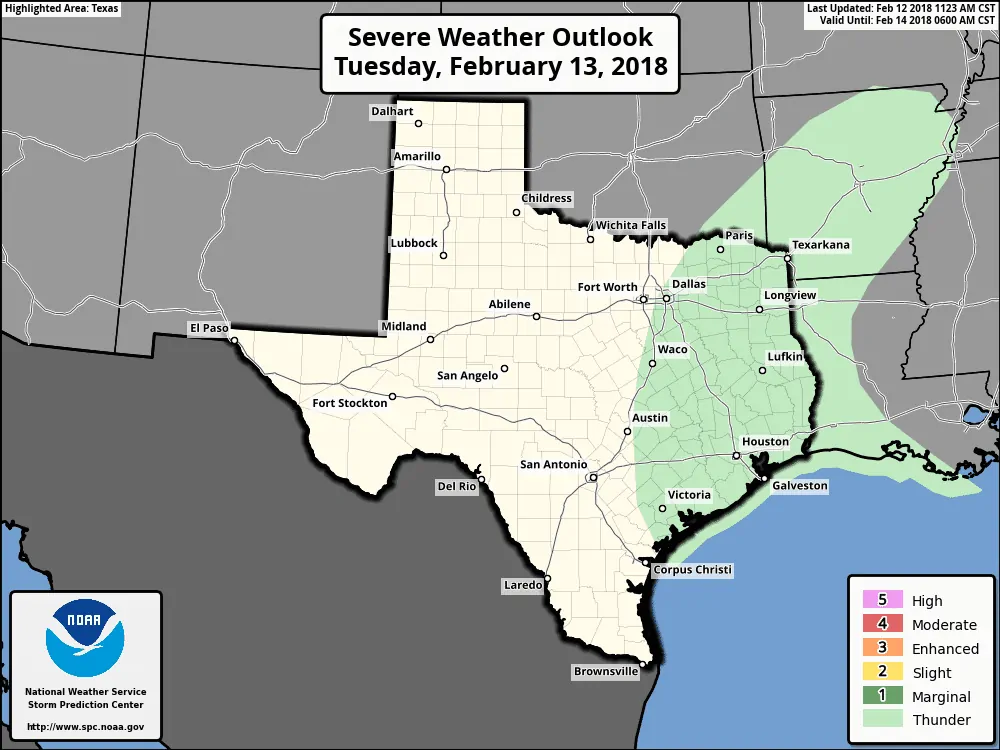
Rain chances return beginning tomorrow morning with scattered showers are expected to develop by the pre-dawn hours along the coast and further inland across central Texas. Coverage of showers and a few thunderstorms is expected to expand across much of southeastern, central, north central and eastern Texas throughout the day eventually exiting the eastern half of the sate by mid- to late-morning on Wednesday. Rainfall amounts are expected to be light and generally under 1/4 inch for most, but a few folks could see some 1/2 inch or higher amounts. Overall, the best coverage of showers and storms will be mainly along and east of the I-35 corridor. Severe weather is not expected, but a few of the stronger storms could produce some small hail, lightning and some gusty winds. Here’s a look at how the radar may shape up over the next 24 to 36 hours. As always, keep in mind this is just a model forecast, not live radar:
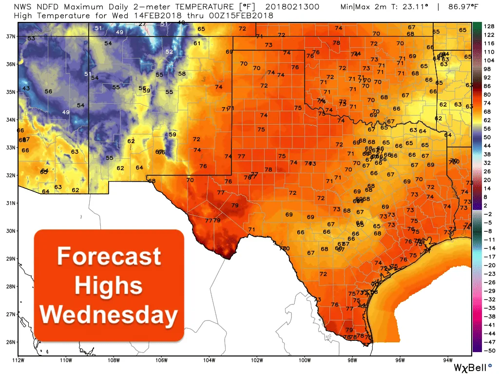
As mentioned above, temps will continue to warm this week until we get to Friday and the arrival of our next front. Wednesday and Thursday will feature temps a good 10 to 20 degrees above normal for mid-February…especially for those across the panhandle, south plains and portions of west Texas where highs are expected to reach the mid- to upper 70s. A few 80 degree readings will not be out of the question, especially west of the I-35 corridor on Thursday. A cold front will begin moving through the panhandle region late Thursday night and into northern Texas by early Friday morning. The front should be pushing into central Texas by Noon and approaching the mid to upper coast by Friday afternoon. Temps look to be seasonal for Saturday with a quick warm-up possible for Sunday.


0 Comments