
Heavy rainfall across southeast Texas will continue into the early afternoon with localized flash flooding possible. Some areas may see rainfall rates up to 2 inches per hour, but widespread flooding issues are not expected. Once the heavy rain moves out later this afternoon and evening, we’ll still see periods of light showers overnight and into tomorrow as well as the cold front continues to work its way south, but the risk of additional flash flooding will come to an end.
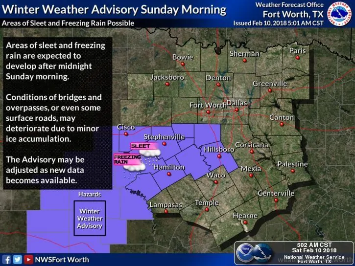
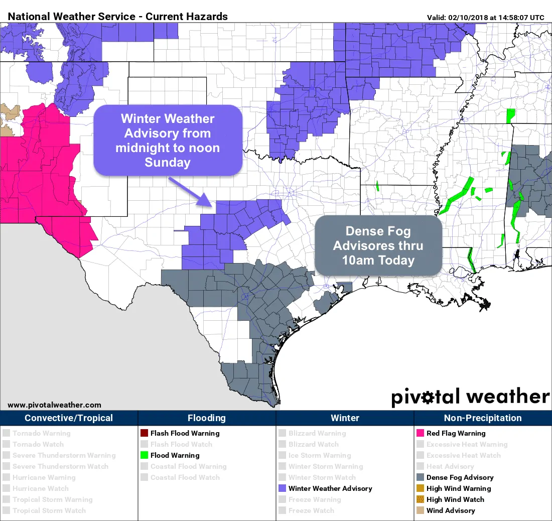
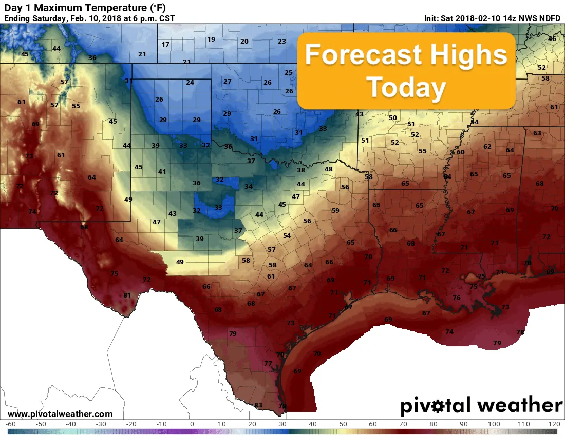
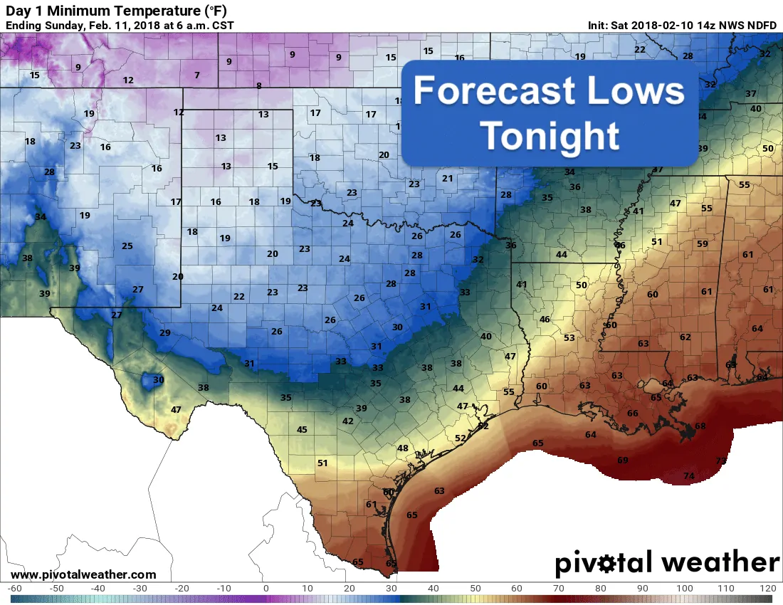
A strong cold front arrived across the northern half of the state overnight and is now working its way into central and south central Texas. It will not be a fast mover, so folks across the southern half of the state will continue with above normal temps today. Across the northern half of the state, we’ll be looking at much colder conditions with highs today in the 20s and 30s for most, and the chance of wintry precipitation overnight…mainly affecting parts of central and west central Texas. ***A Winter Weather Advisory*** has been issued for the following counties effective at Midnight tonight through Noon tomorrow (Sunday): Eastland, Erath, Hood, Somervell, Johnson, Comanche, Mills, Hamilton, Bosque, Hill, Runnels, Tom Green, Concho, Schleicher, Sutton, Callahan, Coleman, Brown, McCulloch, San Saba, Menard, Kimble and Mason. This includes the cities of Cisco, Easland, Ranger, Gorman, Stephenville, Dublin, Granbury, Oak Trail Shores, Glen Rose, Cleburn, Burleson, Comanche, De Leon, Goldthwaite, Hamilton, Hico, Clifton, Meridian, Valley Mills, Hillsboror, Ballinger, Winters, San Angelo, Eden, Eldorado, Sonora, Clyde, Baird, Cross Plains, Coleman, Brownwood, Brady, San Saba, Mendard, Junction and Mason.
Wintry precipitation overnight should be light, but it will be sufficient to cause widespread slick spots bridges and overpasses. With these types of events, black ice is the main threat. Just assume if the pavement has a glazed and wet appearance overnight, it’s likely black ice, so avoid having to be out on the roadways if at all possible.
Forecast highs today are will be an adventure with temps above normal down south, and below normal across the north. We’re pretty used to that here, though! The cold front will arrive across south Texas overnight and conditions will be cooler for Sunday. In addition to the above threat of wintry weather, chances for light rain and drizzle will arrive along with the cold front and temps will stay on the cool side through Monday with a warming trend each day next week.


0 Comments