
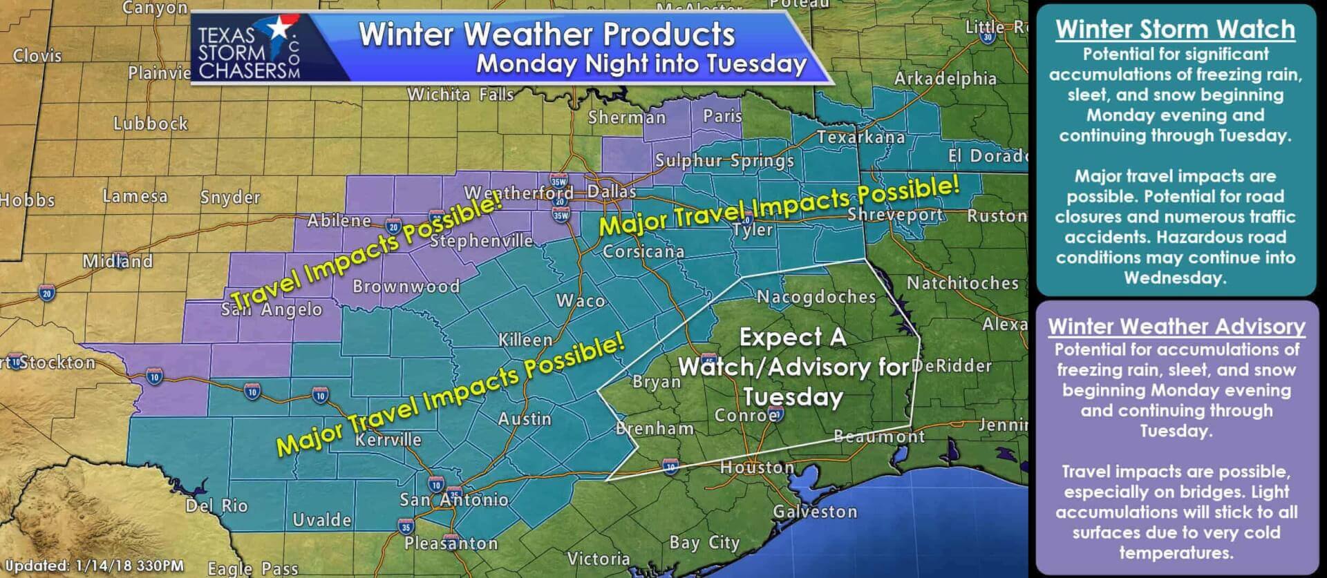
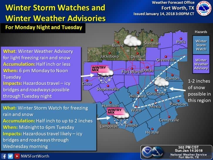
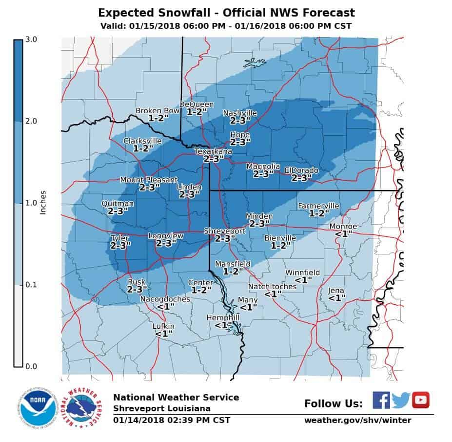
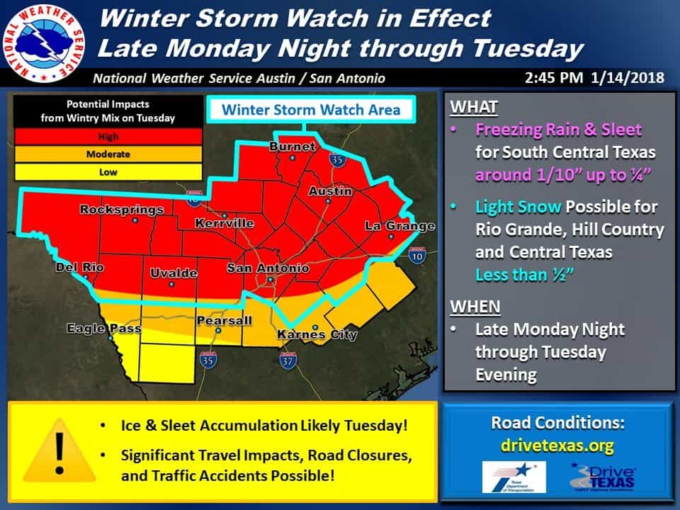
* A Winter Storm Watch is in effect Monday Night into Tuesday Morning for the Hill Country, southern North Texas, Northeast Texas, and parts of East Texas. The watch is in effect on Tuesday for the Edwards Plateau, Central Texas, and portions of South-Central Texas. Some cities included: Del Rio, Uvalde, Junction, San Antonio, Gonzales, San Marcos, Austin, Georgetown, Llano, Brady, Hamilton, Killeen, Waco, Hillsboro, Waxahachie, Corsicana, Fairfield, Palestine, Athens, Terrell, Tyler, Rusk, Carthage, Marshall, Sulphur Springs, Mount Pleasant, De Kalb, and Texarkana. Accumulations of freezing rain, sleet, and snow are possible. Due to very cold temperatures accumulations on all surfaces – including roadways – are expected. Travel conditions may become very hazardous for late Monday Night and into Wednesday morning.
* A Winter Weather Advisory is in effect Monday Evening into Tuesday Morning for the Concho Valley, parts of the Big Country, and into portions of North Texas. Some cities included: Ozona, San Angelo, Winter, Abilene, Brownwood, Eastland, Dublin, Mineral Wells, Weatherford, Fort Worth, Cleburne, Dallas, McKinney, Rockwall, Greenville, Bonham, and Paris. Winter accumulations are expected to be light, but surface temperatures in the 20s mean hazardous travel impacts are still quite possible. These hazardous driving conditions may develop during or just after the Monday evening commute in the D/FW Metroplex.
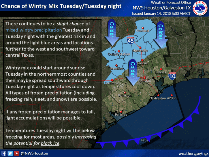
* While not under any watch/advisory at this time, I do expect the Brazos Valley and portions of Southeast Texas to experience some winter weather on Tuesday. As such we’ll probably see a winter weather advisory issued at a later time for those areas.
In lieu of posting a plethora of text weather statements, I’m going to leave you with informational graphics. If you’re wondering about the weather for your specific location I encourage you to head to www.weather.gov and plop in your city/zip code. These accumulations numbers are preliminary and will likely change and shift some as we get more high-resolution data late tonight and into the day tomorrow. Keep in mind there are always a few surprises when it comes to winter weather events in Texas.
One big caveat with this event is even though overall accumulations may not be high, very cold temperatures will be arriving. Anything that falls will probably accumulate on road surfaces, thus even a very light wintry mix could make travel conditions quite difficult. This isn’t like when we see light sleet or light snow at 31 degrees. Temperatures in the 20s will allow for far more impacts than what we’d typically see in a lower-end event. That is especially true in North Texas where precipitation totals may not exceed 0.05″ of freezing rain – or a dusting of sleet/snow.


0 Comments