
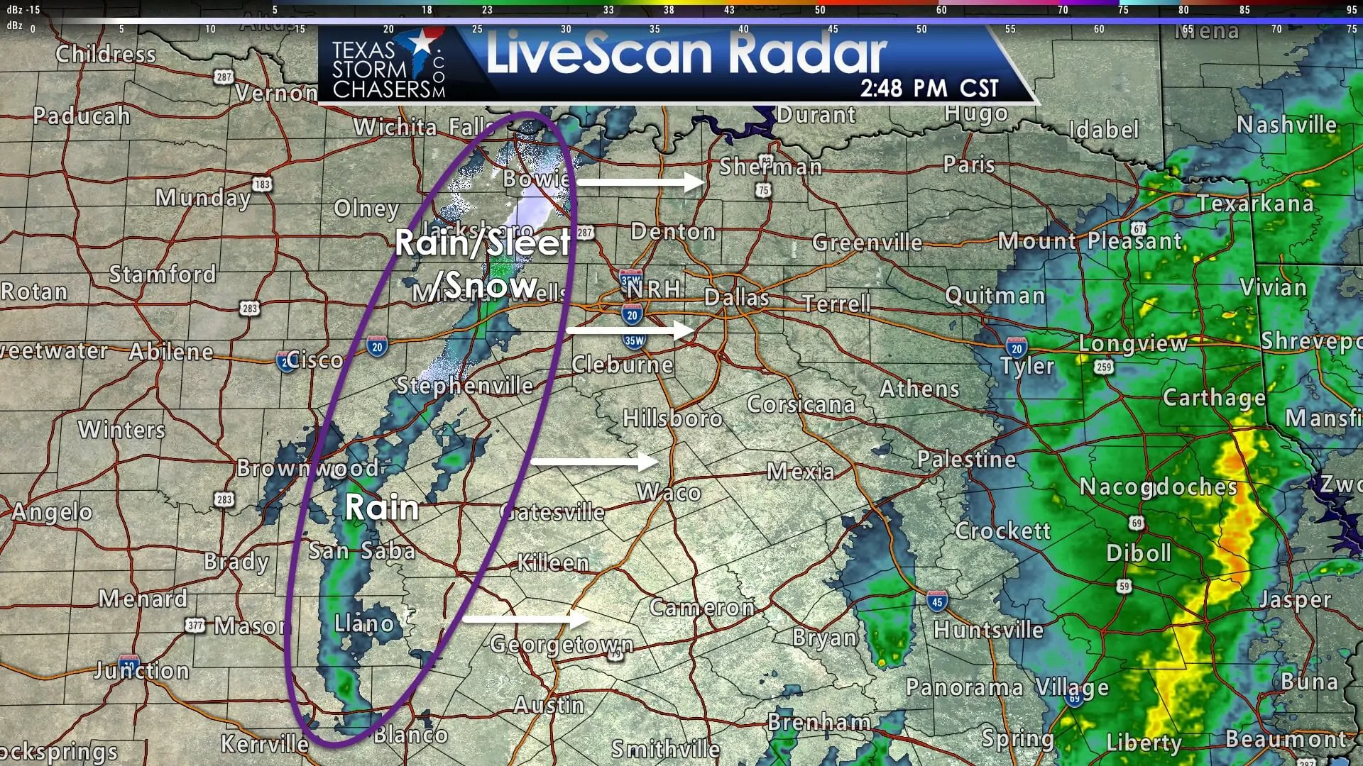
A thin line of precipitation currently extends from Bowie to Stephenville to San Saba to just west of Blanco. This precipitation is associated with a fast-moving upper-level piece of energy. Overall precipitation amounts will be light. South of Interstate 20 precipitation should generally remain in liquid form. A few sleet pellets or snowflakes may mix in. No accumulations are expected south of Interstate 20.
3:15 PM: Light to moderate sleet will move into western and northwestern portions of Dallas/Fort Worth during the next couple of hours. #txwx #dfwwx #texomawx #ctxwx pic.twitter.com/pZ3oPb2EKP
— NWS Fort Worth (@NWSFortWorth) January 11, 2018
Colder temperature profiles north of Interstate 20 into Texoma will support a more mixed precipitation mode. Surface temperatures will generally remain at or above freezing as precipitation falls. There is a chance of a brief period of moderate snowfall in northern parts of the D/FW Metroplex this afternoon. Precipitation will only last one to two hours in most locations as the narrow band of precipitation moves from west to east. Most locations will generally see little to no accumulations. A few spots could receive up to one inch of snowfall if we do see a localized band of heavier snowfall develop this afternoon. Should that heavier band develop those few spots under it could see some accumulations on roadways, which would cause some minor travel hiccups. Widespread travel issues are not expected as this narrow band of snowfall moves from west to east.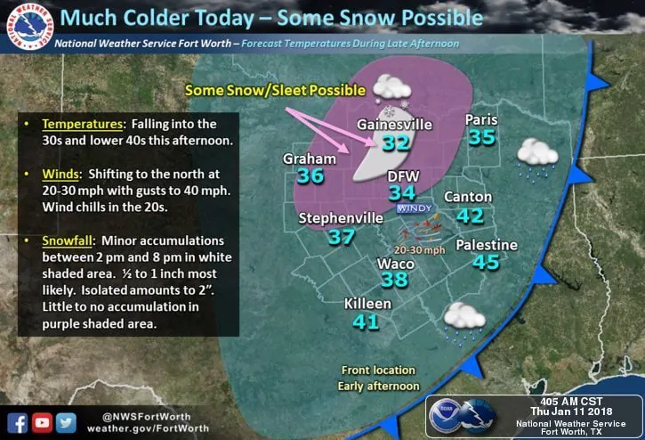
As the upper-level energy departs by early evening we’ll see the band of snowfall weaken as it moves east of Highway 75. It should be gone by the late evening, leaving Northeast Texas with little to no snowflakes. Sorry, Y’all!


0 Comments