
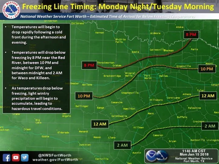
Reports of intermittent sleet have been coming in from around the Dallas/Ft. Worth area. Locations north and west of the DFW metroplex have also been reporting on and off light snow over the past few hours. Temps in the metroplex are still above freezing…but barely. Temps just north of the metroplex are close to or at freezing, so any precip that falls will quickly transition over from sleet to snow with only a very small chance of seeing freezing rain. No significant changes have been made to the previous forecast for light sleet transitioning over to snow across the DFW metroplex by midnight. Locations north of DFW are still expected to see lesser amounts of sleet and snow…generally a dusting or so before dry air moves in behind the front. That’s not to say we won’t see a few travel hazards by tomorrow morning as we’ll likely see bridges and overpasses becoming slick during the overnight hours. If you don’t have to be out on the roadways tonight, stay put. If you do have to be out, slow down…especially as roadways become wet from precipitation…allow extra distance for stopping and extra time to reach your destination.
The Latest Simulated Model Graphic Radar Through 1pm Tuesday
NWS Fort Worth
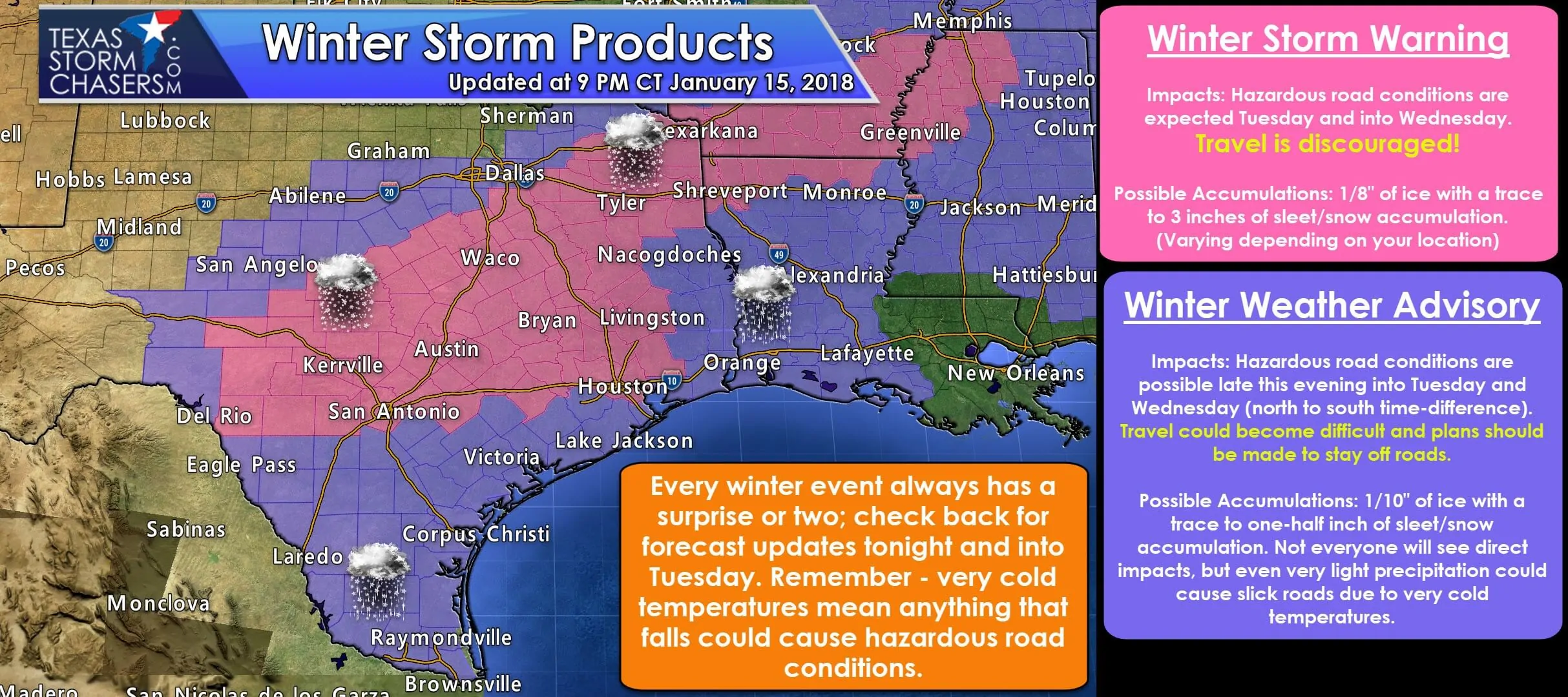
No changes have been made to the current batch of Winter Weather Advisories and Winter Storm Watches…most of which will remain in effect through Tuesday. Folks within the Winter Storm Warning area will begin to feel the impacts of a wintry mix during the overnight hours into early Tuesday. Precipitation coverage may be spotty, but the potential is there for some areas to receive a good 1-3 inches of sleet/snow before all is said and done. This will assuredly make for some nasty driving tomorrow morning, so stay home if you can. Also be sure to check your local media outlets for the latest on school and business closings and delays as we’ve already seen quite a few come across via social media.
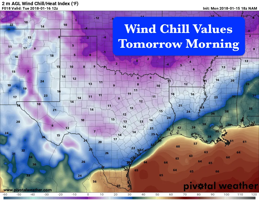
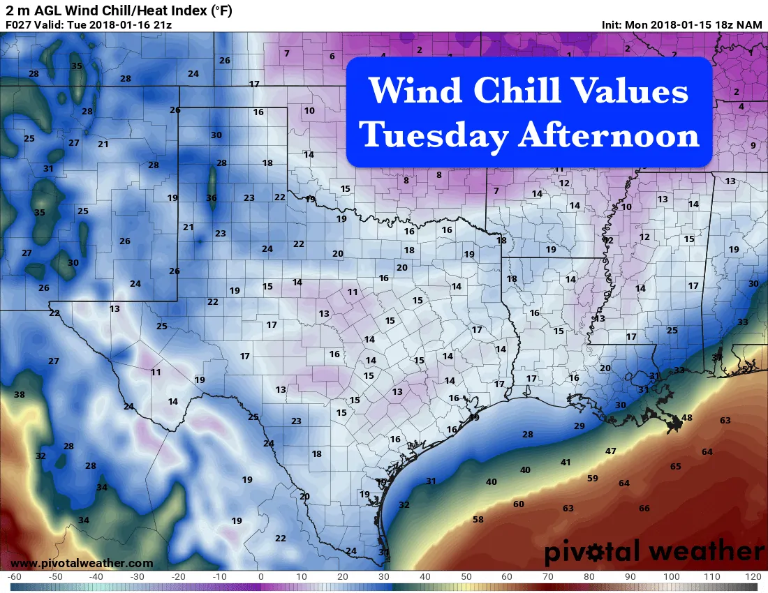
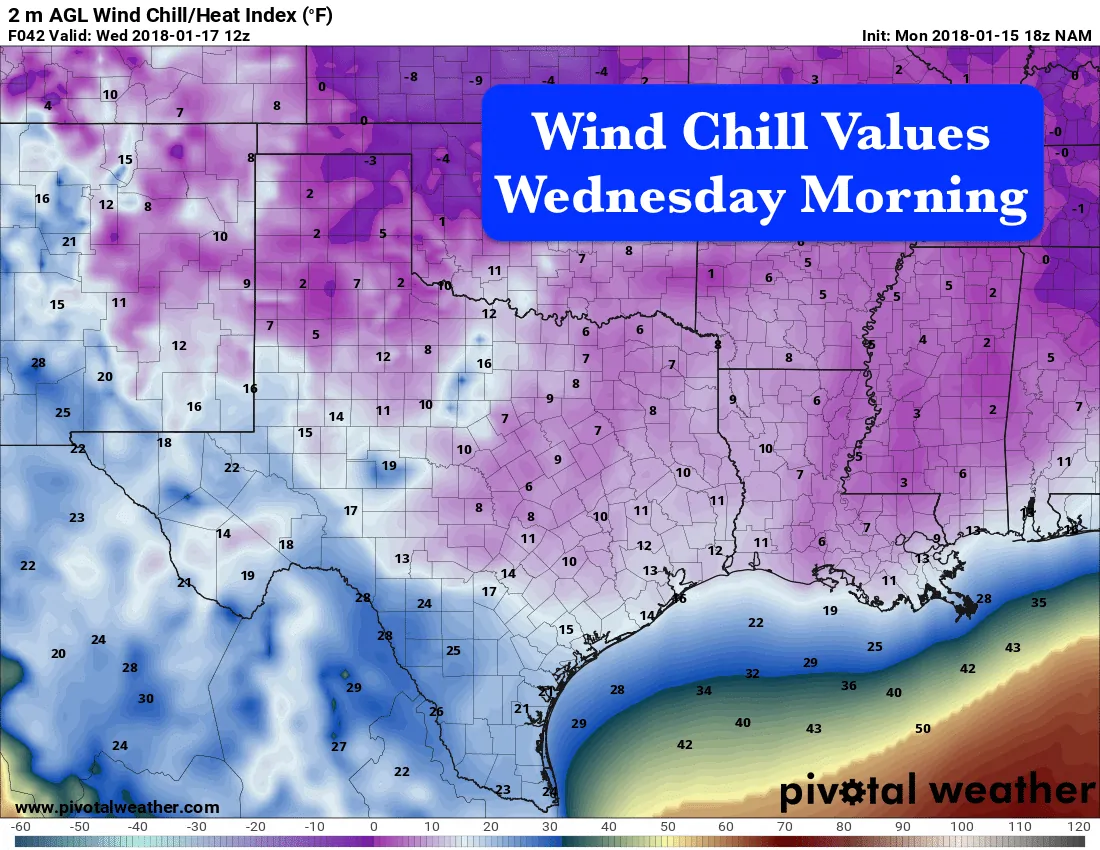
Aside from the fact that it will be sleety and snowy on Tuesday, we’ll also be dealing with some bitter cold once again come tomorrow morning through Wednesday morning. Chill readings overnight for northern Texas, including the Texas panhandle region will drop down into the single digits. Central Texas will see chill values dip down into the low teens, and south central Texas will see chill values down into the upper teens and low 20s. Even tomorrow afternoon continues to look quite brisk with chill values barely making much upward progress. For Wednesday morning, we’re once again seeing chill values down in the single digits across northern Texas and low teens as far south as the coastal bend into southeast Texas. Make sure those outside faucets are covered, water those outdoor plants and cover them as well. And don’t forget to bring those pets indoors!! On a bright note, we’ll be back up in the 60s and 70s again by this weekend, so just hang on!


0 Comments