
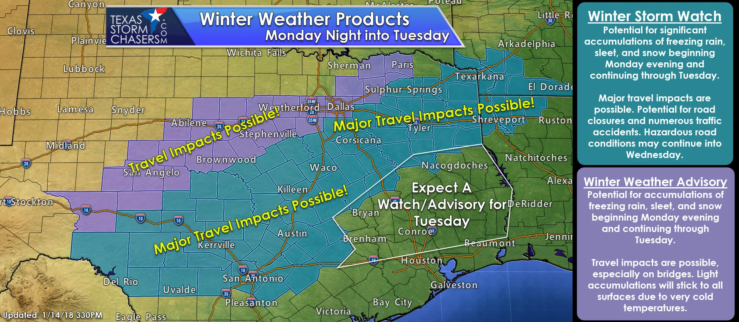
No major forecast updates to report with this late evening’s blog update. The data rolling in this evening thus far continues to support the previous forecast for major travel headaches Monday night through Tuesday for a large swath of southern north Texas, parts of northeast Texas, pretty much all of central Texas and parts of south central Texas. While accumulations of sleet and snow are still forecast to be on the lighter side, what falls will stick around a bit longer than we typically see as temps will stay below freezing all of Tuesday and for much of Wednesday as well. Winter Weather Advisories will take effect across north and west central Texas beginning Monday night and continuing through Tuesday. Winter Storm Watches will be in effect across much of northeast, southern north Texas into central Texas and across southwestern Texas beginning Monday evening as well and continuing through Tuesday. For information about your specific location, visit The National Weather Service page and enter your city and state.
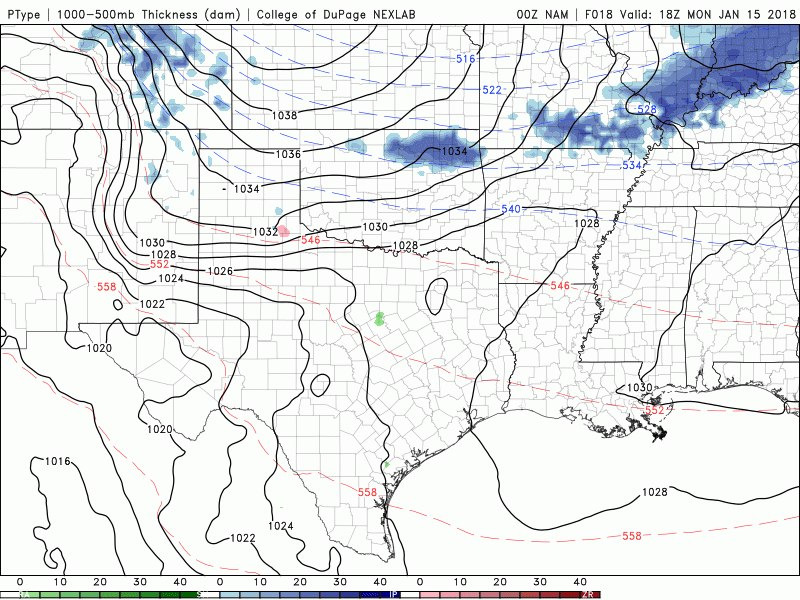
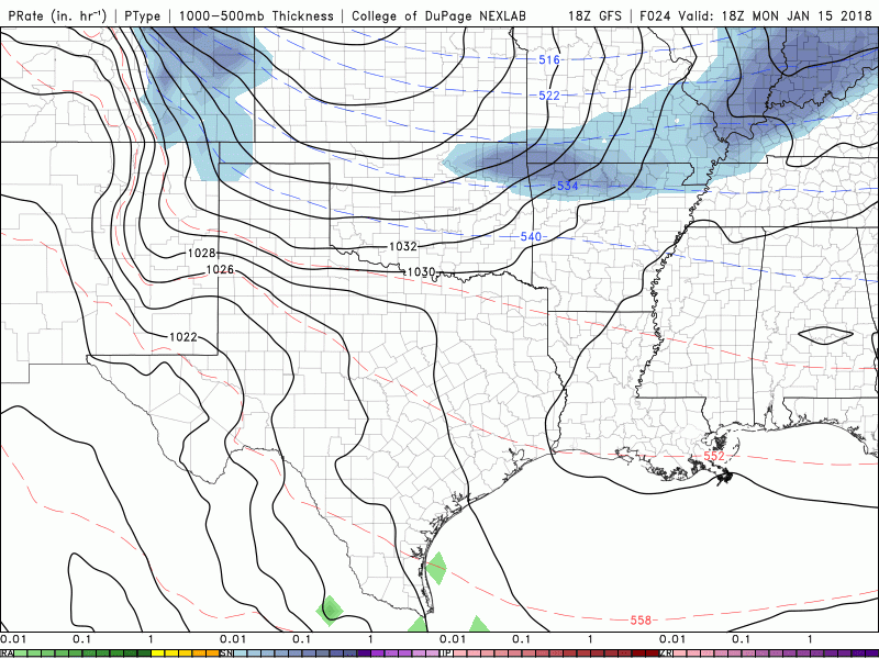
Here’s a peek at the latest animated forecast model graphics from the NAM short range model output and the GFS, one of the long-range forecast models. Both of these animated forecast model loops begin at Noon Monday and end at 6am Wednesday and are in near perfect agreement with each other on wintry weather developing across northern Texas late tomorrow night and continuing south during the day on Tuesday. As you can see, we could also be looking at wintry precipitation down into southeast Texas and also the coastal plains counties by late Tuesday evening into early Wednesday, so we may see a few some advisories issued for those areas later on if trends continue. Either way, all folks within the current Winter Storm Watch and Winter Weather Advisory areas will need to keep a close eye on roadway conditions beginning tomorrow evening, and plan on travel impacts by early Tuesday morning and through out the day. For the latest on roadway conditions, we encourage you to follow your local media outlets for what will likely be an entire day of live coverage. Another great source will be www.drivetexas.org.
NAM Animated Forecast Model Noon Monday through 6am Wednesday
GFS Animated Forecast Model Loop Noon Monday Through 6am Wednesday


0 Comments