
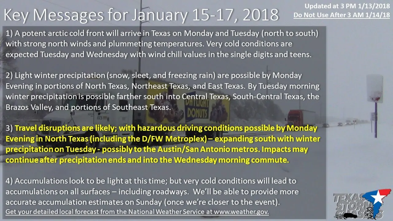
While we’re still 48+ hours out from any potential event, confidence is increasing that we will see impacts from winter precipitation beginning Monday evening and continuing into Tuesday. The first impacts would begin in the north as temperatures fall below freezing with precipitation changing over to freezing rain/sleet. The freezing line would continue moving south Monday night with a switch-over to snow in parts of North Texas and Northeast Texas with a winter mix in Central Texas. By Tuesday morning the freezing line could be approaching San Antonio east to the northwest of Houston. We’re still too far out to post any accumulation numbers, but at this time it looks light. However: Surface temperatures dropping into the 20s will allow for travel impacts with even a trace of winter precipitation. Potentially hazardous travel conditions may develop across a large portion of North Texas and Northeast Texas Monday evening, spreading south into East Texas, the Brazos Valley, Central Texas, the Hill Country, and even parts of South-Central Texas on Tuesday. Please check back for forecast updates tomorrows as we should be posting more detailed accumulation and timing information at that time.
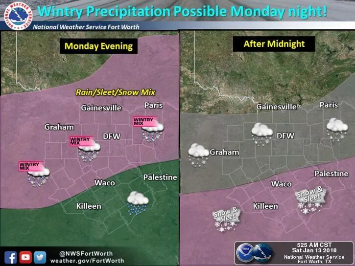
For North Texas and portions of Central Texas (including D/FW, Waco, Temple) from the National Weather Service in Fort Worth… – this could also be implied for Northeast Texas and East Texas
...Wintry precipitation possible across all of North and Central
Texas Monday evening into Tuesday morning...

* LOCATIONS IMPACTED...All of North and Central Texas.

* TIMING...Turning much colder with wintry precipitation behind a
  cold front that moves through the region from north to south
  Monday evening.

* ACCUMULATIONS...Light accumulations of ice, sleet, and snow are
  expected at this time. Generally less than 1/10 of an inch of
  ice and less than a half inch of sleet and snow. Locally higher
  amounts will be possible.

* IMPACTS...Travel is expected to become hazardous and possibly
  very difficult Monday night. Even after precipitation ends
  Tuesday morning, travel may remain hazardous through the day on
  Tuesday as temperatures stay below freezing with mostly cloudy
  skies.

* TEMPERATURES...Temperatures will drop into the 20s Monday night
  with wind chills in the single digits to teens. Highs Tuesday
  will be in the upper 20s to lower 30s. Lows will be in the teens
  Tuesday night with a gradual warm-up for Wednesday.

PRECAUTIONARY/PREPAREDNESS ACTIONS...
The possibility of hazardous and disruptive travel conditions
exists across North and Central Texas Monday night into Tuesday.
In addition to planning for possible delays and alternate travel
plans, preparations should also be made to protect the things most
vulnerable during unseasonably cold weather: including pets,
pipes, plants, and of course...people.
For Central Texas and portions of South-Central Texas (including AUS/SAT) from the National Weather Service in Austin/San Antonio
…COLD TEMPERATURES AND WINTRY MIX POSSIBLE TUESDAY…
A cold front arriving late Monday evening will bring precipitation
and cold temperatures to Central Texas for Tuesday through
Thursday of next week. While rain will begin Monday night confidence
is increasing in chances for a wintry mix, primarily freezing
rain and sleet, near and north of a Del Rio to northern San
Antonio to La Grange line Tuesday morning through Tuesday
afternoon. A few degree difference in temperatures can change the
precipitation type, impacts, and area where the wintry
precipitation is expected so continue to check the forecast ahead
of the event.
In addition to the threat for wintry precipitation cold
temperatures and windchill are another hazard for Tuesday through
Thursday. Ahead of the front Tuesday morning temperatures will be
in the 40s, but will drop into the upper 20s to mid 30s by
Tuesday afternoon. Gusty north winds behind the front will produce
wind chills in the high teens and low 20s Tuesday afternoon.
Temperatures will continue to drop into the mid 20s overnight into
Wednesday morning, with windchill values in the teens across much
of South Central Texas. Temperatures remain cold with highs
Wednesday and Thursday in the upper 30s and lower 40s, with
overnight lows Thursday morning a few degrees around freezing.
Begin preparing now for any changes in plans that a wintry mix
would cause on Tuesday and take steps to protect people, plants,
pets, and your home from the expected cold weather for the middle
of next week.
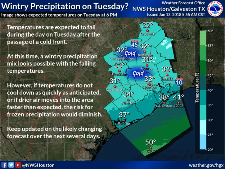
For the Brazos Valley and Southeast Texas
I’m afraid all I have to share with you for now is a graphic from the National Weather Service in Houston. There is the potential for light rain to change over to freezing rain or sleet as temperatures drop below freezing on Tuesday. At this time the freezing line looks to remain just west and north of Houston proper, but it’ll be a race to see if temperatures can fall below freezing before precipitation shuts down. Please check back on Sunday for the latest forecast.


0 Comments