
Our much-discussed arctic cold front is progressing south through the Central Plains and Midwest this evening. Temperatures across the Dakotas, Nebraska, eastward into Iowa and Wisconson have fallen into the single digits to well below zero. Wind chills in North Dakota are bottoming out around 35 degrees below zero. A bit closer to home the leading edge of the front is approaching Lamar, Colorado east to Dodge City to near Kansas City. It isn’t that bad of an evening across Texas with temperatures in the 40s, 50s, and even a few 60s. We saw temperatures spike quite nicely across the western half of Texas this afternoon with 70s common-place. Those living here long enough know that if we see temperatures in the mid-70s in the winter months it is usually right before a nasty arctic blast. That will certainly be the case this weekend.
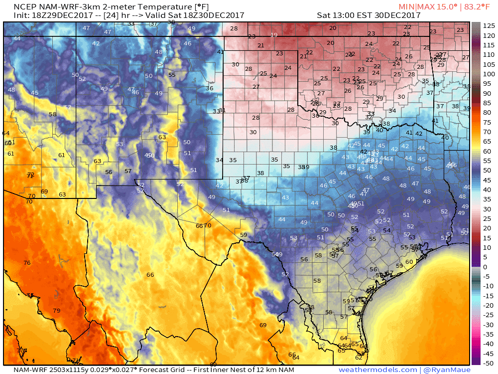
Cold front timing from the North American Model with surface temperatures. Times can be found on the top-right portion of the graphic and are in eastern.
The cold front’s timing has not changed from previous forecasts, although I would still give about a 3-hour buffer on early/late just in case. The initial surge of cooler air will be noticeable, but we’ll also be watching for the freezing line on Saturday and Sunday. That freezing line will be important since any drizzle in the sub-freezing air could cause hazardous travel conditions.
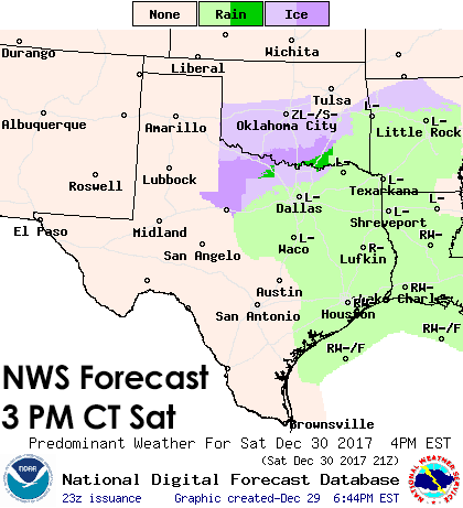
This animation uses the official forecast from the National Weather Service. The light purples and blues indicate where light freezing drizzle or perhaps very light snow may occur. This will not even qualify as a winter storm and precipitation amounts look to remain very light (0.01″ to 0.05″, perhaps a spot or two with 0.1″ of accumulation). However – this is problematic for traveling. Any accumulation of freezing drizzle with temperatures below 30 degrees will likely result in slick bridges and overpasses. Any freezing drizzle that falls with temperatures below 27-28 degrees could even cause icy patches on surface roads. The highest potential for hazardous traveling conditions Saturday evening through Sunday morning will be in portions of the Texas Panhandle, West Texas, Northwest Texas, the Big Country, Texoma, into the northwest half of North Texas (Stephenville to Fort Worth to Paris), and Northeast Texas. Surface roads may not be directly impacted, but there is concern that bridges may ice over where freezing drizzle occurs. As the freezing line moves south Sunday morning into Sunday afternoon the potential for hazardous travel conditions (icy bridges, overpasses) may expand south to include the Concho Valley, Hill Country, and even Central Texas and East Texas (south of Interstate 20). Any precipitation would be very light, but due to very cold temperatures, even a trace of freezing drizzle could be enough to make bridges slick and hazardous. There is an extra concern since Sunday is New Year’s Eve. Fog and drizzle will be ongoing south of the freeze line both days, but will not ice over. Keep in mind the freezing line will be moving south, so we’ll need to watch for parts of South-Central Texas and the Brazos Valley by Sunday evening for a few icy bridges.
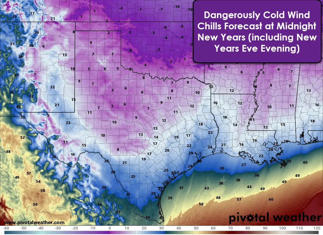
Regardless of potential travel problems this weekend conditions on New Years Eve will be horrendous outdoors. By the time the ball drops in Texas wind chill values will be in the single digits all the way south into the Hill Country into North Texas and Northeast Texas. A few sub-zero wind chill readings would not surprise me. Wind chills in the 10s and 20s will be common all the way to the coast in Southeast Texas with 20s and 30s into South Texas and the Rio Grande Valley. Wind chills in the 30s are very cold for the Rio Grande Valley. If you’re planning on heading out for NYE festivities you need to seriously step up your ‘coat’ plan.


0 Comments