

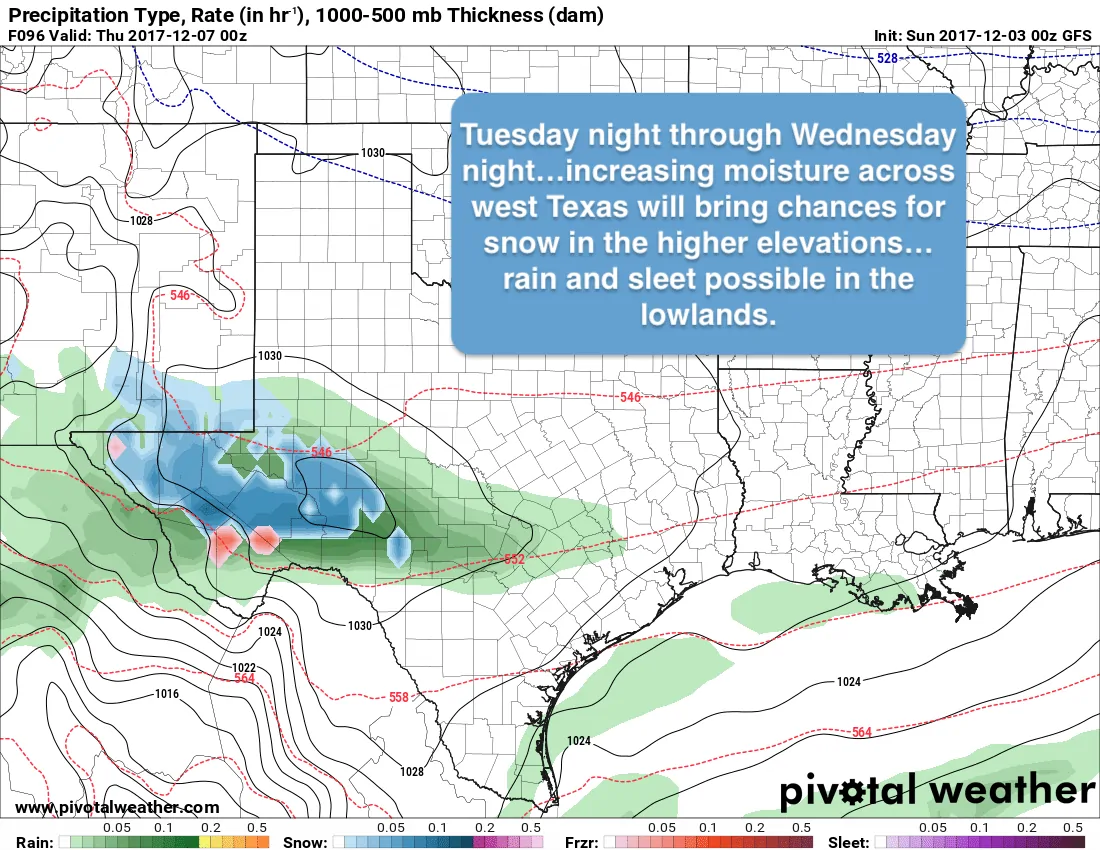
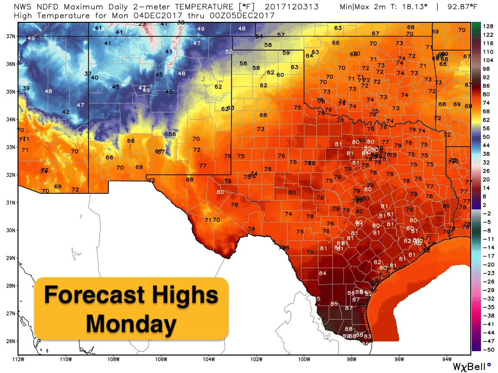
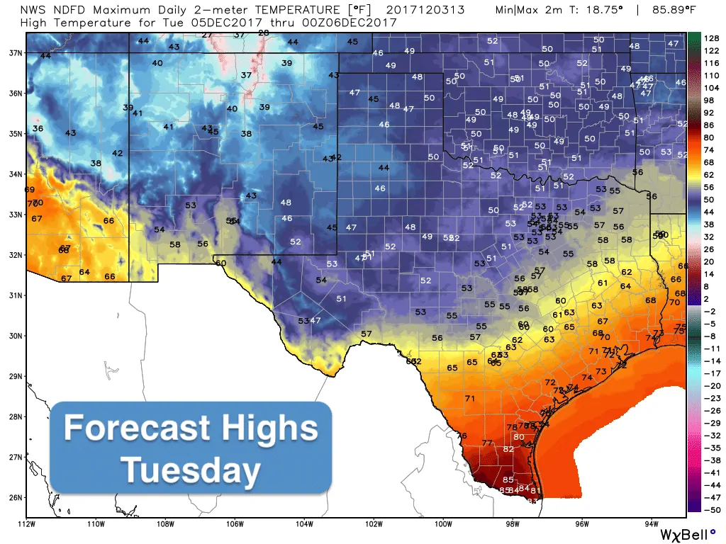
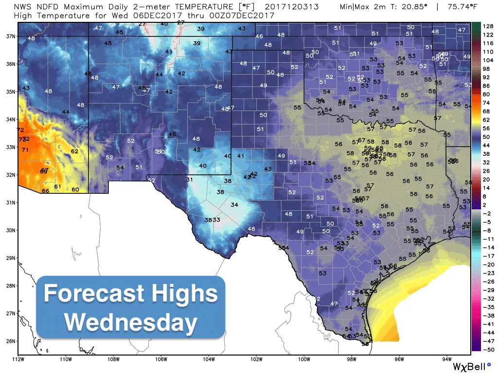
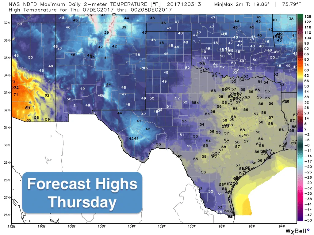
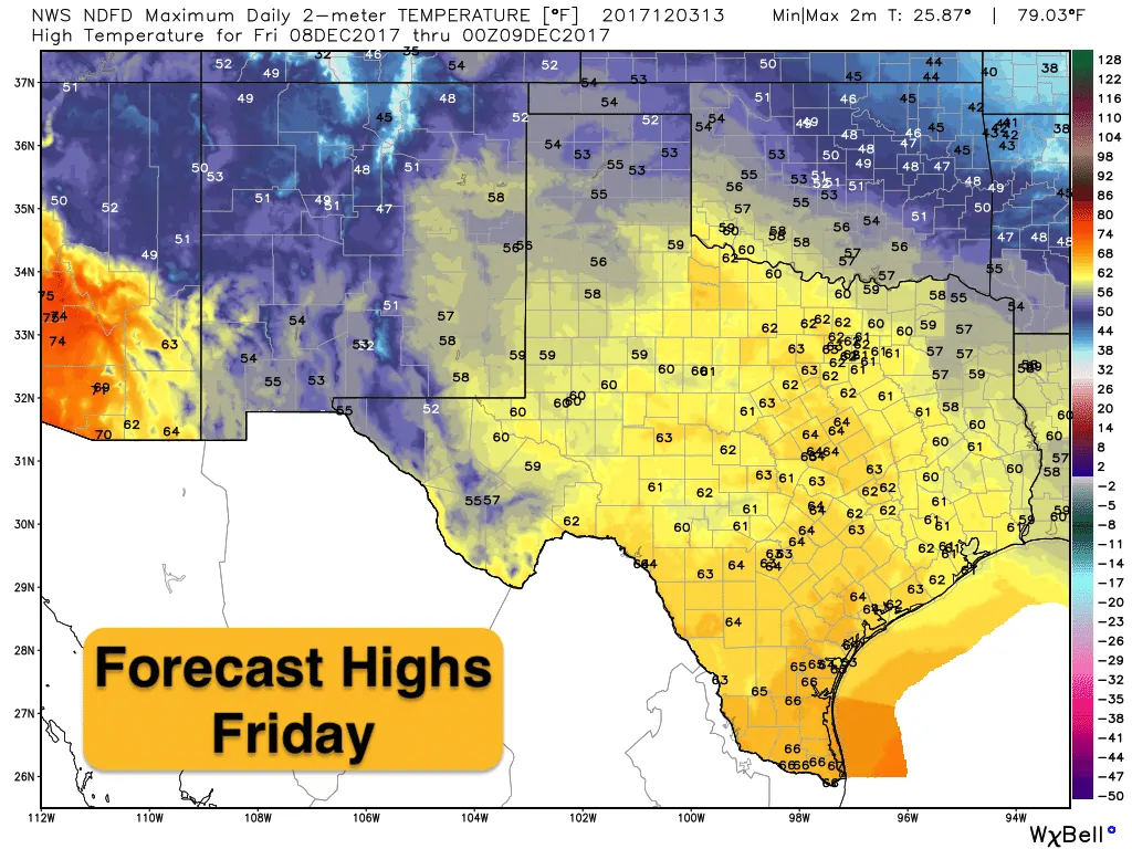
Big changes are on the way this week with a strong cold front arriving on Tuesday. The front will push through the panhandle by Monday afternoon, into northern Texas Monday night, central Texas around daybreak Tuesday, the upper coast by mid-day Tuesday and should clear south Texas by Tuesday evening. Until then, we have another two days of abnormally warm and humid conditions to deal with. Chances for rain across the southern half of the state will increase today…nothing to write home about…but sprinkles and showers will be likely today and overnight and through Monday. Storms will also be likely along and just ahead of the front as it arrives Monday night into Tuesday. Severe weather is not expected but a rumble or two of thunder will not be out of the question. Rain accumulations will be on the lighter side with the best chances for seeing accumulations greater than 1 inch across southeast Texas. Behind the front, winds will be quite gusty and much colder as you’ll see in the temperature graphics below. A weak upper level disturbance will hang back out west which will tap into some mid-level moisture and bring chances for some snow across the higher elevations of far western Texas behind the front Tuesday night through Wednesday. The lowland areas of western Texas should just see a cold rain, but some sleet mixed in with the rain is a possibility as well. Temps will remain below normal for several days after the front has passed, but we will see a gradual warm-up by the end of the week and into next weekend. Our next front will arrive over the weekend, but current forecast models take most of the coldest air off to our east once again.


0 Comments