
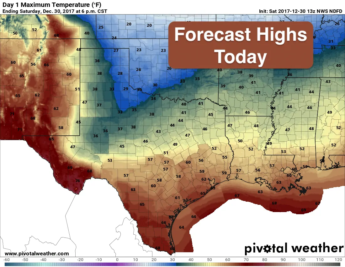
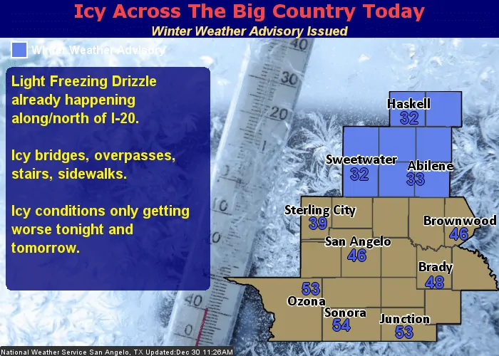
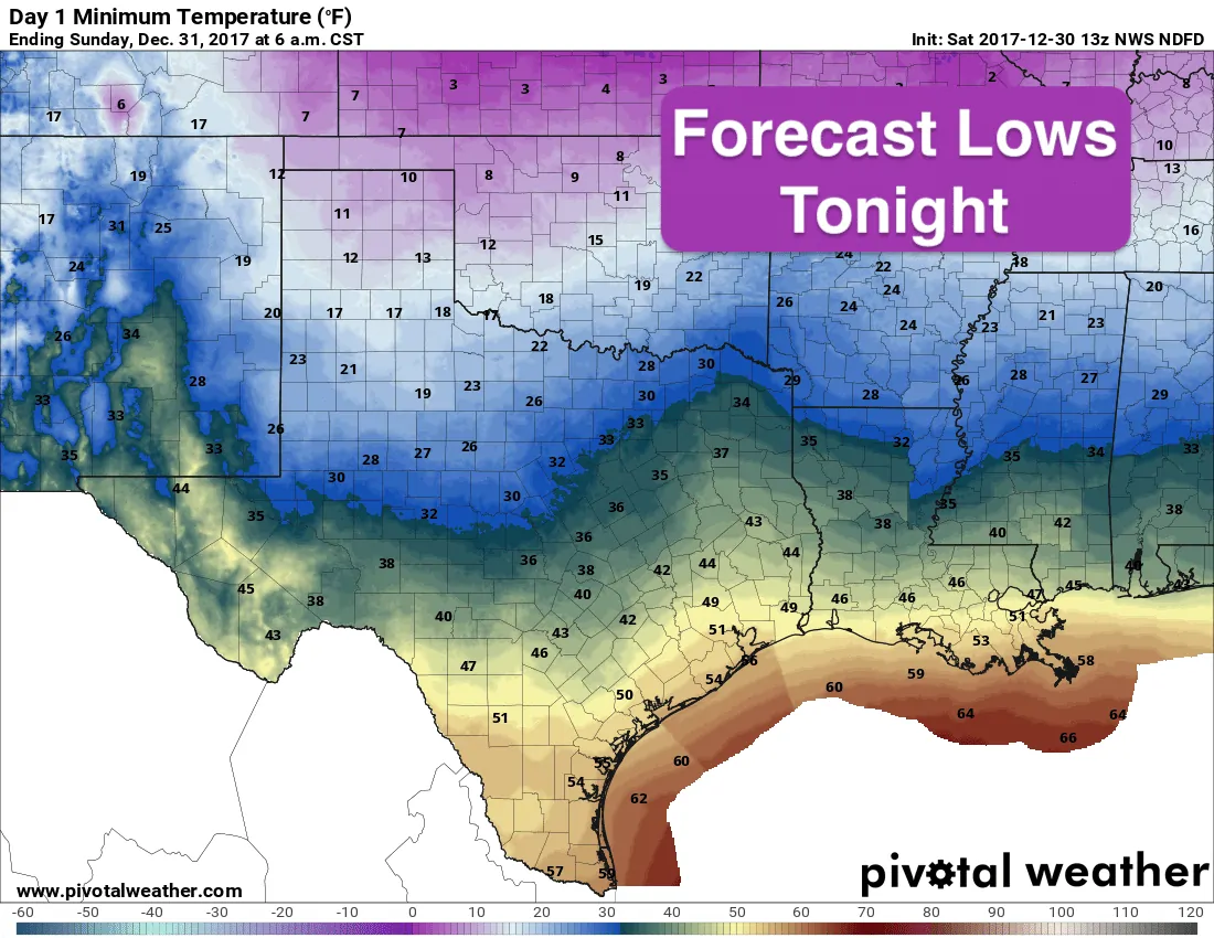
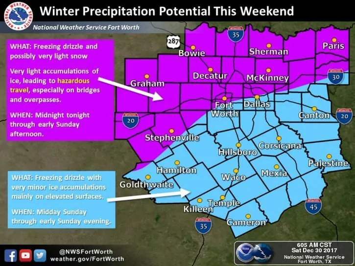
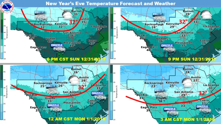
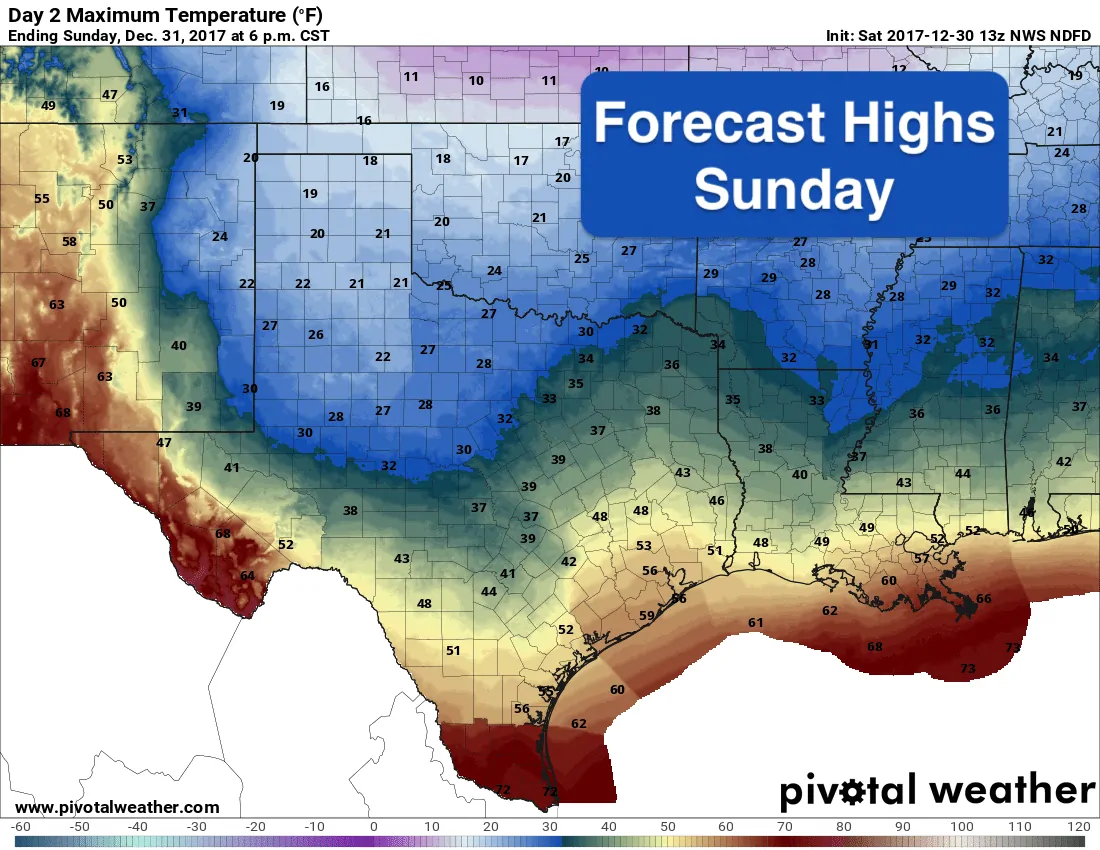
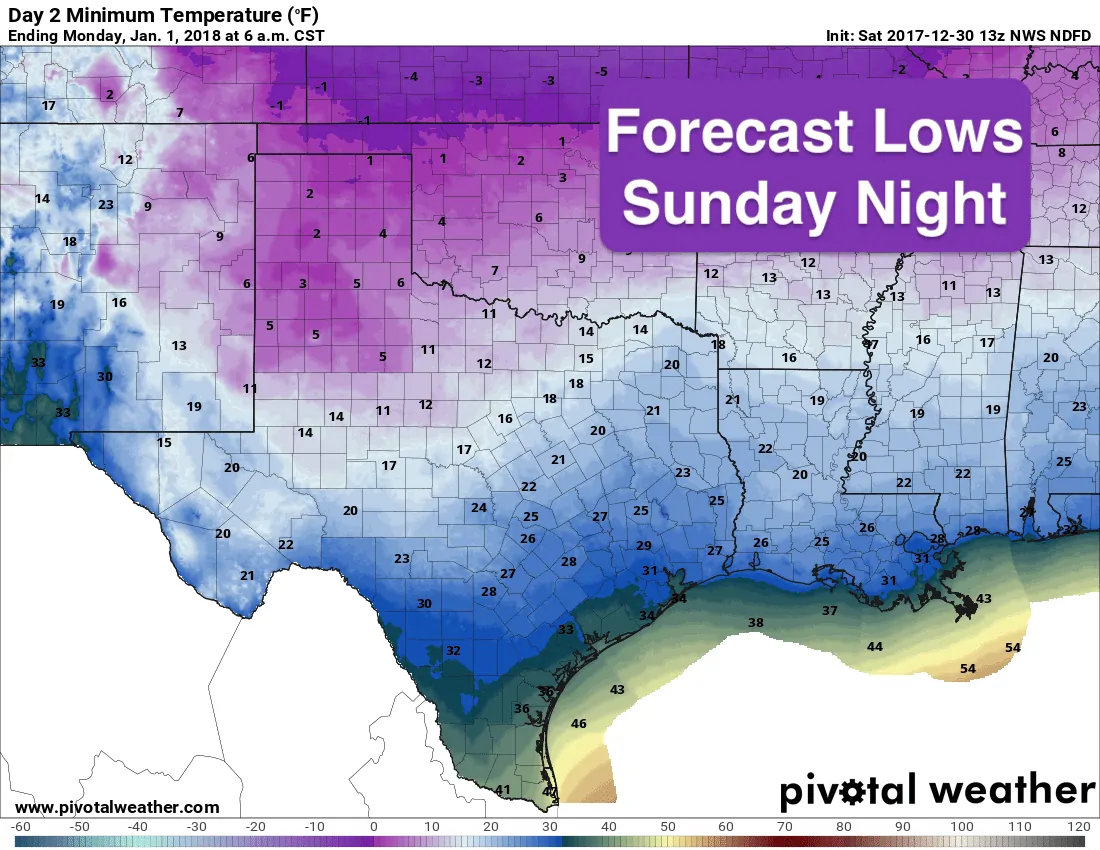
The arctic front we’ve been talking about for several days now is slowly pushing its way through the state. It’s not a fast mover like we typically see…instead, we’ll just see temps continue to drop throughout the day and into tomorrow as the colder arctic air continues to spill into our state. In fact, temps today will be quite nice across the southern half of the state, and across far west Texas as well, with highs still in the 60s and nearly 70s. But for northern Texas and western North Texas…we’ll be dealing with chilly temps and the chance for icy spots on the roadways as post-frontal drizzle continues to plague these regions. Travel hazards at the moment are confined to western north Texas…mainly along Farm to Market roads south of a line from Quanah over to Childress with Winter Weather Advisories currently in effect for Fisher, Nolan, Haskell, Throckmorton, Jones, Shackelford, Taylor and Callahan counties until 6am Sunday. Additional Advisories may be issued later today and tomorrow, and we’ll update you once we hear of any. Of course as we continue into the evening hours and overnight, we’ll continue to see on and off chances for freezing drizzle impacting the northern half of the state with bridges and elevated surfaces seeing light accumulations of ice. Exactly where the greatest impacts will be is hard to nail down at the moment and will entirely depend on where the highest amounts of precipitation fall during the overnight hours into early Sunday morning/New Year’s Eve day. Believe it or not, area lakes may also play a role in enhancing precipitation to their south…similar to the lake effect snows you see up north…so we may see a few more robust bands of precipitation around a few of our north Texas lakes. As always, you can obtain the latest on roadway conditions by visiting www.drivetexas.org before hitting heading out tonight and early tomorrow.
Chances for icy drizzle will continue overnight and through Sunday as well behind the cold front as it slowly moves south. Accumulations of any ice or snow that falls will be light, but still has the potential to create some travel issues due to icy patches on roads and bridges. Most impacted areas will be across the northern half of the state as we typically see. Parts of central Texas may experience some minor issues with patchy icing on bridges and other elevated surfaces, but widespread travel impacts are not expected. By New Year’s Eve, most of the precipitation is expected to be south of the I-20 corridor, mainly impacts portions of the northern and western Hill Country region, leaving north Texas dry, but of course very cold.
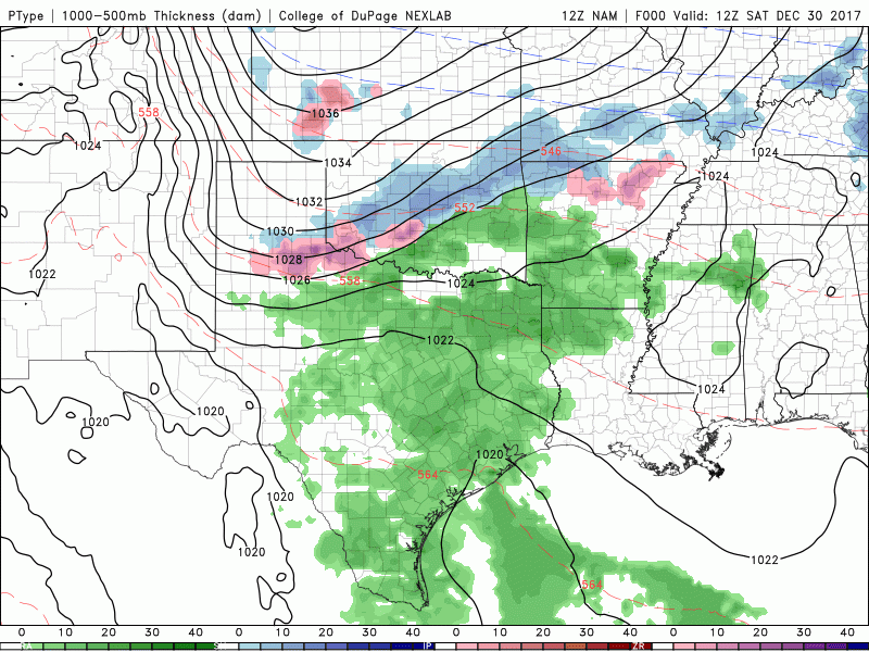
Simulated Radar with Precipitation Type through 9am New Year’s Day
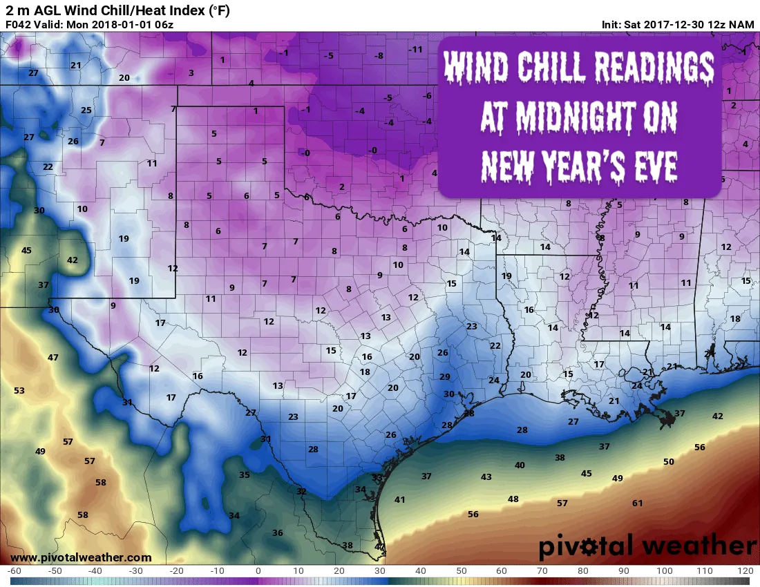
Wind Chill readings on NYE are expected to be in the single digits across the panhandle and a large portion of northern Texas and it will become dangerous to be outside exposed to the elements for any great length of time without a proper coat, hat, gloves and warm boots. These are also serious pipe-busting temps, so be sure to wrap and insulate outdoor faucets as best as you can if you’ve not done so already. Leave warm water dripping and leave cabinet doors open under sinks that have plumbing running through exterior walls to let as much warm air as possible reach those areas. Also make sure outdoor pets and livestock have adequate shelter and access to non-frozen water during this freezing event. Wind chills in the teens are expected as far south as Waco and Austin. Hopefully everyone has indoor plans for NYE this year!


0 Comments