
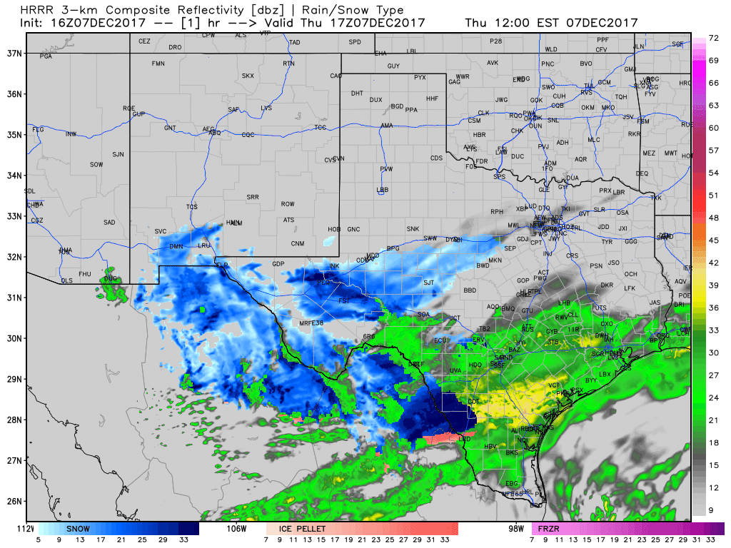
Confidence is increasing that accumulating snow will occur tonight in portions of South Texas, the Coastal Bend, and Coastal Plains. Light snowfall is impacting portions of the Edwards Plateau and South Texas this afternoon. Social media photos indicate around an inch of wet snow has accumulated on grassy surfaces north of Laredo. As temperatures warm this afternoon we’ll likely see a transition back to a rain/sleet or pure rain precipitation mode across South Texas. The forecast becomes more interesting tonight as temperatures cool and we start to see a transition back to snow. Snow flurries are possible farther north today, but accumulations are not expected.
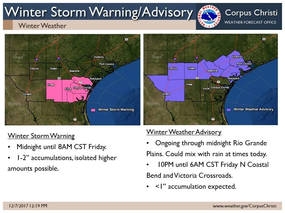
The National Weather Service has issued a Winter Storm Warning for Duval, Jim Wells, Kleberg, Nueces, and San Patricio counties in South Texas. One to two inches of wet snow is possible on elevated and grassy surfaces. The best timeframe for accumulating snowfall will be from midnight to 8 AM on Friday. Most surface roads will remain wet with ground temperatures above freezing, but elevated roadways may accumulate slush/snow. Surface temperatures are expected to remain around 33-35 degrees, but heavier bursts of snowfall may still result in accumulations. This Winter Storm Warning does include Freer, Alice, and Corpus Christi.
A Winter Weather Advisory is in effect through midnight in the Rio Grande Plains where snowfall has been observed this morning. This advisory goes into effect for the northern Coastal Bend and Victoria Crossroads at 10 PM tonight through 6 AM Friday. Rain is expected to mix with or change-over to snow. Accumulations under one inch on grassy and elevated surfaces will be possible. Surface temperatures are anticipated to remain above freezing, so surface roads should remain wet.
While not under any type of advisory/warning at this time – it is not out of the question for a rain/snow mix to occur farther south than indicated above into Deep South Texas, and farther northeast into the Coastal Plains. These advisories/warnings would probably be issued with the afternoon forecast update around 3-4 PM. Snowfall accumulations of a dusting to one inch would be the primary accumulation range.


0 Comments