
It’ll be another warm day across the state unless you’re in the Texas Panhandle. A weak cool front will make slow progress south today. The only region that will notice much cooler temperatures will be the Texas Panhandle. Cold air damming will keep temperatures in the 40s and 50s in the Panhandle today. This week cool front will slowly move south through Texas today and tonight. Behind it will be a drier airmass, but not much in the way of a cool off.
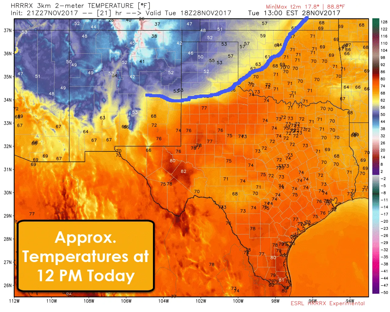
Gusty north/northeast winds will cause wind chills to be down in the 40s. Those are not particularly cold for late November, but it has been quite warm as of late. Otherwise, temperatures by lunchtime should be in the lower to upper 70s across the remainder of Texas. The lower 80s are expected in the Permian Basin to the Trans-Pecos.
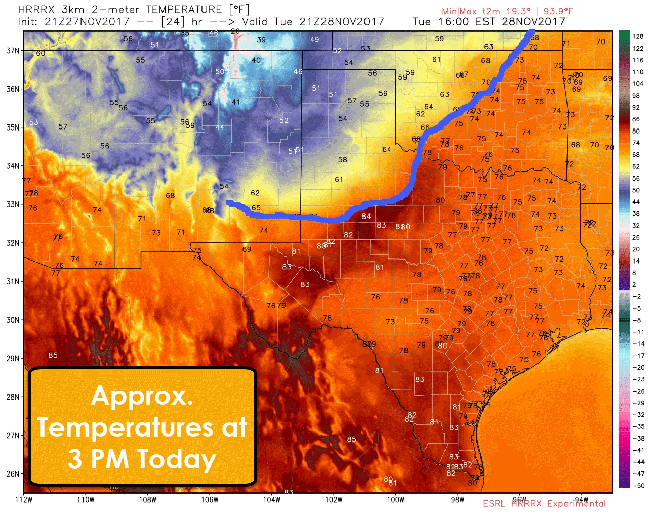
By about 3 PM the front should be moving into Northwest Texas and northern sections of the Permian Basin. Behind the front temperatures will range from the upper 40s near Dalhart to the upper 50s and lower 60s in West Texas. Ahead of the front, we’ll see compressional heating across the Trans-Pecos, Permian Basin, and portions of West-Central Texas and the Big Country. Temperatures will likely make it into the 70s if not into the 80s. I think the particular weather model used in this graphic may be overdoing temperatures a bit just ahead of the cool front.
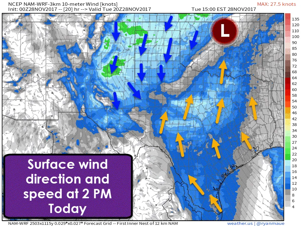
Winds will be noticeable both ahead and behind the cool front today thanks to a surface low moving across northern Oklahoma. That system will bring the chance of rainfall to parts of Kansas and Oklahoma tonight, but not for us. Sustained winds of 10 to 20 MPH are expected across the state with gusts over 30 MPH possible. The lightest winds should be in Northeast Texas extending south into far Southeast Texas. Once the cool front passes a given location winds will switch around to the north.
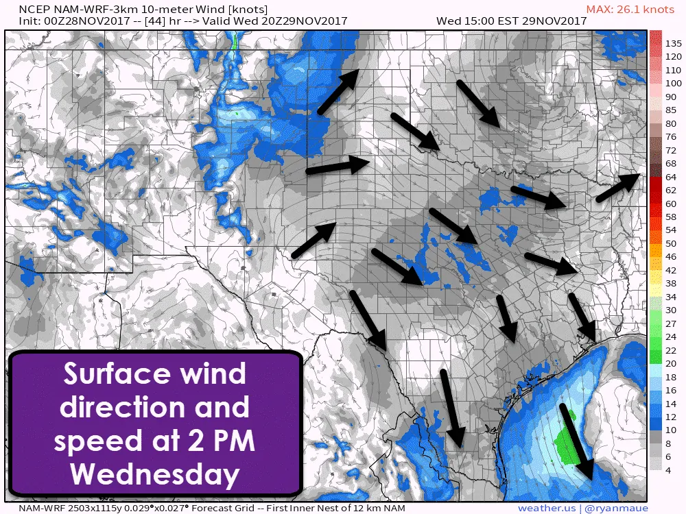
Winds on Wednesday will be lighter and generally out of the northwest. By Wednesday afternoon we’ll start to see slightly higher winds of 15 to 25 MPH across the western Texas Panhandle.
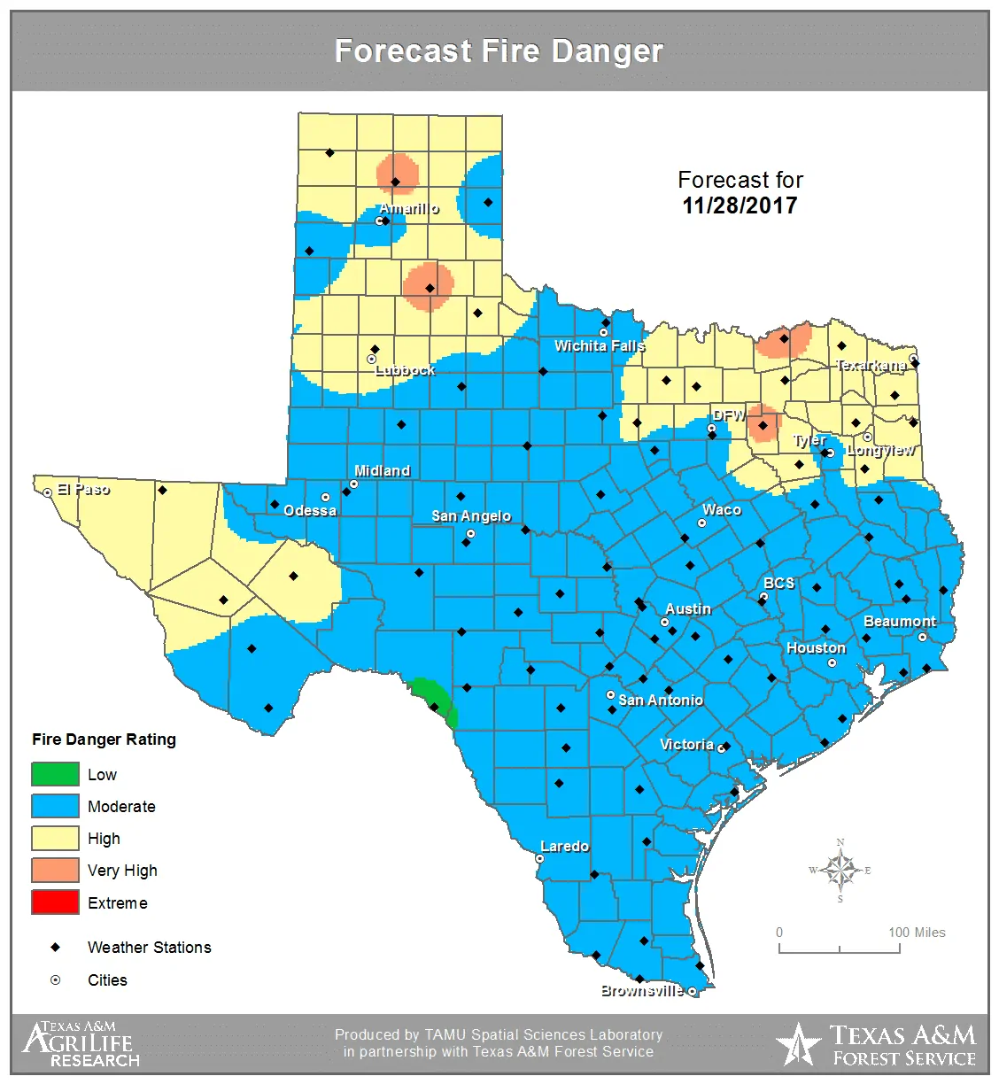
The forecast wildfire danger will be moderate to high across the state today. Gusty winds, above-average temperatures (ahead of the front), and dry surface fuels will continue to support grass fires. Gusty winds will support increased initial attack activity and rates of spread. Fire danger behind the cool front will be high in the Panhandle due to low relative humidity values and gusty north/northeast winds.
With the exception of the cooler weather in the Panhandle today we really won’t see too much of a cool down with this front. The airmass will be drier behind the front across Texas tomorrow, but high temperatures should only five to ten degrees lower. Morning low temperatures won’t be drastically impacted either, again a few degrees cooler. A reinforcing shot of cooler air will help keep the Panhandle comparatively cooler again on Thursday before warming again on Friday and through the weekend. Warm weather is expected state-wide this upcoming weekend.
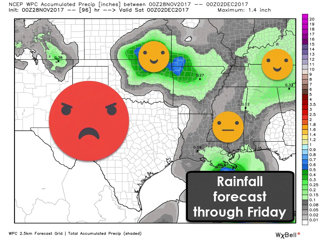
Those hoping for rain in the coming days will be disappointed. The precipitation forecast through Friday from the Weather Prediction Center gives Texas a big zero. Portions of Oklahoma and Kansas will likely see some rainfall tonight and parts of the Deep South and the Southeast United States should see light rainfall amounts as well. However, we do have some hope in the extended range.
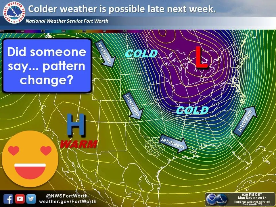
Long-range weather model ensembles have been showing a pattern change beginning in the latter half of next week. We could see precipitation chances increase for the first half of next week in parts of Texas, but consistency in weather model guidance is low. Most models are showing an impressive ‘dip’ in the jetstream beginning in about ten days. Details and specifics are obviously not going to be reliable that far out, but it does appear we could head into a much cooler weather pattern for the second week of December. As a fall and winter fan, I certainly hope that prospect pans out. Remember: we may be facing a warm winter overall, but we will likely still have bouts of frigid air and a few chances of wintery mischief.


0 Comments