
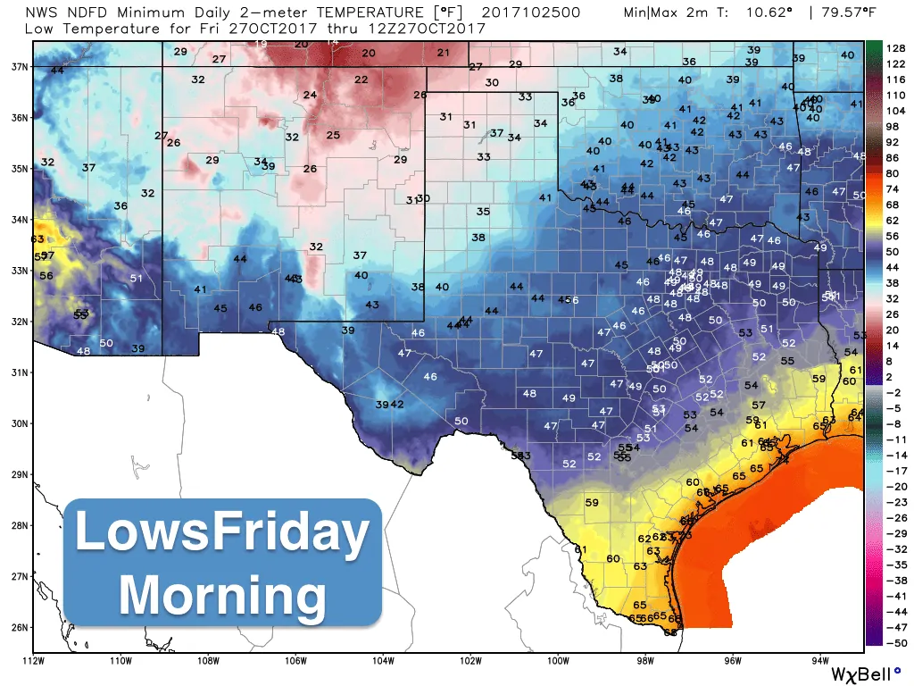
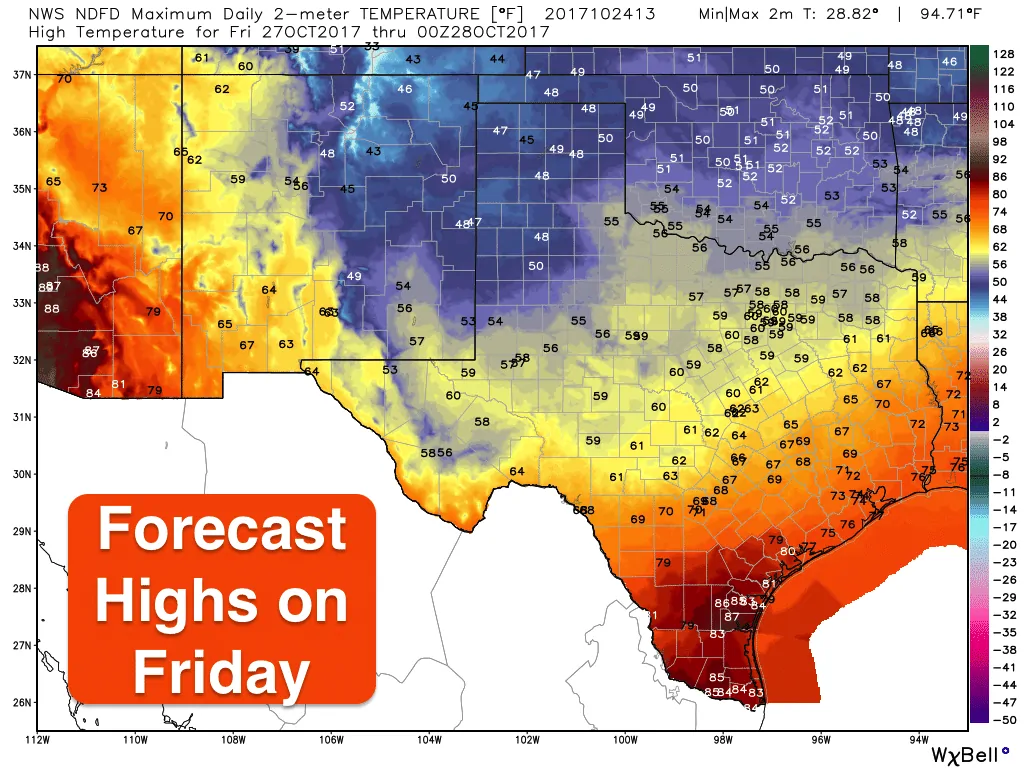
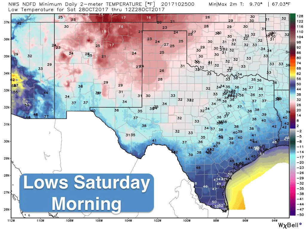
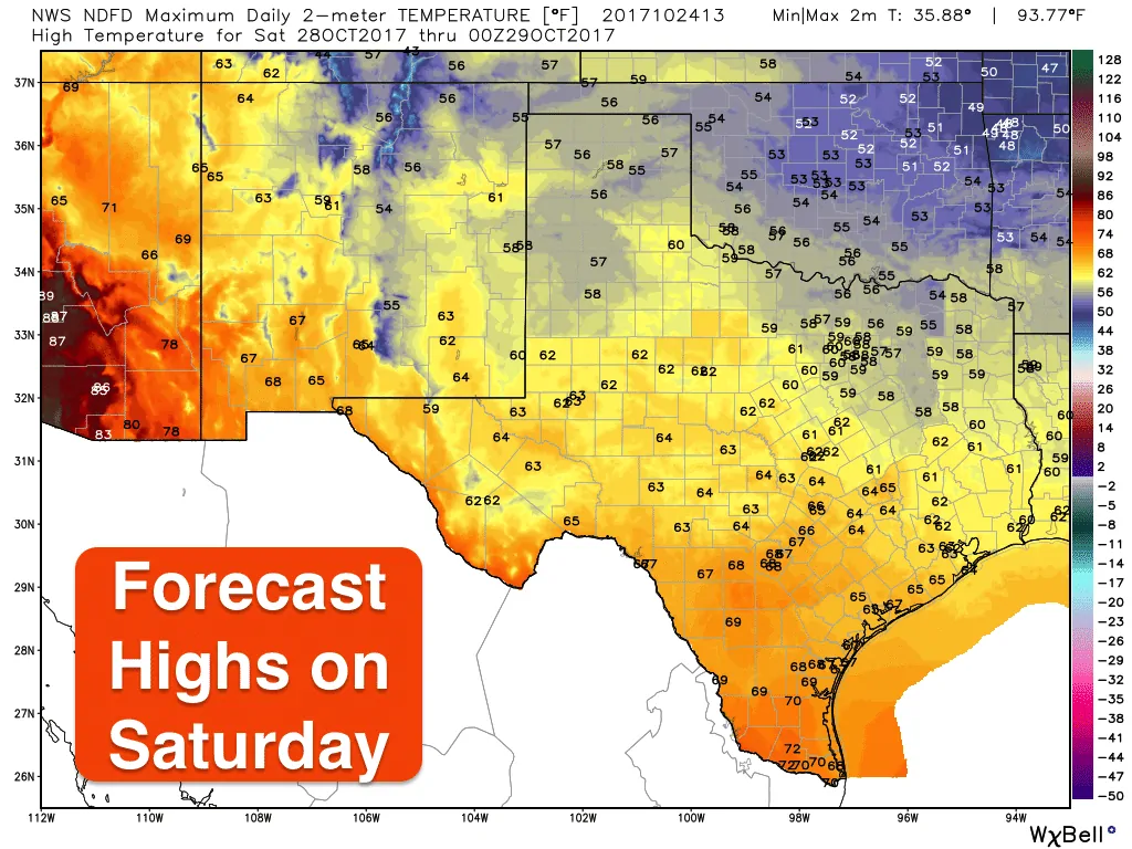
The strongest cold air of the season will spill into the state beginning late Thursday as our next cold front arrives. Based on current model projections, the front will push across the panhandle region Thursday afternoon and evening arriving in northern Texas by late Thursday evening into early Friday. By dawn on Friday, the front is expected to be stretched across central Texas and is expected to reach the mid to upper coast by Friday afternoon and into deep south Texas by Friday evening. Winds will once again be quite blustery behind the front with gusty winds between 20-30mph. Thankfully this time around, we won’t be dealing with a squall line of storms like we were with last Saturday’s cold front. This front will arrive mostly dry with only slight chances for showers across parts of east and southeast Texas Thursday afternoon and some potential for drizzle behind the front for north central and northeast Texas. The panhandle could see a few flurries…yes, flurries late Thursday night….but nothing in the way of winter weather impacts. Temps behind the front by Friday morning will drop down into the low 30s across the panhandle, with 40s expected across northern Texas. By Saturday morning once the the front has cleared the coast, we’ll be seeing low dropping into the 20s across the panhandle, low to mid 30s across both north and western Texas, with 40s to low 50s expected for south central and costal regions. Highs will increase a few degrees each day and by Monday, temps will be back up to about where they should be for this time of the year!


0 Comments