
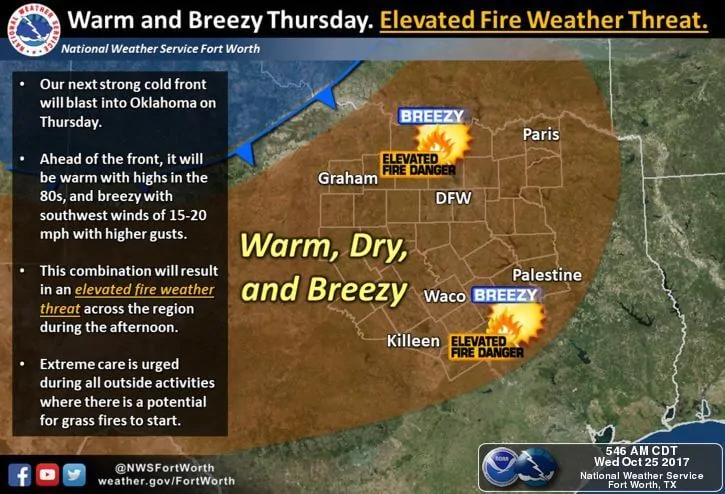
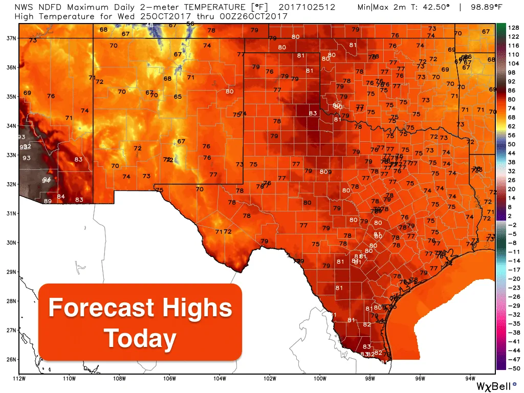
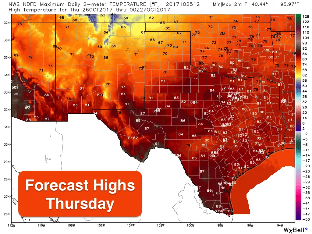
Today and tomorrow will be our last days with above normal Fall temps before a strong Canadian cold front arrives on Thursday. Everyone will be enjoying plenty of sunshine and highs in the 70s and 80s today and tomorrow, so take advantage of that while you can! We’ll be quite breezy tomorrow as well with sustained southwest winds up to 20mph with higher gusts. Elevated fire weather conditions will be present all across western Texas, west central Texas and up into north Texas by Thursday ahead of the front, so take extra precautions with anything that could generate sparks or flames.
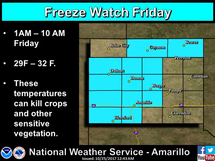
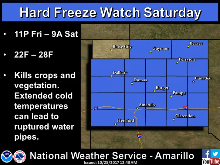
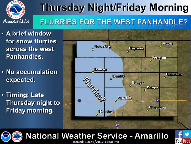
For residents in the panhandle region, Freeze Watches have been issued for Friday and Saturday once the post-frontal cold air mass takes hold across the area. Additional Freeze or Frost advisories may be needed for parts of the rolling plains and western north Texas, but that will depend on how quickly winds die down after the front blows through. Either way, plan now to cover sensitive plants and bring container plants indoors for the weekend. Flurries will also be possible late Thursday night into early Friday morning across the western half of the panhandle, but not much in the way of accumulation is expected since soil temps are still quite warm and the precipitation will be very light.


0 Comments