
Tropical mischief is on the horizon as a quick-developing system may bring impacts to the Gulf Coast of the United States this weekend. The eventual location of those impacts and the extent of potential impacts will not be something we can accurately determine until we’re within 48-60 hours. At this juncture, we’re still 96-120 hours out from any potential landfall. Before the hype-train gets going let’s get into the details.
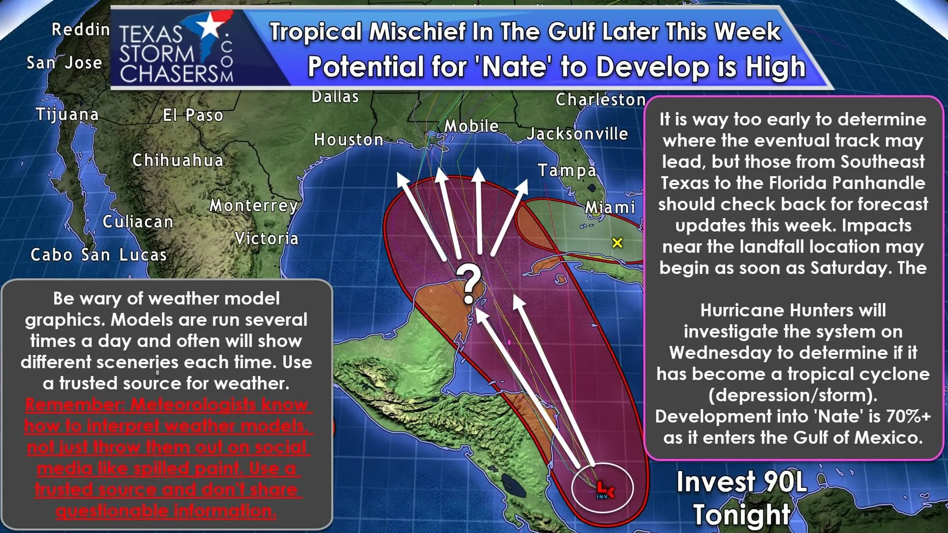
An area of thunderstorms is located over the southwestern Carribean tonight. This activity has shown some increase in organization today. A general northwestward movement is anticipated through Thursday with some interaction with Honduras and Nicaragua possible. After that, the system will move near the eastern Yucatan Peninsula before entering the southern Gulf of Mexico this weekend. Development into a Tropical Storm is fairly likely (70%+) by the time it enters the Gulf of Mexico. I do caution you that the system has not even formed a defined low-level circulation yet. Weather models tend to do much better when there is a ‘pinpoint’ low pressure in place. Without that defined low on a map, the models are simply guessing where it is before it even forms. Garbage into the weather models will usually lead to the garbage coming out of them. There’s a reason we’re not showing weather models in this graphic tonight except for a few thin lines.
Once a system enters the Gulf of Mexico it really has no place to go except land. That will be the case for Invest 90L or future Nate by the weekend. A substantial part of the eventual track of this system will depend on the strength of an upper-level high pressure over the western Atlantic. The strength of that high will dictate when the system begins to move north and eventually northeast from its ongoing northwestward track. A stronger high pressure would result in the northward turn taking place later while a weaker high pressure, or a weakness in general, would allow the system to ‘sneak’ in and move north/northeast earlier. That’s why folks from the Southeast Texas coast eastward into the Florida Panhandle will have to watch this system closely in coming days. These situations are tricky to forecast and usually result in forecast shifts even 24 hours out from an impending landfall – although to a lesser extent than what you’d see three days out. I don’t want to lessen anyone’s guard on the Texas coast, but we’d have to see a substantial westward shift in weather model tracks to get any impacts from this system. We’ve seen shifts before, so that’s why I want you to check back for forecast updates this week. Compared to Texas there is a climatologically higher probability of a landfall in Lousiana and points east in October, but by no means is that to say we should let our guard down. This year has reminded everyone that Mama Nature will do whatever the heck it wants.
My lack of estimating a future intensity for this system is intentional. We need to officially get it ‘on the board’ before we even try and guesstimate at what the intensity could look like. However, conditions are expected to be favorable for intensification across the Gulf of Mexico and northwestern Carribean. We’ve seen systems spin up in a hurry in similar conditions.


0 Comments