
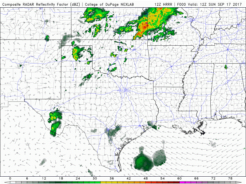
Above average temperatures will continue as we head into the last official week of Summer. Moisture from Tropical Storm Norma off the Baja Peninsula continues to stream over the western half of the state and we’ll once again have a good chance of seeing thunderstorms develop by later this afternoon. The Storm Prediction Center has placed a Slight Risk (Level 2) of severe weather across much of the western and central panhandle for later this afternoon with gusty winds, quarter size hail and isolated tornadoes being the main threats. Strong to severe storm development will be most likely after 3pm across eastern New Mexico and the western panhandle, then these clusters of storms will trek east across the panhandle through the evening hours, and into western Oklahoma overnight. Here’s a look at how the radar may shape up through the evening hours. Keep in mind this is just a model forecast, not live radar.
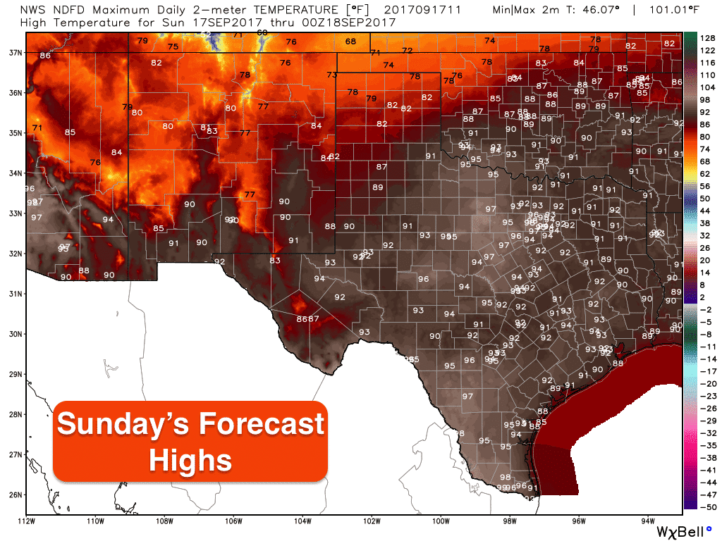
Highs today will continue to be above average for all but the northern panhandle region which saw a weak cold front push into the area. Unfortunately, this cold front will not move much further south and will lift out of the area by this afternoon. We are expecting to see continued above average temps for this final week of astronomical summer, but we’ll be monitoring for the arrival of a cold front early next week which may bring us some nice relief from our recent summer heat. That’s way too far out in the forecast for any specifics, but we are getting into that time of the year when cold fronts become more frequent and we begin to think of sweater weather just around the corner!


0 Comments