
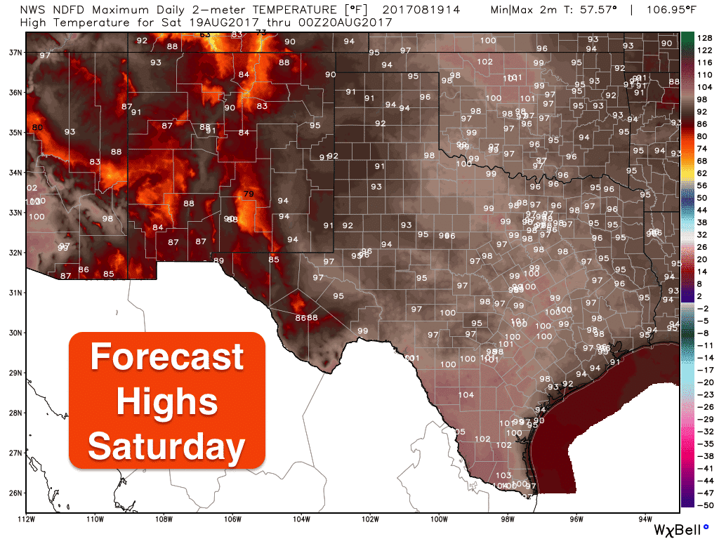
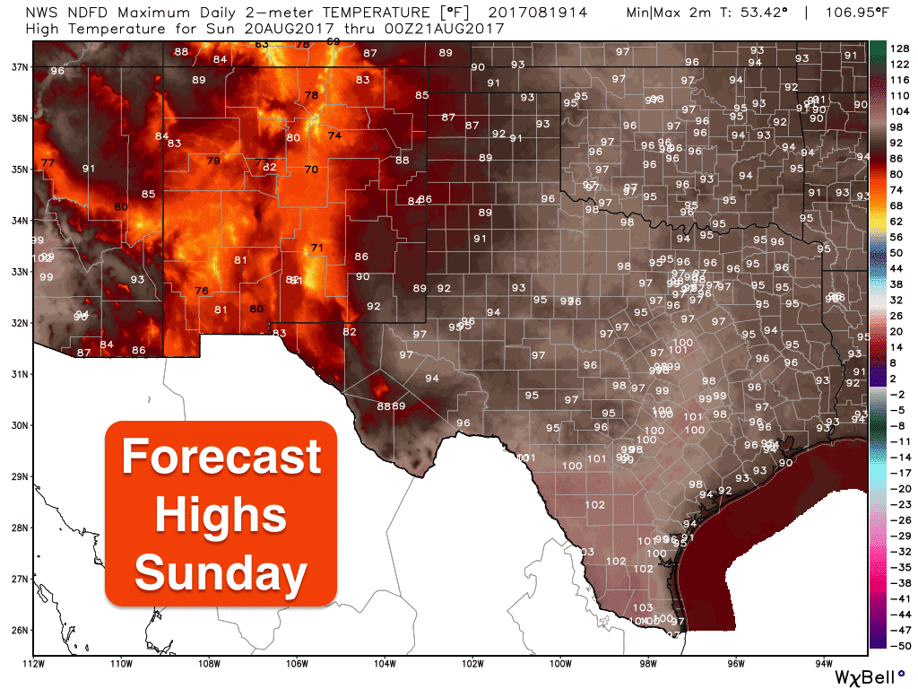
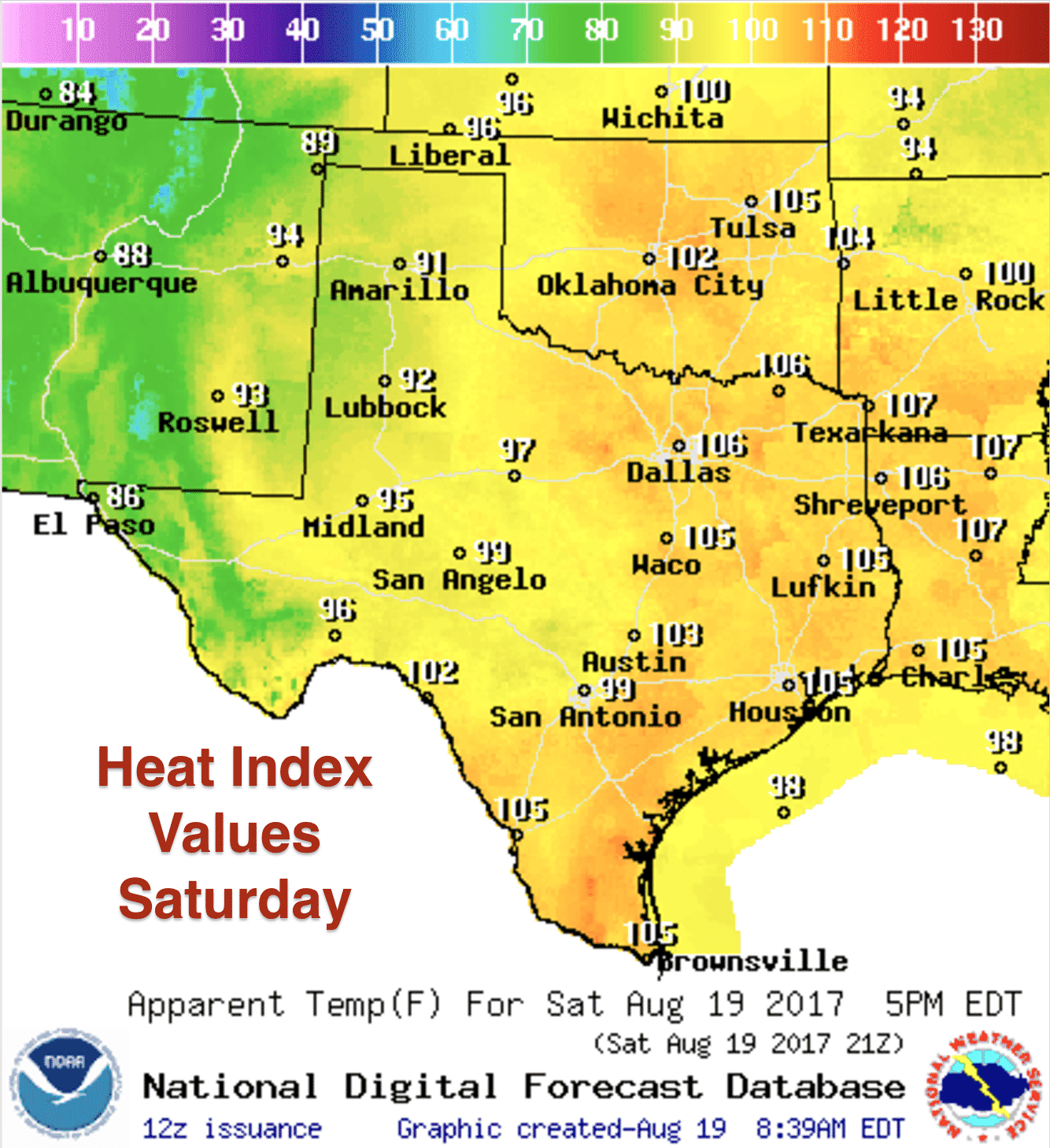
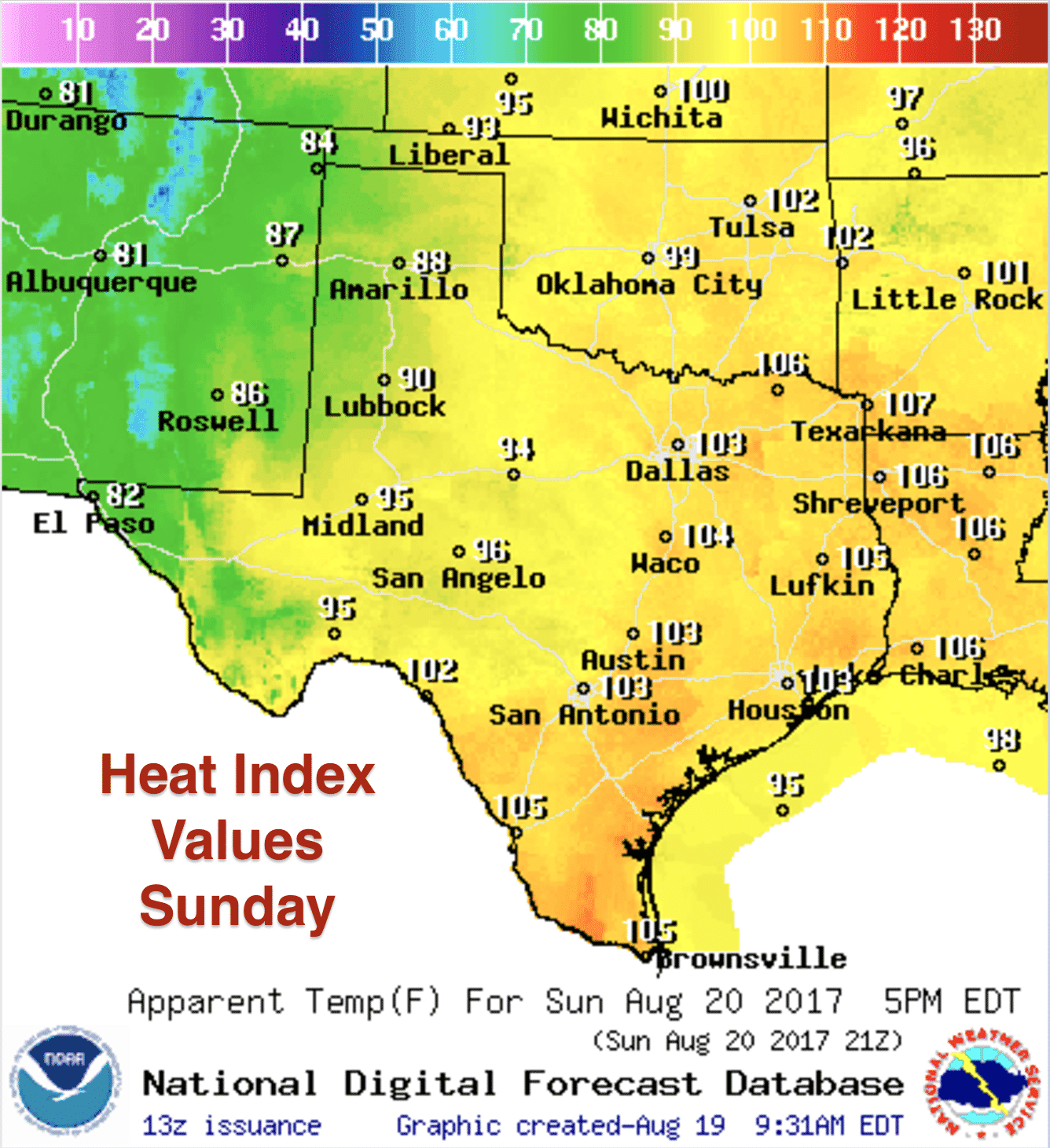
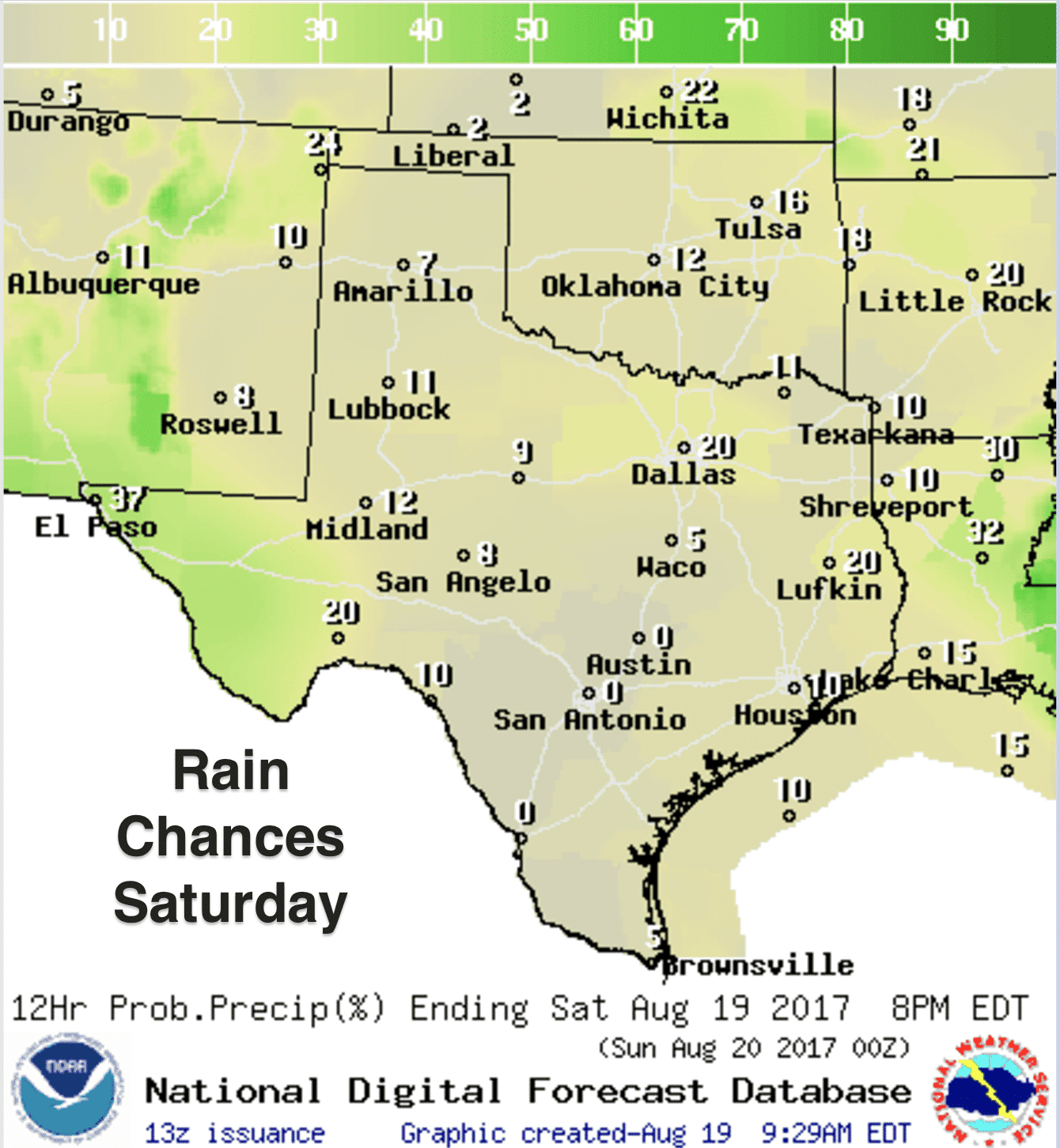
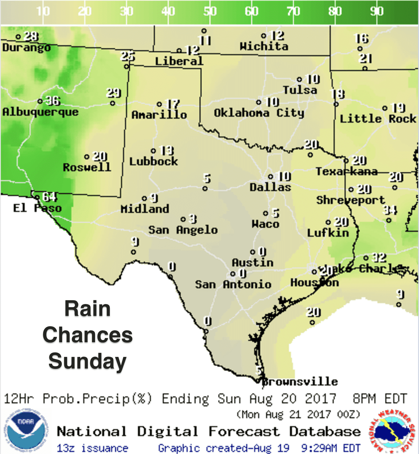
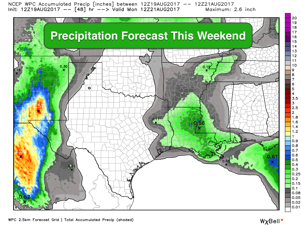
A ridge of high pressure continues to dominate the southern half of the state this weekend which will mean little to no chances for rainfall across much of central and southern Texas. We may see a few coastal showers which move inland during the afternoon, but beyond that we’ll continue with hot and dry conditions. Best chances for rainfall this weekend will be across far western Texas, parts of the panhandle and northern Texas and over into eastern Texas as well. Severe weather is not expected…just general thunder and brief periods of heavy rainfall similar to what we’ve seen the past couple of days. Highs will be seasonally hot with heat index values reaching 105 or more each afternoon for areas along and east of the I-35 corridor where humidity values will be the greatest.
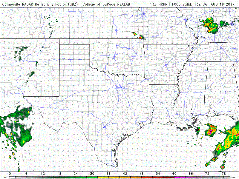
Afternoon storms are expected to develop during peak heating this afternoon across far western Texas and along and north of the I-20 corridor. Greatest rainfall accumulations will be found across far western Texas this afternoon and into the overnight hours where localized flash flooding is possible. Severe weather is not expected, but a few of the storms could become robust with gusty winds and frequent lightning as the main threats. Here’s a peek at how the radar may shape up by later this afternoon through about 2am Sunday morning. As always, keep in mind this is just a model forecast, not live radar:
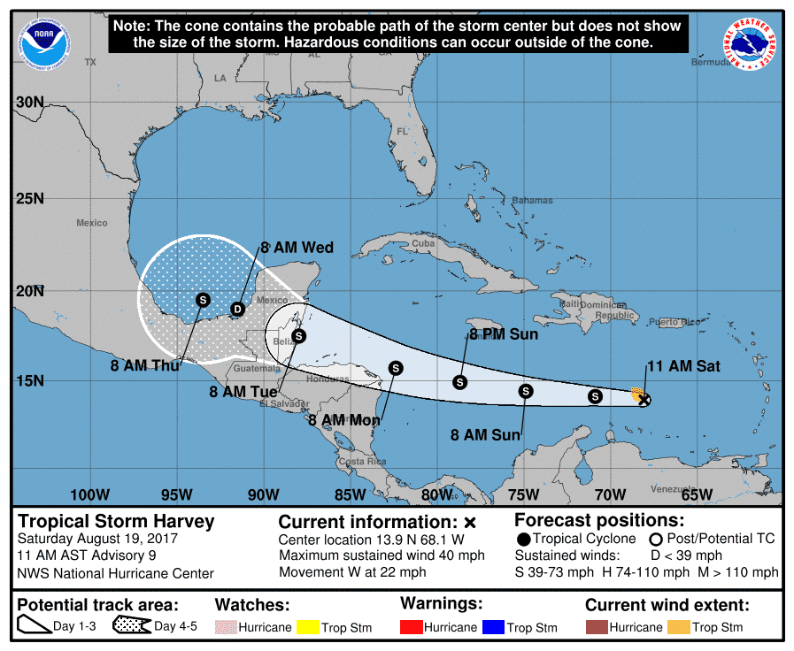
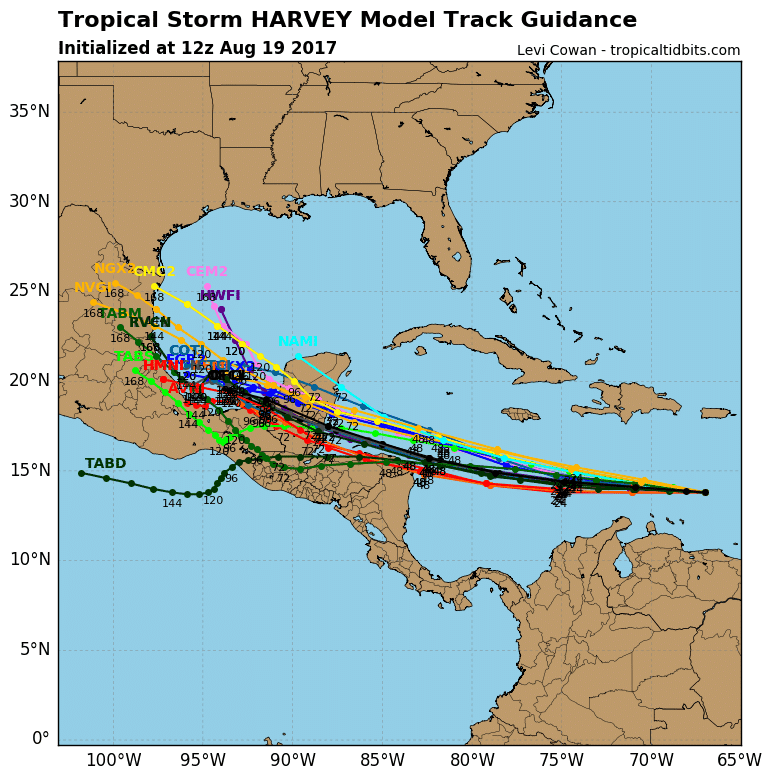
Looking ahead into next week…high pressure will build in over the state for the first few days of next week before a summertime cold front begins to push into the state by Wednesday. As typical with summertime fronts, they aren’t that “cool” and they don’t tend to push very far into the state which means it will likely stall out somewhere across central Texas by Thursday. It will bring rain chances along with it, but how much and exactly where really can’t be pinpointed this far out. Let’s just say there’s hope for a bit of a cool down for at least the northern half of the state by the middle of next week and leave it at that. Another interesting feature which the NWS Brownsville included in this morning’s forecast discussion was the possibility of Tropical Storm Harvey making it as far north as deep south Texas by late next week. This is still a long ways out and a lot will depend on if it can survive the trip across the Yucatan Peninsula and how much it can strengthen once it emerges into the Bay of Campeche by next Wednesday. At any rate, it will be something for residents in deep south Texas to keep an eye on late in the week.


0 Comments