

A summer cold front has moved through the Texas Panhandle with temperatures in the 60s and 70s. The leading edge of the front now extends from near Hobbs to Lubbock to Childress extending northeast to Oklahoma City. This front will be a focal point for thunderstorm development after 3 PM this afternoon. A weakening cluster of thunderstorms is located near the Red River in Northeast Oklahoma into western Arkansas. These storms will continue to move southeast while gradually weakening into the afternoon hours. Some back-building of storms may occur on the western edge of this thunderstorm cluster, so we’ll have to keep an eye on any storms impacting eastern North Texas and East Texas through the late morning hours. Severe weather is not expected with this thunderstorm cluster.
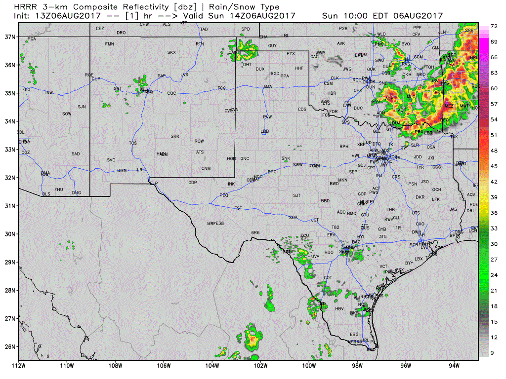
By the mid-afternoon, the cool front should be located from the cool front should be located from near the Big Country east into Texoma. As temperatures warm into the 90s and convective temperatures are reached we’ll see thunderstorm initiation occur. The storms that fire up in Texoma along the front in Texoma this afternoon may grow upscale fairly quickly into a squall line or thunderstorm cluster. These storms will tend to move south at 20 to 30 MPH. It looks fairly likely that the D/FW Metroplex will be impacted by these storms in the 6 PM to 10 PM timeframe. Some of these storms will likely be strong with high winds, small hail, and heavy rainfall. Some wind gusts may exceed 50-60 MPH, so localized wind damage is possible. Those with outdoor plans should be ready to move to an indoor shelter if thunderstorms approach. We’ll also see an uptick in isolated to scattered thunderstorms this evening and overnight in the Texas Panhandle, West Texas, Permian Basin, and Big Country.
The cool front will stall out on Monday from near the Concho Valley northeast into North Texas. Scattered to numerous showers and thunderstorms are expected in the proximity of this front on Monday and Tuesday across the Big Country, Concho Valley, North Texas, Northeast Texas, East Texas, and in Central Texas. Isolated to scattered storms are expected in the Panhandle and across South-Central Texas, the Middle Coast, and Southeast Texas.
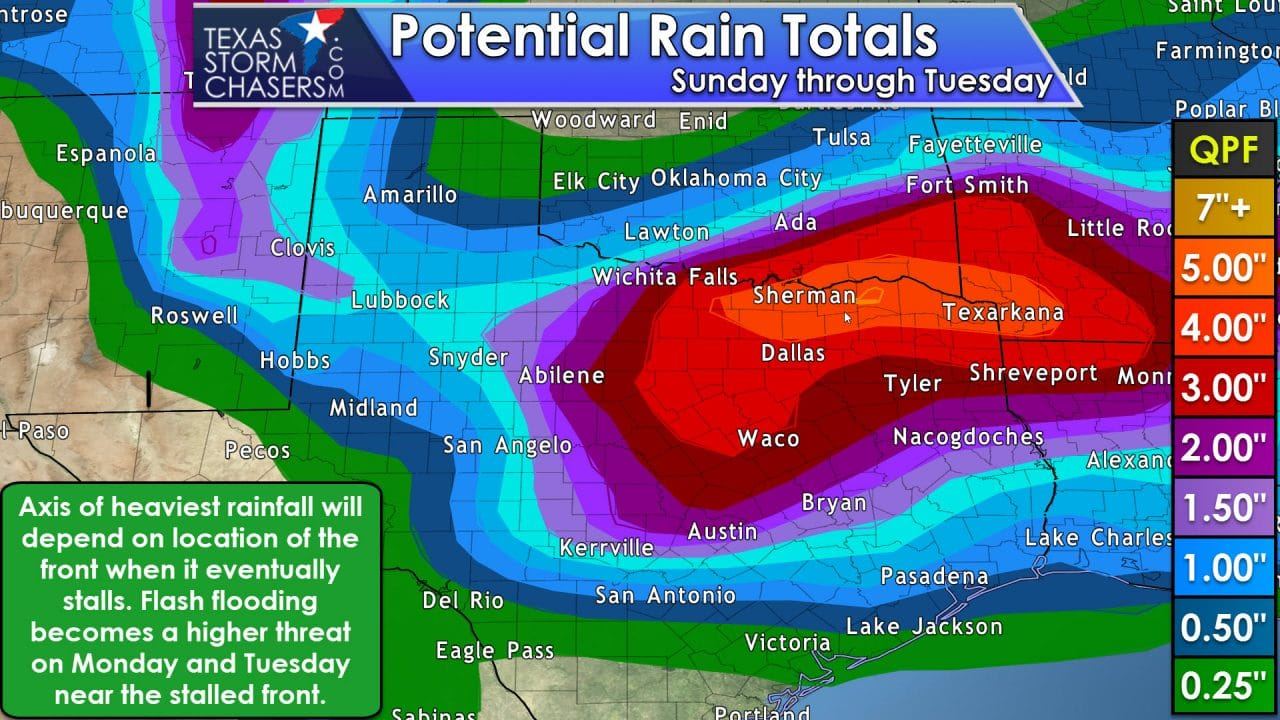
Flash flooding isn’t likely to become a substantial problem today thanks to storms having a steady movement – also known as not sitting over one location for a prolonged period of time. That will change on Monday as the cool front stalls out. The good news is we’re going to see much cooler temperatures where the clouds and rain hold in tough. The bad news is we’re going to see a period of heavier rains fall over the same locations. Training thunderstorms are most likely in the proximity of the cool front and/or residual outflow boundaries. Lots of moisture will allow for high rainfall rates. As of now it looks like the relative highest risk of flooding on Monday and Tuesday will be in North Texas and Northeast Texas – but not all of those regions will see flooding. We can’t tell you yet where the highest relative zone of flooding will set up just yet, but flash flood watches are likely to be issued later today for parts of those areas. Scattered thunderstorm chances look to continue this upcoming week, but should be lower than Monday and Tuesday.


0 Comments