
As previously reported, Hurricane Harvey made landfall at 10pm yesterday between Port Aransas and Port O’Connor Texas as a Category 4 Hurricane. This is the strongest hurricane that has hit the Texas Gulf Coast since Hurricane Carla made landfall as a Category 4 hurricane. As of the 7am National Hurricane Center update this morning, Harvey has moved inland about 50 miles and is still a Category 1 hurricane with maximum sustained winds of 80mph. Further weakening is expected and we should see Harvey downgraded to a Tropical Storm soon…possibly by the next NHC update at 10am. Unfortunately, Harvey will not be making much progress over the next several days. It’s likely that he’ll remain at Tropical Storm strength through Wednesday of next week while wobbling around near and over coastal south central Texas. Catastrophic flooding will be the main threat in addition to continued storm surge threats and very windy conditions.
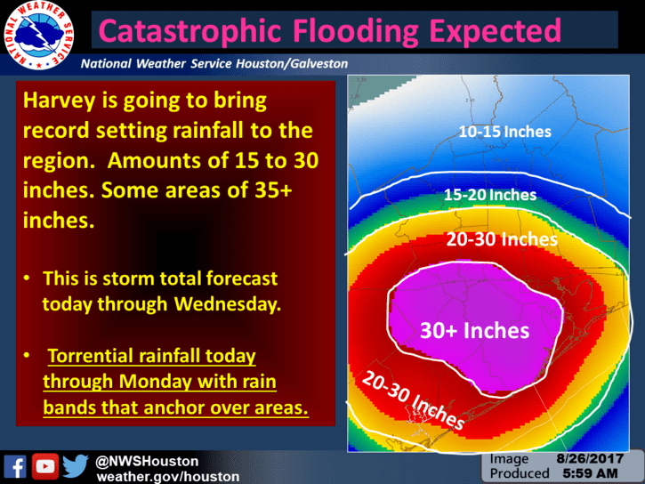
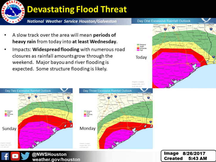
Due to the length of time Harvey will remain over the area, rainfall estimates continue to be adjusted with upwards of 30 to 40 inches now possible across coastal south central and southeast Texas as Harvey’s rain bands continue to move across the region. We do not have rainfall estimates by city as much will depend on where the heaviest rain bands from Harvey will set up. Some across the area will not see as much, and there will be a pretty tight gradient between those who do see significant rain with catastrophic impacts and those who see only general heavy rainfall and flooding conditions. Either way, this will continue to be a significant issue for south central and southeast Texas for several days with numerous road closures and significant transportation impacts expected. Travel is obviously not recommended, so if you don’t have to get out and you’re not in immediate danger…just stay put.
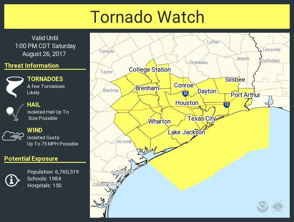
Parts of southeast Texas (Houston, Galveston, Lake Jackson, Wharton, Conroe, Brenham, College Station, Dayton and Port Arthur) are under a Tornado WATCH until 1pm this afternoon. Harvey’s outer rain bands will continue to impact the region today with the threat for a few quick tornado spin-ups in addition to very heavy rainfall and flooding issues. Have a way to receive weather warnings and seek shelter immediately if one is issued for your location.


0 Comments