
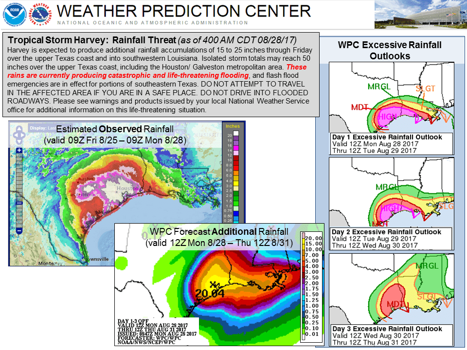
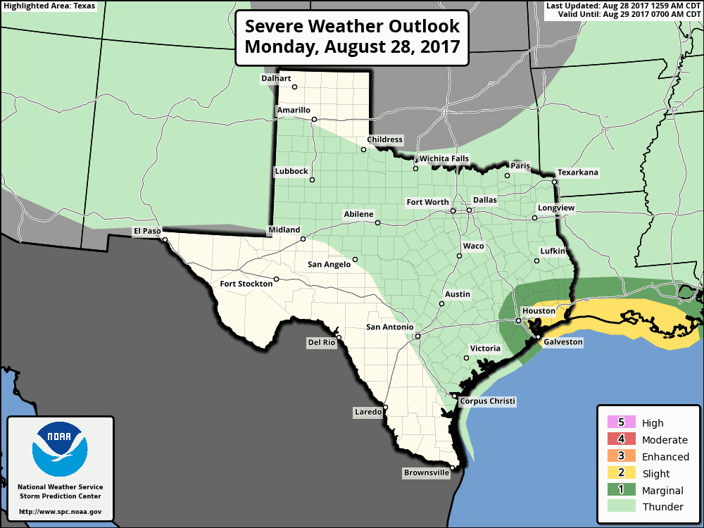
As of the 7am National Hurricane Center update this morning, Tropical Storm Harvey is moving back over the Gulf of Mexico near Matagorda Bay where it will remain before turning back to the northeast on Tuesday and make a second landfall near Galveston Bay. Harvey is expected to undergo some strengthening once offshore, but significant intensification is not currently forecast due to wind shear across the area and his lack of a strong inner core. While a majority of the heavy rain from Harvey has shifted east this morning into far southeast Texas and southwestern Louisiana, we are expected to see an uptick in precipitation later today back to the west across the Houston/Galveston metro areas. Do not let your guard down during this lull in precipitation, and continue to shelter in place and stay off the roadways unless it’s a dire emergency. Additional rainfall as much as 15-25 inches is still expected to impact southeast Texas through the end of the week before Harvey has completely moved out of the region. Isolated accumulations of 50 or more inches is also possible. The threat for quick spin-up tornados will also hang around, but will shift further east towards Louisiana and will probably remain east of the Houston/Galveston metro for the next several days. Still, we can’t completely rule out additional tornadic activity across all of southeast Texas until Harvey has departed.


0 Comments