
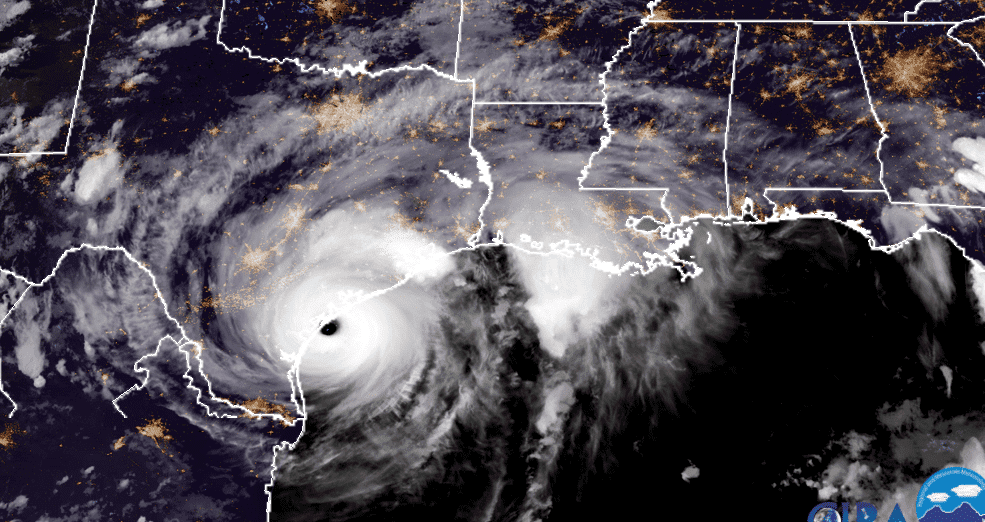
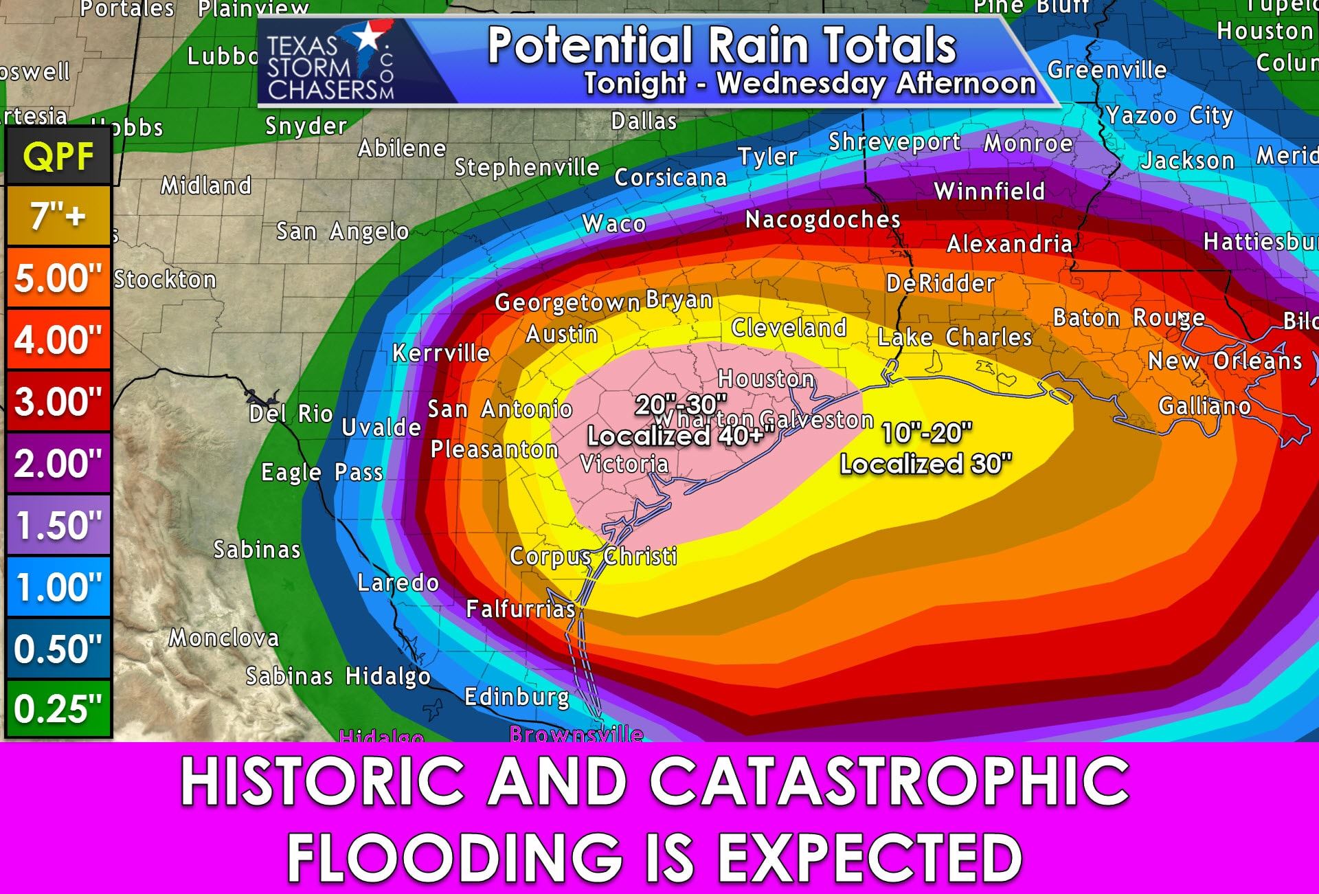
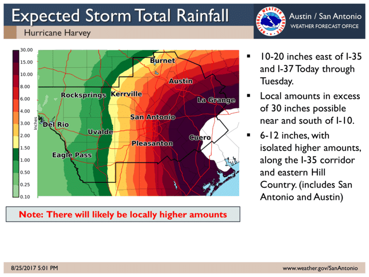
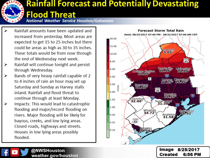
Here’s the latest update for rainfall across the southern half of the state between tonight and into the middle of next week. Catastrophic doesn’t even begin to describe what is about to unfold over the next several days across the coastal bend region up into southeast Texas once Harvey makes landfall here in a bit and stalls out across the region. He is currently forecast to remain in the area for several days before finally ejecting off to the east during the middle of the coming week. There is also the chance he could drift just offshore again and make a second landfall. There’s still a lot of disagreement in the forecast model as to exactly where Harvey will go once he’s made landfall, but regardless of his track after landfall, the most urgent concern will be the amount of rain he will dump across the south central and southeast Texas before he moves on. As depicted in the graphic below, the greatest amount of rainfall will be situated between just east of Corpus and on up into the Houston/Galveston area. Widespread 20-30 inch amounts with isolated 40+ inch rainfall totals will be likely. This is in addition to any storm surge along the immediate coastline. Damage from both surge, winds and rainfall will be extensive. It’s no doubt that the insured damage estimates will range in the billions…40 Billion based on estimates I saw in the news earlier today. And that data was based on losses from a Category 3 hurricane…and Harvey is now a Category 4. It will take many months, if not many years, to fully recover from this storm…which will likely go down as this generation’s storm of 1900. Hopefully by now, everyone who was under mandatory evacuation orders has done so. For those who chose to stay behind, good luck and please find a permanent marker to write your social security number on your forearm just in case.


0 Comments