
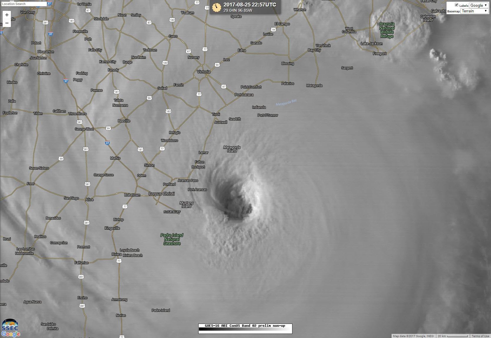
Hurricane Harvey has continued to strengthen and is now a potentially catastrophic category4 hurricane with maximum sustained winds of 130 MPH. The center of Harvey is located 45 miles east with the western eye-wall 10 miles east of Port Aransas. Harvey’s forward speed is slowing and is down to 8 MPH, although it may be even slower based on real-time radar data. Regardless of this intensification, the impacts to the coast will be the same. Landfall looks like it will occur within the next 2-3 hours from Port Aransas to Rockport. Remember, the inland impacts aren’t going to change based on the landfall strength of Harvey. Catastrophic flooding is still likely as the system stalls out over the Coastal Plains this weekend and at least the first half of next week.
Hurricane Harvey Tropical Cyclone Update
NWS National Hurricane Center Miami FL AL092017
600 PM CDT Fri Aug 25 2017
…6 PM CDT POSITION AND INTENSITY UPDATE…
…HARVEY BECOMES A CATEGORY FOUR HURRICANE…
…SUSTAINED HURRICANE-FORCE WINDS SPREADING ONTO THE MIDDLE TEXAS
COAST…
Air Force Reserve Reconnaissance aircraft data indicate that Harvey
has become a category 4 hurricane with maximum sustained winds of
130 mph (215 km/h).
A station at Aransas Pass run by the Texas Coastal Observing
Network recently reported a sustained wind of 74 mph (119 km/h) with
a gust to 96 mph (154 km/h).
SUMMARY OF 600 PM CDT…2300 UTC…INFORMATION
———————————————-
LOCATION…27.7N 96.7W
ABOUT 45 MI…70 KM E OF CORPUS CHRISTI TEXAS
ABOUT 50 MI…85 KM SSW OF PORT OCONNOR TEXAS
MAXIMUM SUSTAINED WINDS…130 MPH…215 KM/H
PRESENT MOVEMENT…NW OR 325 DEGREES AT 8 MPH…13 KM/H
MINIMUM CENTRAL PRESSURE…941 MB…27.79 INCHES


0 Comments